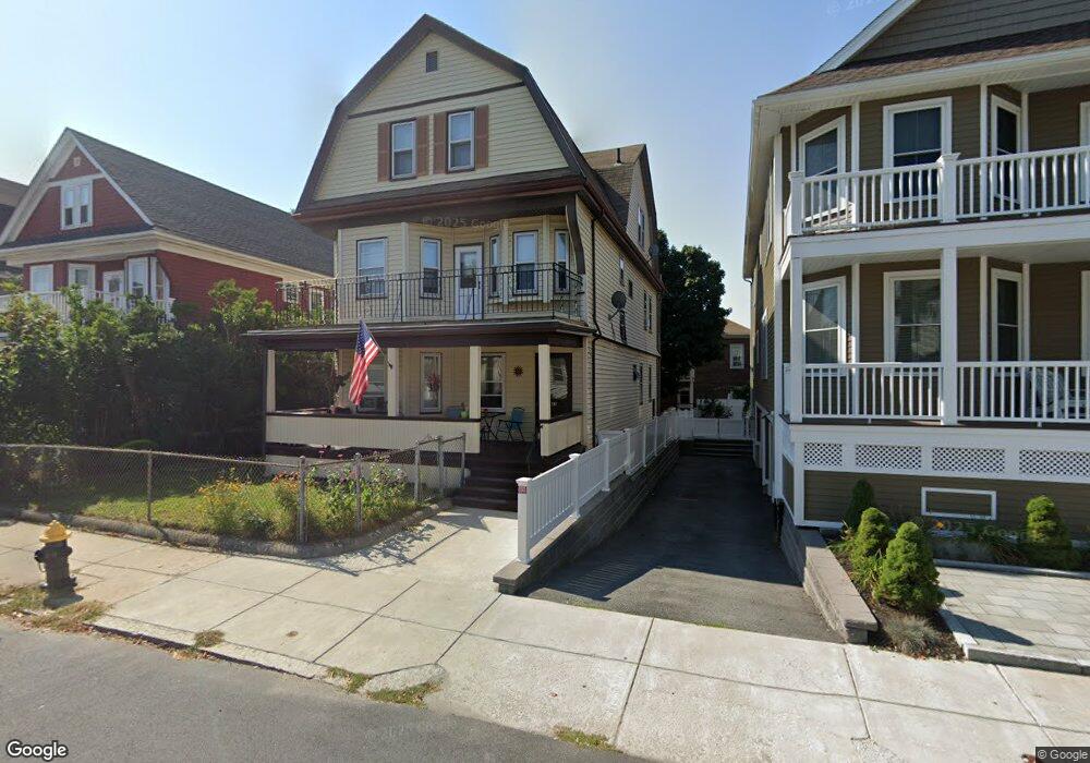
63 Saint Andrew Rd Unit 3 Boston, MA 02128
Harbor View-Orient Heights NeighborhoodEstimated Value: $1,003,000 - $1,108,000
2
Beds
1
Bath
3,117
Sq Ft
$340/Sq Ft
Est. Value
About This Home
This home is located at 63 Saint Andrew Rd Unit 3, Boston, MA 02128 and is currently estimated at $1,060,000, approximately $340 per square foot. 63 Saint Andrew Rd Unit 3 is a home located in Suffolk County with nearby schools including Excel Academy East Boston, East Boston Montessori School, and Brooke Charter Schools East Boston.
Ownership History
Date
Name
Owned For
Owner Type
Purchase Details
Closed on
Oct 12, 2017
Sold by
Stella James
Bought by
Stella 2017 T
Current Estimated Value
Purchase Details
Closed on
Mar 3, 2015
Sold by
Rosatto James R
Bought by
Rosatto Ft
Create a Home Valuation Report for This Property
The Home Valuation Report is an in-depth analysis detailing your home's value as well as a comparison with similar homes in the area
Home Values in the Area
Average Home Value in this Area
Purchase History
| Date | Buyer | Sale Price | Title Company |
|---|---|---|---|
| Stella 2017 T | -- | -- | |
| Rosatto Ft | -- | -- |
Source: Public Records
Tax History Compared to Growth
Tax History
| Year | Tax Paid | Tax Assessment Tax Assessment Total Assessment is a certain percentage of the fair market value that is determined by local assessors to be the total taxable value of land and additions on the property. | Land | Improvement |
|---|---|---|---|---|
| 2025 | $10,170 | $878,200 | $269,200 | $609,000 |
| 2024 | $9,104 | $835,200 | $290,100 | $545,100 |
| 2023 | $8,465 | $788,200 | $273,800 | $514,400 |
| 2022 | $8,162 | $750,200 | $260,600 | $489,600 |
| 2021 | $7,624 | $714,500 | $248,200 | $466,300 |
| 2020 | $6,424 | $608,300 | $265,800 | $342,500 |
| 2019 | $5,725 | $543,200 | $173,500 | $369,700 |
| 2018 | $5,081 | $484,800 | $173,500 | $311,300 |
| 2017 | $4,583 | $432,800 | $173,500 | $259,300 |
| 2016 | $4,368 | $397,100 | $173,500 | $223,600 |
| 2015 | $4,349 | $359,100 | $131,300 | $227,800 |
| 2014 | $4,097 | $325,700 | $131,300 | $194,400 |
Source: Public Records
Map
Nearby Homes
- 5 Nancia St Unit 2
- 29 St Andrew Rd Unit 1
- 20 Nancia St
- 1044 Saratoga St Unit 1
- 1030 Bennington St Unit 15
- 1203 Bennington St
- 16 Boardman St Unit 105
- 36A Leyden St
- 49 Faywood Ave
- 56 Main St
- 188 Gladstone St Unit 1
- 550 Pleasant St Unit 11D
- 550 Pleasant St Unit 506
- 92 Waldemar Ave
- 14 Pleasant Park Rd
- 19 Pleasant Park Rd
- 177 Cowper St
- 443 Bennington St
- 9 Marshall St
- 795 Saratoga St
- 63 Saint Andrew Rd
- 61 Saint Andrew Rd
- 65 Saint Andrew Rd
- 65 Saint Andrew Rd Unit 1
- 59 St Andrew Rd Unit 3
- 59 Saint Andrew Rd
- 59 Saint Andrew Rd Unit 2
- 69 Saint Andrew Rd
- 69 Saint Andrew Rd Unit 3
- 69 Saint Andrew Rd Unit 2
- 102 Bayswater St Unit 104
- 106 Bayswater St Unit 108
- 98 Bayswater St Unit 100
- 98 Bayswater St Unit 2
- 98 Bayswater St Unit 3
- 57 St Andrew Rd Unit 2
- 57 Saint Andrew Rd Unit 3
- 57 Saint Andrew Rd Unit 1
- 57 Saint Andrew Rd
- 57 Saint Andrew Rd Unit 2