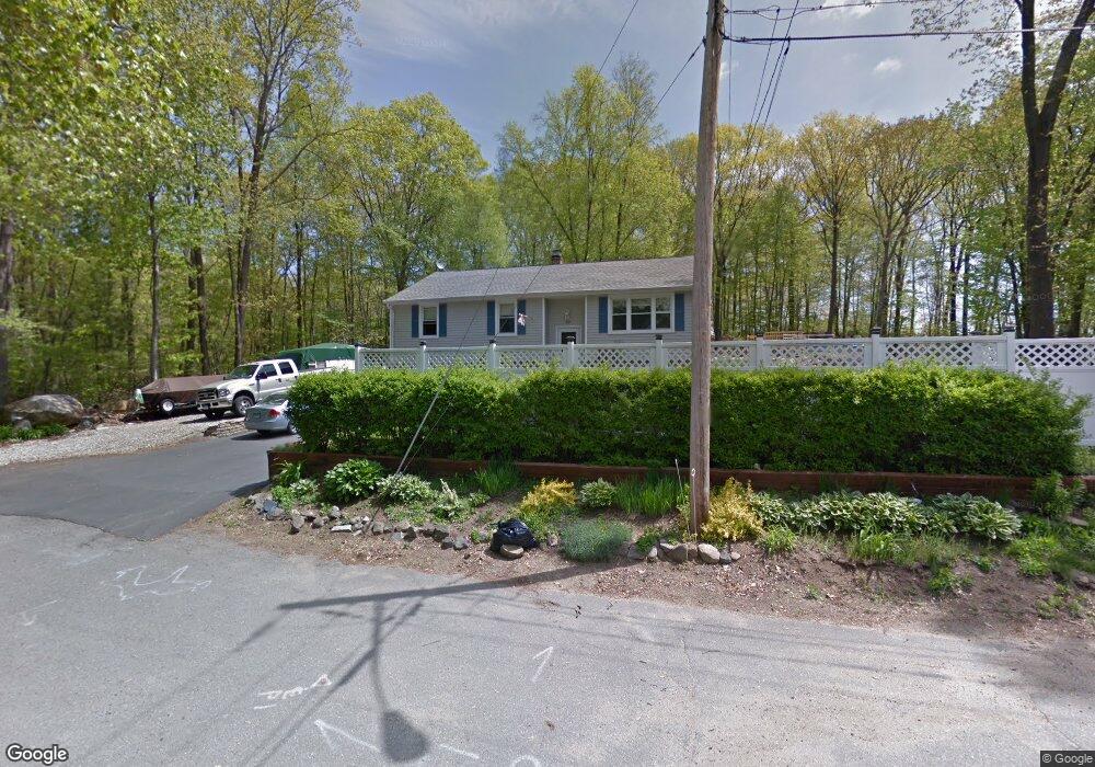
63 Tosun Rd Wolcott, CT 06716
Estimated Value: $284,000 - $347,000
3
Beds
1
Bath
1,158
Sq Ft
$275/Sq Ft
Est. Value
About This Home
This home is located at 63 Tosun Rd, Wolcott, CT 06716 and is currently estimated at $318,534, approximately $275 per square foot. 63 Tosun Rd is a home located in New Haven County with nearby schools including Tyrrell Middle School, Wolcott High School, and St Peter & Paul School.
Ownership History
Date
Name
Owned For
Owner Type
Purchase Details
Closed on
Jul 29, 2008
Sold by
Jenkins Nancy A and Jenkins Nancy L
Bought by
Jenkins Nancy L and Garcia Edward
Current Estimated Value
Home Financials for this Owner
Home Financials are based on the most recent Mortgage that was taken out on this home.
Original Mortgage
$196,000
Interest Rate
6.35%
Purchase Details
Closed on
Aug 16, 2006
Sold by
Jenkins Nancy A
Bought by
Jenkins Nancy L
Home Financials for this Owner
Home Financials are based on the most recent Mortgage that was taken out on this home.
Original Mortgage
$100,000
Interest Rate
6.88%
Create a Home Valuation Report for This Property
The Home Valuation Report is an in-depth analysis detailing your home's value as well as a comparison with similar homes in the area
Home Values in the Area
Average Home Value in this Area
Purchase History
| Date | Buyer | Sale Price | Title Company |
|---|---|---|---|
| Jenkins Nancy L | $89,500 | -- | |
| Jenkins Nancy L | $100,000 | -- |
Source: Public Records
Mortgage History
| Date | Status | Borrower | Loan Amount |
|---|---|---|---|
| Open | Jenkins Nancy L | $185,400 | |
| Closed | Jenkins Nancy L | $196,000 | |
| Previous Owner | Jenkins Nancy L | $100,000 |
Source: Public Records
Tax History Compared to Growth
Tax History
| Year | Tax Paid | Tax Assessment Tax Assessment Total Assessment is a certain percentage of the fair market value that is determined by local assessors to be the total taxable value of land and additions on the property. | Land | Improvement |
|---|---|---|---|---|
| 2025 | $5,595 | $155,710 | $40,090 | $115,620 |
| 2024 | $5,149 | $155,710 | $40,090 | $115,620 |
| 2023 | $4,962 | $155,710 | $40,090 | $115,620 |
| 2022 | $4,796 | $155,710 | $40,090 | $115,620 |
| 2021 | $4,296 | $129,620 | $37,870 | $91,750 |
| 2020 | $4,296 | $129,620 | $37,870 | $91,750 |
| 2019 | $4,296 | $129,620 | $37,870 | $91,750 |
| 2018 | $4,174 | $129,620 | $37,870 | $91,750 |
| 2017 | $4,053 | $129,620 | $37,870 | $91,750 |
| 2016 | $3,694 | $127,760 | $38,830 | $88,930 |
| 2015 | $3,588 | $127,760 | $38,830 | $88,930 |
| 2014 | $3,471 | $127,760 | $38,830 | $88,930 |
Source: Public Records
Map
Nearby Homes
- 8 Constitution Dr
- 47 Finch Rd
- 2 Red Fox Run
- 106 Wakelee Rd Unit 13
- 24 Sharon Rd Unit 3
- 36 Sharon Rd Unit 9
- 7 Pimlico Rd
- 3 Pimlico Rd
- 0 Woodtick Rd Unit 24119429
- 20 Wolf Hill Rd Unit 4D
- 20 Wolf Hill Rd Unit 6F
- 186 Windy Dr
- 0 Arvida Rd Unit 24054898
- 374 Beth Ln
- 210 Munson Rd Unit 2-G
- 210 Munson Rd Unit 2-F
- 210 Munson Rd Unit 2-E
- 210 Munson Rd Unit 2-D
- 210 Munson Rd Unit 2-C
- 210 Munson Rd Unit 2-B