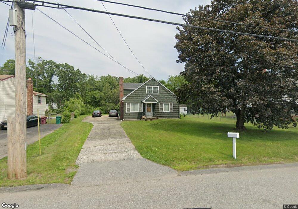
63 Totman Rd Lowell, MA 01854
Pawtucketville NeighborhoodEstimated Value: $572,000 - $679,000
3
Beds
1
Bath
2,401
Sq Ft
$258/Sq Ft
Est. Value
About This Home
This home is located at 63 Totman Rd, Lowell, MA 01854 and is currently estimated at $619,233, approximately $257 per square foot. 63 Totman Rd is a home located in Middlesex County with nearby schools including Joseph McAvinnue Elementary School, Charlotte M. Murkland Elementary School, and Dr. Gertrude Bailey Elementary School.
Create a Home Valuation Report for This Property
The Home Valuation Report is an in-depth analysis detailing your home's value as well as a comparison with similar homes in the area
Home Values in the Area
Average Home Value in this Area
Tax History Compared to Growth
Tax History
| Year | Tax Paid | Tax Assessment Tax Assessment Total Assessment is a certain percentage of the fair market value that is determined by local assessors to be the total taxable value of land and additions on the property. | Land | Improvement |
|---|---|---|---|---|
| 2025 | $6,182 | $538,500 | $189,800 | $348,700 |
| 2024 | $5,867 | $492,600 | $177,400 | $315,200 |
| 2023 | $5,750 | $463,000 | $154,200 | $308,800 |
| 2022 | $5,304 | $418,000 | $140,300 | $277,700 |
| 2021 | $4,987 | $370,500 | $121,900 | $248,600 |
| 2020 | $4,938 | $369,600 | $124,300 | $245,300 |
| 2019 | $4,767 | $339,500 | $109,400 | $230,100 |
| 2018 | $4,473 | $319,100 | $104,200 | $214,900 |
| 2017 | $4,383 | $293,800 | $94,700 | $199,100 |
| 2016 | $4,031 | $265,900 | $88,400 | $177,500 |
| 2015 | $3,985 | $257,400 | $86,500 | $170,900 |
| 2013 | $3,858 | $257,000 | $108,900 | $148,100 |
Source: Public Records
Map
Nearby Homes
- 101 Laurie Ln
- 6 Louis Farm Rd Unit 6
- 3 Louis Farm Rd Unit 3
- 69 Coburn Dr
- 49 Coburn Dr
- 54 Shirley Ave
- 20 Sandy Ln
- 527 Pawtucket Blvd Unit 304
- 240 Trotting Park Rd
- 1975 Middlesex St Unit 51
- 1975 Middlesex St Unit 10
- 1370 Varnum Ave
- 24 Brouilette St Unit A
- 307 Pawtucket Blvd Unit 13
- 1401 Pawtucket Blvd Unit 10
- 1820 Skyline Dr Unit 18
- 295 Pawtucket Blvd Unit 7
- 1461 Pawtucket Blvd Unit 12
- 15 Dowling Dr
- 770 Princeton Blvd