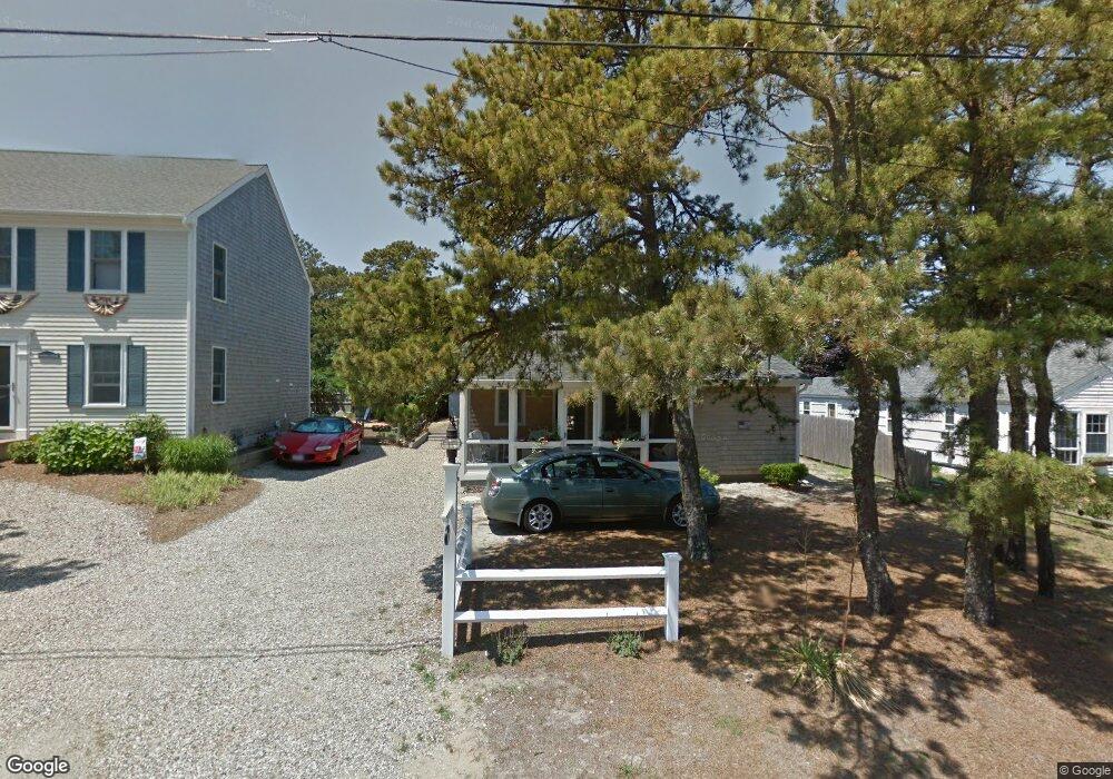
63 Uncle Rolf Rd Dennis Port, MA 02639
Dennis Port NeighborhoodEstimated Value: $680,000 - $854,000
3
Beds
1
Bath
650
Sq Ft
$1,198/Sq Ft
Est. Value
About This Home
This home is located at 63 Uncle Rolf Rd, Dennis Port, MA 02639 and is currently estimated at $778,770, approximately $1,198 per square foot. 63 Uncle Rolf Rd is a home located in Barnstable County with nearby schools including Dennis-Yarmouth Regional High School and St. Pius X. School.
Ownership History
Date
Name
Owned For
Owner Type
Purchase Details
Closed on
Apr 27, 1994
Sold by
Collins Mary K Est
Bought by
Lafrank John F and Lafrank Karenm
Current Estimated Value
Home Financials for this Owner
Home Financials are based on the most recent Mortgage that was taken out on this home.
Original Mortgage
$62,400
Interest Rate
7.7%
Mortgage Type
Purchase Money Mortgage
Create a Home Valuation Report for This Property
The Home Valuation Report is an in-depth analysis detailing your home's value as well as a comparison with similar homes in the area
Home Values in the Area
Average Home Value in this Area
Purchase History
| Date | Buyer | Sale Price | Title Company |
|---|---|---|---|
| Lafrank John F | $78,000 | -- |
Source: Public Records
Mortgage History
| Date | Status | Borrower | Loan Amount |
|---|---|---|---|
| Closed | Lafrank John F | $62,400 |
Source: Public Records
Tax History Compared to Growth
Tax History
| Year | Tax Paid | Tax Assessment Tax Assessment Total Assessment is a certain percentage of the fair market value that is determined by local assessors to be the total taxable value of land and additions on the property. | Land | Improvement |
|---|---|---|---|---|
| 2025 | $3,199 | $738,700 | $279,000 | $459,700 |
| 2024 | $3,075 | $700,400 | $268,300 | $432,100 |
| 2023 | $2,974 | $636,800 | $243,900 | $392,900 |
| 2022 | $2,712 | $484,200 | $192,200 | $292,000 |
| 2021 | $3,222 | $425,600 | $188,400 | $237,200 |
| 2020 | $2,514 | $412,100 | $188,400 | $223,700 |
| 2019 | $2,482 | $402,200 | $200,600 | $201,600 |
| 2018 | $2,443 | $385,300 | $191,000 | $194,300 |
| 2017 | $2,277 | $370,200 | $175,900 | $194,300 |
| 2016 | $2,161 | $330,900 | $165,800 | $165,100 |
| 2015 | $2,118 | $330,900 | $165,800 | $165,100 |
| 2014 | $2,005 | $315,700 | $155,800 | $159,900 |
Source: Public Records
Map
Nearby Homes
- 154 Old Wharf Rd Unit 26
- 154 Old Wharf Rd Unit 14
- 64 Beaten Rd
- 112 Old Wharf Rd Unit E4
- 112 Old Wharf Rd Unit E1
- 120 Old Wharf Rd Unit 11
- 37 Ocean Dr Unit 2
- 217 Old Wharf Rd Unit 64
- 241 Old Wharf Rd Unit 82
- 241 Old Wharf Rd Unit 127
- 241 Old Wharf Rd Unit 90
- 262 Old Wharf Rd Unit 67
- 262 Old Wharf Rd Unit 5
- 262 Old Wharf Rd Unit 5
- 262 Old Wharf Rd Unit 20
- 262 Old Wharf Rd Unit 87
- 37 Beach Hills Rd
- 37-A Beach Hills Rd
- 80 Michaels Ave
- 31 Easy St
- 61 Uncle Rolf Rd
- 65 Uncle Rolf Rd
- 67 Uncle Rolf Rd
- 59 Uncle Rolf Rd
- 68 Bain Rd
- 64 Uncle Rolf Rd
- 71 Uncle Rolf Rd
- 55 Uncle Rolf Rd
- 60 Uncle Rolf Rd
- 70 Bain Rd
- 70 Uncle Rolf Rd
- 183-187 Captain Chase Rd
- 73 Uncle Rolf Rd
- 179 Captain Chase Rd
- 53 Uncle Rolf Rd
- 183-189 Captain Chase Rd
- 5 Captain Chase Rd
- 5 Captain Chase Rd
- 183 Captain Chase Rd Unit A&B
- 183 Captain Chase Rd Unit 1-7