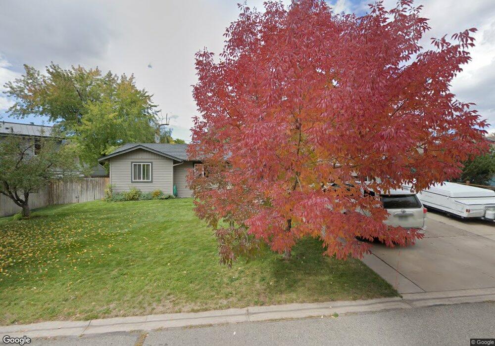
63 Ute Carbondale, CO 81623
Estimated Value: $1,265,000 - $1,409,482
3
Beds
3
Baths
2,246
Sq Ft
$587/Sq Ft
Est. Value
About This Home
This home is located at 63 Ute, Carbondale, CO 81623 and is currently estimated at $1,319,371, approximately $587 per square foot. 63 Ute is a home located in Eagle County with nearby schools including Cornerstone Classical School.
Ownership History
Date
Name
Owned For
Owner Type
Purchase Details
Closed on
Mar 14, 2008
Sold by
Hjerleid David
Bought by
Hjerleid David and Hjerleid Margaret A
Current Estimated Value
Home Financials for this Owner
Home Financials are based on the most recent Mortgage that was taken out on this home.
Original Mortgage
$331,000
Outstanding Balance
$201,224
Interest Rate
5.72%
Mortgage Type
New Conventional
Estimated Equity
$1,118,147
Purchase Details
Closed on
Sep 15, 2003
Sold by
Argueta Rodolfo and Argueta Carmen
Bought by
Hjerleid David
Home Financials for this Owner
Home Financials are based on the most recent Mortgage that was taken out on this home.
Original Mortgage
$248,000
Interest Rate
5.87%
Mortgage Type
Purchase Money Mortgage
Purchase Details
Closed on
Apr 10, 2001
Sold by
Argueta Rodolfo and Argueta Maria Delcarmen
Bought by
Argueta Rodolfo and Argueta Carmen
Purchase Details
Closed on
May 1, 1996
Purchase Details
Closed on
Oct 12, 1993
Create a Home Valuation Report for This Property
The Home Valuation Report is an in-depth analysis detailing your home's value as well as a comparison with similar homes in the area
Home Values in the Area
Average Home Value in this Area
Purchase History
| Date | Buyer | Sale Price | Title Company |
|---|---|---|---|
| Hjerleid David | -- | Stewart Title Of Colorado In | |
| Hjerleid David | $310,000 | -- | |
| Argueta Rodolfo | -- | -- | |
| -- | $198,000 | -- | |
| -- | $139,400 | -- |
Source: Public Records
Mortgage History
| Date | Status | Borrower | Loan Amount |
|---|---|---|---|
| Open | Hjerleid David | $331,000 | |
| Closed | Hjerleid David | $248,000 | |
| Closed | Hjerleid David | $46,500 |
Source: Public Records
Tax History
| Year | Tax Paid | Tax Assessment Tax Assessment Total Assessment is a certain percentage of the fair market value that is determined by local assessors to be the total taxable value of land and additions on the property. | Land | Improvement |
|---|---|---|---|---|
| 2025 | $4,617 | $78,900 | $17,500 | $61,400 |
| 2024 | $4,476 | $59,960 | $12,620 | $47,340 |
| 2023 | $4,476 | $59,960 | $12,620 | $47,340 |
| 2022 | $3,548 | $43,980 | $11,120 | $32,860 |
| 2021 | $3,646 | $45,250 | $11,440 | $33,810 |
| 2020 | $3,337 | $43,460 | $9,650 | $33,810 |
| 2019 | $3,368 | $43,460 | $9,650 | $33,810 |
| 2018 | $3,192 | $40,800 | $7,630 | $33,170 |
| 2017 | $3,022 | $40,800 | $7,630 | $33,170 |
| 2016 | $2,607 | $34,570 | $7,960 | $26,610 |
| 2015 | -- | $34,570 | $7,960 | $26,610 |
| 2014 | $1,769 | $24,680 | $5,970 | $18,710 |
Source: Public Records
Map
Nearby Homes
- 128 Hopi
- 231 Robinson St Unit R226
- 231 Robinson St Unit R340
- 201 Tree Farm Dr Unit The Creekside
- 201 Tree Farm Dr Unit All Parcels
- 201 Tree Farm Dr Unit The Lakeview
- 361 Robinson St Unit 232
- TBD Tree Farm Dr Unit A4 - 201
- TBD Tree Farm Dr Unit A1-302
- TBD Tree Farm Dr Unit A2 - 301
- TBD Tree Farm Dr Unit A4 - 202
- TBD Tree Farm Dr Unit A1-202
- TBD Tree Farm Dr Unit The Edge at Tree Far
- TBD Tree Farm Dr Unit A1-203
- TBD Tree Farm Dr Unit A3 - 301
- TBD Tree Farm Dr Unit A1-301
- TBD Tree Farm Dr Unit A3 -201
- TBD Tree Farm Dr Unit A-2 302
- TBD Tree Farm Dr Unit A2-201
- TBD Tree Farm Dr Unit A1-201
Your Personal Tour Guide
Ask me questions while you tour the home.