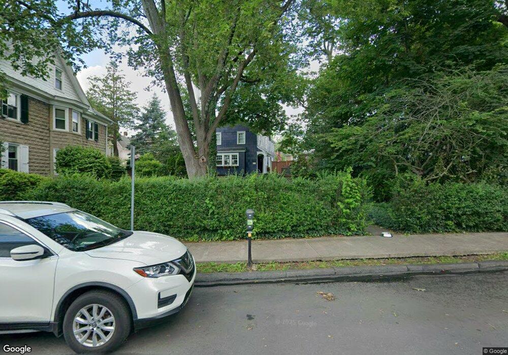
63 W Oakland Ave Doylestown, PA 18901
Estimated Value: $593,000 - $913,000
3
Beds
3
Baths
1,536
Sq Ft
$451/Sq Ft
Est. Value
About This Home
This home is located at 63 W Oakland Ave, Doylestown, PA 18901 and is currently estimated at $692,144, approximately $450 per square foot. 63 W Oakland Ave is a home located in Bucks County with nearby schools including Doyle El School, Lenape Middle School, and Central Bucks High School-West.
Ownership History
Date
Name
Owned For
Owner Type
Purchase Details
Closed on
Nov 30, 2009
Sold by
Kulp John Allen
Bought by
Laity David J and Laity Nancy J
Current Estimated Value
Home Financials for this Owner
Home Financials are based on the most recent Mortgage that was taken out on this home.
Original Mortgage
$208,000
Outstanding Balance
$136,433
Interest Rate
5.01%
Mortgage Type
New Conventional
Estimated Equity
$555,711
Purchase Details
Closed on
Sep 14, 2002
Sold by
Histand Florence Moyer
Bought by
Kulp John Allen
Home Financials for this Owner
Home Financials are based on the most recent Mortgage that was taken out on this home.
Original Mortgage
$160,000
Interest Rate
5.62%
Create a Home Valuation Report for This Property
The Home Valuation Report is an in-depth analysis detailing your home's value as well as a comparison with similar homes in the area
Home Values in the Area
Average Home Value in this Area
Purchase History
| Date | Buyer | Sale Price | Title Company |
|---|---|---|---|
| Laity David J | $468,000 | None Available | |
| Kulp John Allen | $226,000 | Multiple |
Source: Public Records
Mortgage History
| Date | Status | Borrower | Loan Amount |
|---|---|---|---|
| Open | Laity David J | $208,000 | |
| Previous Owner | Kulp John Allen | $160,000 |
Source: Public Records
Tax History Compared to Growth
Tax History
| Year | Tax Paid | Tax Assessment Tax Assessment Total Assessment is a certain percentage of the fair market value that is determined by local assessors to be the total taxable value of land and additions on the property. | Land | Improvement |
|---|---|---|---|---|
| 2025 | $3,171 | $17,600 | $4,480 | $13,120 |
| 2024 | $3,171 | $17,600 | $4,480 | $13,120 |
| 2023 | $3,021 | $17,600 | $4,480 | $13,120 |
| 2022 | $2,979 | $17,600 | $4,480 | $13,120 |
| 2021 | $2,946 | $17,600 | $4,480 | $13,120 |
| 2020 | $2,914 | $17,600 | $4,480 | $13,120 |
| 2019 | $2,882 | $17,600 | $4,480 | $13,120 |
| 2018 | $2,846 | $17,600 | $4,480 | $13,120 |
| 2017 | $2,816 | $17,600 | $4,480 | $13,120 |
| 2016 | $2,816 | $17,600 | $4,480 | $13,120 |
| 2015 | -- | $17,600 | $4,480 | $13,120 |
| 2014 | -- | $17,600 | $4,480 | $13,120 |
Source: Public Records
Map
Nearby Homes
- 37 N Clinton St
- 69 E Oakland Ave
- 20 E Court St
- 195 Lafayette St
- 130 N Clinton St
- 110 E Ashland St
- 1 Barnes Ct
- 236 Green St
- 155 E Oakland Ave
- 146 N Church St
- 146 E Court St
- 89 Homestead Dr
- 403 S Main St Unit S201
- 3 Steeplechase Dr
- 9 Mill Creek Dr
- 339 E Ashland St
- 272 Fox Chase Ln
- 121 Cottage St
- 114 Progress Dr
- 418 North St
- 77 W Oakland Ave
- 61 W Oakland Ave Unit C
- 61 W Oakland Ave Unit A
- 61 W Oakland Ave Unit B
- 76 Mary St
- 79 W Oakland Ave
- 57 W Oakland Ave
- 37 S Clinton St
- 55 W Oakland Ave
- 70 SW Oakland Ave Unit 315
- 70 SW Oakland Ave Unit 106
- 70 SW Oakland Ave Unit 210
- 70 SW Oakland Ave Unit 202 & 203
- 70 SW Oakland Ave Unit 312
- 75 Mary St
- 63 Mary St
- 59 Mary St
- 51 W Oakland Ave
- 70 W Oakland Ave Unit 104
- 70 W Oakland Ave Unit 305+