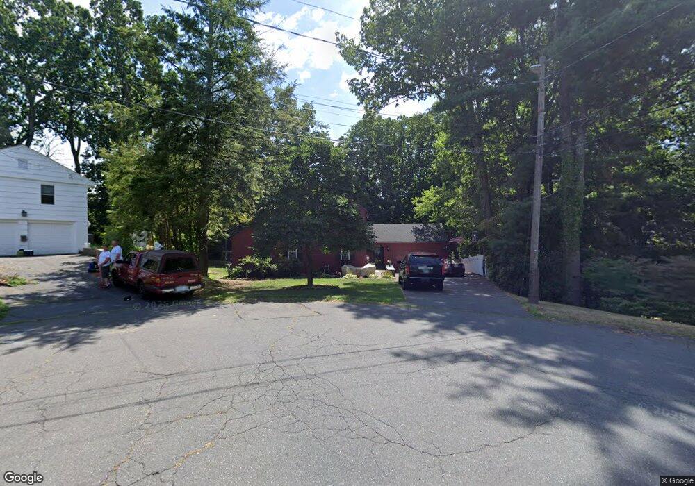
63 Woodridge Cir West Hartford, CT 06107
Estimated Value: $584,000 - $702,000
3
Beds
4
Baths
1,776
Sq Ft
$367/Sq Ft
Est. Value
About This Home
This home is located at 63 Woodridge Cir, West Hartford, CT 06107 and is currently estimated at $652,037, approximately $367 per square foot. 63 Woodridge Cir is a home located in Hartford County with nearby schools including Wolcott School, Sedgwick Middle School, and Conard High School.
Ownership History
Date
Name
Owned For
Owner Type
Purchase Details
Closed on
Nov 10, 2005
Sold by
Floriani Paul T and Floriani Lisa B
Bought by
Bates Robert L and Samele-Bates Lori J
Current Estimated Value
Home Financials for this Owner
Home Financials are based on the most recent Mortgage that was taken out on this home.
Original Mortgage
$362,000
Interest Rate
5.37%
Purchase Details
Closed on
Mar 21, 2000
Sold by
Graves Stephen H and Graves Caroline R
Bought by
Blair Lisa M and Floriani Paul T
Purchase Details
Closed on
Mar 30, 1998
Sold by
Szumyk Robin S
Bought by
Graves Stephen H and Graves Caroline R
Purchase Details
Closed on
May 16, 1988
Sold by
Roberts P S
Bought by
Andrews P M
Create a Home Valuation Report for This Property
The Home Valuation Report is an in-depth analysis detailing your home's value as well as a comparison with similar homes in the area
Home Values in the Area
Average Home Value in this Area
Purchase History
| Date | Buyer | Sale Price | Title Company |
|---|---|---|---|
| Bates Robert L | $382,000 | -- | |
| Blair Lisa M | $289,000 | -- | |
| Graves Stephen H | $236,600 | -- | |
| Andrews P M | $255,000 | -- |
Source: Public Records
Mortgage History
| Date | Status | Borrower | Loan Amount |
|---|---|---|---|
| Open | Andrews P M | $372,405 | |
| Closed | Andrews P M | $25,001 | |
| Closed | Andrews P M | $362,000 |
Source: Public Records
Tax History Compared to Growth
Tax History
| Year | Tax Paid | Tax Assessment Tax Assessment Total Assessment is a certain percentage of the fair market value that is determined by local assessors to be the total taxable value of land and additions on the property. | Land | Improvement |
|---|---|---|---|---|
| 2025 | $12,827 | $286,440 | $98,980 | $187,460 |
| 2024 | $12,131 | $286,440 | $98,980 | $187,460 |
| 2023 | $11,721 | $286,440 | $98,980 | $187,460 |
| 2022 | $11,652 | $286,440 | $98,980 | $187,460 |
| 2021 | $10,823 | $255,150 | $110,600 | $144,550 |
| 2020 | $9,817 | $234,850 | $97,860 | $136,990 |
| 2019 | $9,817 | $234,850 | $97,860 | $136,990 |
| 2018 | $9,629 | $234,850 | $97,860 | $136,990 |
| 2017 | $9,638 | $234,850 | $97,860 | $136,990 |
| 2016 | $9,470 | $239,680 | $88,830 | $150,850 |
| 2015 | $9,182 | $239,680 | $88,830 | $150,850 |
| 2014 | $8,957 | $239,680 | $88,830 | $150,850 |
Source: Public Records
Map
Nearby Homes
- 43 Burnham Dr
- 25 Fowler Dr
- 281 South Rd
- 32 Miles Standish Dr
- 1 Valley Crest Dr
- 54 Red Top Dr
- 24 Thorne Rd Unit 24
- 34 Sandhurst Dr
- 236 Ridgewood Rd
- 479 S Main St
- 61 Waterside Ln
- 371 Middle Rd
- 42 Avery Rd
- 422 S Main St
- 00 Old Farm Dr
- 16 Thornton Dr
- 18 Federal St
- 228 Reservoir Rd
- 29 Fairwood Farms Dr
- 107 Westgate St
- 57 Woodridge Cir
- 64 Woodridge Cir
- 62 Woodridge Cir
- 53 Woodridge Cir
- 58 Woodridge Cir
- 395 Ridgewood Rd
- 50 Woodridge Cir
- 47 Woodridge Cir
- 389 Ridgewood Rd
- 48 Woodridge Cir
- 39 Oak Ridge Ln
- 43 Woodridge Cir
- 35 Oak Ridge Ln
- 385 Ridgewood Rd
- 47 Oak Ridge Ln
- 31 Oak Ridge Ln
- 46 Woodridge Cir
- 51 Oak Ridge Ln
- 27 Oak Ridge Ln