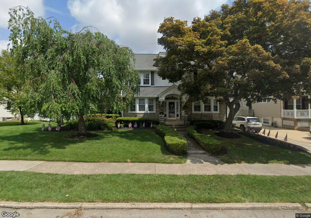
630 Ashurst Rd Havertown, PA 19083
Estimated Value: $844,000 - $956,000
4
Beds
4
Baths
2,752
Sq Ft
$322/Sq Ft
Est. Value
About This Home
This home is located at 630 Ashurst Rd, Havertown, PA 19083 and is currently estimated at $887,363, approximately $322 per square foot. 630 Ashurst Rd is a home located in Delaware County with nearby schools including Chatham Park Elementary School, Haverford Middle School, and Haverford Senior High School.
Ownership History
Date
Name
Owned For
Owner Type
Purchase Details
Closed on
Nov 3, 2025
Sold by
Mclaverty Monica A
Bought by
Irrevocable Grantor Trust
Current Estimated Value
Purchase Details
Closed on
Jun 20, 1994
Sold by
Cahill Walter J and Cahill Maria L
Bought by
Mclaverty John F and Mclaverty Monica A
Home Financials for this Owner
Home Financials are based on the most recent Mortgage that was taken out on this home.
Original Mortgage
$150,000
Interest Rate
8.74%
Mortgage Type
Purchase Money Mortgage
Create a Home Valuation Report for This Property
The Home Valuation Report is an in-depth analysis detailing your home's value as well as a comparison with similar homes in the area
Home Values in the Area
Average Home Value in this Area
Purchase History
| Date | Buyer | Sale Price | Title Company |
|---|---|---|---|
| Irrevocable Grantor Trust | $1,325,000 | None Listed On Document | |
| Mclaverty John F | $229,000 | -- |
Source: Public Records
Mortgage History
| Date | Status | Borrower | Loan Amount |
|---|---|---|---|
| Previous Owner | Mclaverty John F | $150,000 |
Source: Public Records
Tax History Compared to Growth
Tax History
| Year | Tax Paid | Tax Assessment Tax Assessment Total Assessment is a certain percentage of the fair market value that is determined by local assessors to be the total taxable value of land and additions on the property. | Land | Improvement |
|---|---|---|---|---|
| 2025 | $12,421 | $483,090 | $129,850 | $353,240 |
| 2024 | $12,421 | $483,090 | $129,850 | $353,240 |
| 2023 | $12,069 | $483,090 | $129,850 | $353,240 |
| 2022 | $11,786 | $483,090 | $129,850 | $353,240 |
| 2021 | $19,202 | $483,090 | $129,850 | $353,240 |
| 2020 | $9,945 | $213,980 | $65,740 | $148,240 |
| 2019 | $9,762 | $213,980 | $65,740 | $148,240 |
| 2018 | $9,595 | $213,980 | $0 | $0 |
| 2017 | $9,391 | $213,980 | $0 | $0 |
| 2016 | $1,174 | $213,980 | $0 | $0 |
| 2015 | $1,198 | $213,980 | $0 | $0 |
| 2014 | $1,198 | $213,980 | $0 | $0 |
Source: Public Records
Map
Nearby Homes
- 727 E Manoa Rd
- 530 E Manoa Rd
- 530 Kenmore Rd
- 210 Farnham Rd
- 104 Brentwood Rd
- 142 Foster Ave
- 1108 Allston Rd
- 227 N Linden Ave
- 243 Rock Glen Rd
- 221 E Park Rd
- 137 Strathmore Rd
- 223 E Park Rd
- 148 Meadowbrook Ave
- 110 E Township Line Rd
- 400 Witley Rd
- 7661 Overbrook Ave
- 433 Haverford Rd
- 15 Rodman Ave
- 1404 Greywall Ln
- 1354 Arbordale Rd