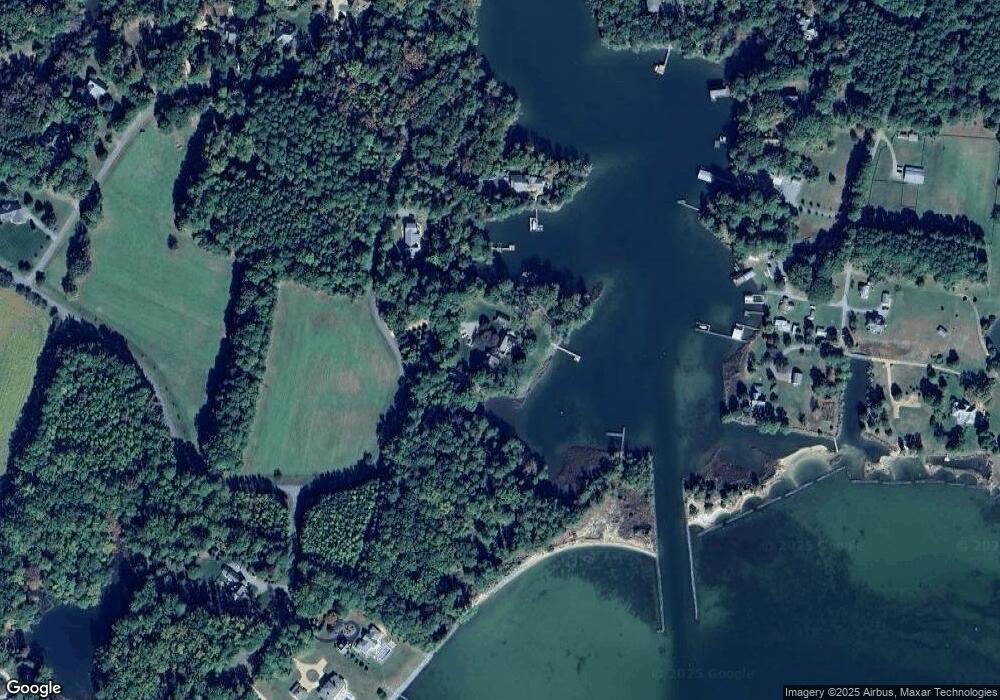
630 Bland Point Rd Deltaville, VA 23043
Estimated Value: $1,225,000 - $3,783,000
4
Beds
7
Baths
4,076
Sq Ft
$527/Sq Ft
Est. Value
About This Home
This home is located at 630 Bland Point Rd, Deltaville, VA 23043 and is currently estimated at $2,146,548, approximately $526 per square foot. 630 Bland Point Rd is a home located in Middlesex County with nearby schools including Middlesex Elementary School, St. Clare Walker Middle School, and Middlesex High School.
Ownership History
Date
Name
Owned For
Owner Type
Purchase Details
Closed on
Feb 14, 2008
Sold by
Hall Laurence J
Bought by
Cutler Gordon B
Current Estimated Value
Home Financials for this Owner
Home Financials are based on the most recent Mortgage that was taken out on this home.
Original Mortgage
$400,000
Outstanding Balance
$253,363
Interest Rate
6.14%
Mortgage Type
New Conventional
Estimated Equity
$1,893,185
Create a Home Valuation Report for This Property
The Home Valuation Report is an in-depth analysis detailing your home's value as well as a comparison with similar homes in the area
Home Values in the Area
Average Home Value in this Area
Purchase History
| Date | Buyer | Sale Price | Title Company |
|---|---|---|---|
| Cutler Gordon B | $2,750,000 | -- |
Source: Public Records
Mortgage History
| Date | Status | Borrower | Loan Amount |
|---|---|---|---|
| Open | Cutler Gordon B | $400,000 |
Source: Public Records
Tax History Compared to Growth
Tax History
| Year | Tax Paid | Tax Assessment Tax Assessment Total Assessment is a certain percentage of the fair market value that is determined by local assessors to be the total taxable value of land and additions on the property. | Land | Improvement |
|---|---|---|---|---|
| 2025 | $8,495 | $1,392,600 | $525,800 | $866,800 |
| 2024 | $8,495 | $1,392,600 | $525,800 | $866,800 |
| 2023 | $8,495 | $1,392,600 | $525,800 | $866,800 |
| 2022 | $8,495 | $1,392,600 | $525,800 | $866,800 |
| 2021 | $8,190 | $1,320,900 | $546,300 | $774,600 |
| 2020 | $8,190 | $1,320,900 | $546,300 | $774,600 |
| 2019 | $8,190 | $1,320,900 | $546,300 | $774,600 |
| 2018 | $7,397 | $1,320,900 | $546,300 | $774,600 |
| 2017 | $7,397 | $1,320,900 | $546,300 | $774,600 |
| 2016 | $7,131 | $1,345,400 | $544,800 | $800,600 |
| 2015 | -- | $0 | $0 | $0 |
| 2014 | -- | $0 | $0 | $0 |
| 2013 | -- | $0 | $0 | $0 |
Source: Public Records
Map
Nearby Homes
- 4.6 Bland Point Rd
- 211 Porpoise Cove Ln
- 318 Paradise Ln
- 16445 General Puller Hwy
- 16527 General Puller Hwy
- 00 Providence Rd
- 791 Stove Point Rd
- 330 Jackson Farm Ln
- 00 Apache Dr
- 146 Robins Point Ave
- 134 Dove Haven
- 00 Robins Point Ave
- 65 Oyster Shell Rd Unit 10
- 26 Tupelo St
- 117 Lark Dr
- 0 Seabreeze Ln
- 335 Jackson Creek Rd
- 253-255 General Puller Hwy
- 82 Sturgeon St
- 959 Robins Point Ave
- 696 Bland Point Rd
- 746 Bland Point Rd
- 700 Moores Pointe Rd
- 682 Moores Pointe Rd
- 648 Moores Pointe Rd
- 652 Moores Pointe Rd
- 680 Moores Pointe Rd
- 624 Moores Pointe Rd
- 662 Moores Pointe Rd
- 686 Moores Pointe Rd
- 73 Falling Tide Rd
- LOT 34 Falling Tide Rd
- 574 Moores Pointe Rd
- 665 Moores Pointe Rd
- 60 Falling Tide Rd
- 687 Moores Pointe Rd
- 494 Moores Pointe Rd
- 782 Bland Point Rd
- 832 Bland Point Rd
- 34 Falling Tide Rd
