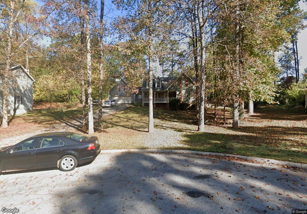
630 Buckeye Cir SE Conyers, GA 30094
Estimated Value: $275,415 - $345,000
4
Beds
4
Baths
2,046
Sq Ft
$155/Sq Ft
Est. Value
About This Home
This home is located at 630 Buckeye Cir SE, Conyers, GA 30094 and is currently estimated at $316,854, approximately $154 per square foot. 630 Buckeye Cir SE is a home located in Rockdale County with nearby schools including Barksdale Elementary School, Gen. Ray Davis Middle School, and Salem High School.
Ownership History
Date
Name
Owned For
Owner Type
Purchase Details
Closed on
May 12, 2025
Sold by
Smith Patricia
Bought by
Lantrip Linda A and Smith Patricia
Current Estimated Value
Purchase Details
Closed on
Jun 22, 2007
Sold by
Nabors Rebecca
Bought by
Smith Patricia
Home Financials for this Owner
Home Financials are based on the most recent Mortgage that was taken out on this home.
Original Mortgage
$170,600
Interest Rate
6.35%
Mortgage Type
New Conventional
Purchase Details
Closed on
Aug 17, 2006
Sold by
Arienzo Gerald V and Arienzo Mary A
Bought by
Nabors Fulton
Home Financials for this Owner
Home Financials are based on the most recent Mortgage that was taken out on this home.
Original Mortgage
$145,000
Interest Rate
6.46%
Create a Home Valuation Report for This Property
The Home Valuation Report is an in-depth analysis detailing your home's value as well as a comparison with similar homes in the area
Home Values in the Area
Average Home Value in this Area
Purchase History
| Date | Buyer | Sale Price | Title Company |
|---|---|---|---|
| Lantrip Linda A | -- | -- | |
| Smith Patricia | $170,600 | -- | |
| Nabors Fulton | $130,000 | -- |
Source: Public Records
Mortgage History
| Date | Status | Borrower | Loan Amount |
|---|---|---|---|
| Previous Owner | Smith Patricia | $170,600 | |
| Previous Owner | Nabors Fulton | $145,000 |
Source: Public Records
Tax History Compared to Growth
Tax History
| Year | Tax Paid | Tax Assessment Tax Assessment Total Assessment is a certain percentage of the fair market value that is determined by local assessors to be the total taxable value of land and additions on the property. | Land | Improvement |
|---|---|---|---|---|
| 2024 | $2,131 | $116,560 | $25,360 | $91,200 |
| 2023 | $1,671 | $103,600 | $26,400 | $77,200 |
| 2022 | $1,570 | $87,400 | $22,640 | $64,760 |
| 2021 | $1,342 | $75,480 | $17,040 | $58,440 |
| 2020 | $1,090 | $67,160 | $13,560 | $53,600 |
| 2019 | $770 | $55,520 | $10,840 | $44,680 |
| 2018 | $632 | $50,960 | $9,680 | $41,280 |
| 2017 | $658 | $51,560 | $8,680 | $42,880 |
| 2016 | $569 | $51,560 | $8,680 | $42,880 |
| 2015 | $569 | $51,560 | $8,680 | $42,880 |
| 2014 | $436 | $50,880 | $8,000 | $42,880 |
| 2013 | -- | $51,080 | $12,000 | $39,080 |
Source: Public Records
Map
Nearby Homes
- 4938 Lake Forest Dr SE
- 634 Knollwood Cir SE
- 2178 NE Hillwood Dr
- 801 Greenwood Trail SE
- 4931 W Lake Dr SE
- 4811 W Lake Dr SE
- 821 Greenwood Trail SE
- 5312 Ashley Dr SE
- 4731 Shadybrook Way SE Unit 2
- 824 Cedar Lake Dr SE
- 4980 W Lake Dr SE
- 4710 Cedar Brook Dr SE
- 4670 Cedar Brook Dr SE
- 4797 Hemlock Dr SE
- 4773 Bell Cir SE
- 4822 Navajo Trail SE
- 570 Bell Rd SE
- 510 Bell Rd SE Unit 1
- 632 Buckeye Cir SE
- 620 Buckeye Cir SE
- 629 Edgewater Cir SE
- 631 Edgewater Cir SE
- 4757 Cedar Lake Dr SE
- 612 Buckeye Cir SE
- 4761 Cedar Lake Dr SE Unit 4
- 4753 Cedar Lake Dr SE Unit 3
- 631 Buckeye Cir SE
- 629 Buckeye Cir SE
- 4765 Cedar Lake Dr SE
- 625 Edgewater Cir SE Unit 3
- 619 Buckeye Cir SE
- 4749 Cedar Lake Dr SE
- 632 Edgewater Cir SE
- 0 Buckeye Cir SE Unit 8892263
- 0 Buckeye Cir SE Unit 8836143
- 0 Buckeye Cir SE Unit 8811986
- 0 Buckeye Cir SE Unit 8430272
- 0 Buckeye Cir SE Unit 7132274