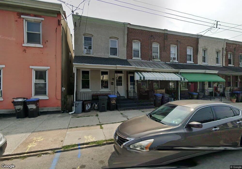
630 E Main St Norristown, PA 19401
Estimated Value: $161,000 - $211,781
3
Beds
2
Baths
1,128
Sq Ft
$159/Sq Ft
Est. Value
About This Home
This home is located at 630 E Main St, Norristown, PA 19401 and is currently estimated at $178,927, approximately $158 per square foot. 630 E Main St is a home located in Montgomery County with nearby schools including Charles Blockson Middle School, Cole Manor Elementary School, and East Norriton Middle School.
Ownership History
Date
Name
Owned For
Owner Type
Purchase Details
Closed on
Jul 24, 2008
Sold by
Hsbc Mortgage Services Inc
Bought by
630 E Main St Llc
Current Estimated Value
Purchase Details
Closed on
Jul 10, 2008
Sold by
Gambone Louis
Bought by
Hsbc Mortgage Ser Inc
Purchase Details
Closed on
Jan 4, 2001
Sold by
Gambone Mary and Gambone Louis
Bought by
Gambone Louis
Purchase Details
Closed on
Dec 28, 2000
Sold by
Gambone Mary and Gambone Louis
Bought by
Gambone Louis
Purchase Details
Closed on
Mar 28, 1996
Sold by
Gambone Mary
Bought by
Gambone Mary and Gambone Louis
Create a Home Valuation Report for This Property
The Home Valuation Report is an in-depth analysis detailing your home's value as well as a comparison with similar homes in the area
Home Values in the Area
Average Home Value in this Area
Purchase History
| Date | Buyer | Sale Price | Title Company |
|---|---|---|---|
| 630 E Main St Llc | $67,000 | None Available | |
| Hsbc Mortgage Ser Inc | $1,423 | None Available | |
| Gambone Louis | $2,500 | -- | |
| Gambone Louis | $2,500 | -- | |
| Gambone Mary | -- | -- |
Source: Public Records
Tax History Compared to Growth
Tax History
| Year | Tax Paid | Tax Assessment Tax Assessment Total Assessment is a certain percentage of the fair market value that is determined by local assessors to be the total taxable value of land and additions on the property. | Land | Improvement |
|---|---|---|---|---|
| 2025 | $2,983 | $48,600 | -- | -- |
| 2024 | $2,983 | $48,600 | -- | -- |
| 2023 | $2,956 | $48,600 | $0 | $0 |
| 2022 | $2,893 | $48,600 | $0 | $0 |
| 2021 | $2,878 | $48,600 | $0 | $0 |
| 2020 | $2,746 | $48,600 | $0 | $0 |
| 2019 | $2,696 | $48,600 | $0 | $0 |
| 2018 | $1,794 | $48,600 | $0 | $0 |
| 2017 | $2,476 | $48,600 | $0 | $0 |
| 2016 | $2,456 | $48,600 | $0 | $0 |
| 2015 | $2,353 | $48,600 | $0 | $0 |
| 2014 | $2,353 | $48,600 | $0 | $0 |
Source: Public Records
Map
Nearby Homes