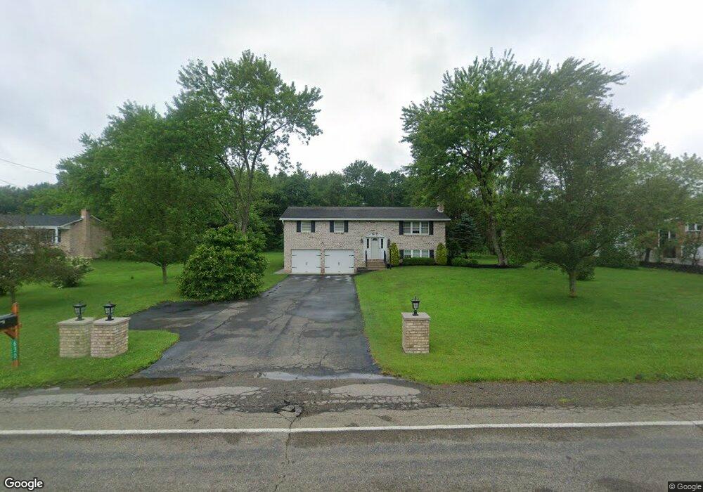
630 Ekastown Rd Sarver, PA 16055
Buffalo Township NeighborhoodEstimated Value: $321,000 - $399,308
3
Beds
2
Baths
1,872
Sq Ft
$187/Sq Ft
Est. Value
About This Home
This home is located at 630 Ekastown Rd, Sarver, PA 16055 and is currently estimated at $350,327, approximately $187 per square foot. 630 Ekastown Rd is a home located in Butler County with nearby schools including Buffalo Elementary School, Freeport Area Senior High School, and Harvest Baptist Academy.
Ownership History
Date
Name
Owned For
Owner Type
Purchase Details
Closed on
Nov 1, 2013
Sold by
Alviano Darin D
Bought by
Caro Brandon D
Current Estimated Value
Home Financials for this Owner
Home Financials are based on the most recent Mortgage that was taken out on this home.
Original Mortgage
$164,000
Outstanding Balance
$122,931
Interest Rate
4.36%
Mortgage Type
New Conventional
Estimated Equity
$227,396
Purchase Details
Closed on
Jul 10, 2007
Sold by
Reinheimer Marcie
Bought by
Alviano Darin D
Home Financials for this Owner
Home Financials are based on the most recent Mortgage that was taken out on this home.
Original Mortgage
$135,200
Interest Rate
6.54%
Mortgage Type
New Conventional
Create a Home Valuation Report for This Property
The Home Valuation Report is an in-depth analysis detailing your home's value as well as a comparison with similar homes in the area
Home Values in the Area
Average Home Value in this Area
Purchase History
| Date | Buyer | Sale Price | Title Company |
|---|---|---|---|
| Caro Brandon D | $205,000 | -- | |
| Alviano Darin D | $169,000 | -- |
Source: Public Records
Mortgage History
| Date | Status | Borrower | Loan Amount |
|---|---|---|---|
| Open | Caro Brandon D | $164,000 | |
| Previous Owner | Alviano Darin D | $135,200 |
Source: Public Records
Tax History Compared to Growth
Tax History
| Year | Tax Paid | Tax Assessment Tax Assessment Total Assessment is a certain percentage of the fair market value that is determined by local assessors to be the total taxable value of land and additions on the property. | Land | Improvement |
|---|---|---|---|---|
| 2025 | $4,500 | $20,688 | $3,840 | $16,848 |
| 2024 | $4,250 | $20,688 | $3,840 | $16,848 |
| 2023 | $3,995 | $20,688 | $3,840 | $16,848 |
| 2022 | $3,778 | $20,688 | $3,840 | $16,848 |
| 2021 | $4,006 | $21,888 | $0 | $0 |
| 2020 | $3,984 | $21,888 | $3,840 | $18,048 |
| 2019 | $3,912 | $21,888 | $3,840 | $18,048 |
| 2018 | $3,822 | $21,888 | $3,840 | $18,048 |
| 2017 | $3,822 | $21,888 | $3,840 | $18,048 |
| 2016 | $782 | $21,888 | $3,840 | $18,048 |
| 2015 | $444 | $21,888 | $3,840 | $18,048 |
| 2014 | $444 | $21,888 | $3,840 | $18,048 |
Source: Public Records
Map
Nearby Homes
- 105 Snyder Ln
- 108 Kimberly Dr
- Miramar Plan at Oak Creek
- Carlisle Plan at Oak Creek
- Somerset Plan at Oak Creek
- Avalon Plan at Oak Creek
- Rockford Plan at Oak Creek
- Birmingham Plan at Oak Creek
- Sanibel Plan at Oak Creek
- 118 Acorn Dr
- 109 Acorn Dr
- 168 Twin Oaks Dr
- Grand Cayman w/ Finished Basement Plan at Twin Oaks Ranch Homes
- Eden Cay w/ Finished Basement Plan at Twin Oaks Ranch Homes
- Grand Bahama w/ Finished Basement Plan at Twin Oaks Ranch Homes
- Dominica Spring w/ Finished Basement Plan at Twin Oaks Ranch Homes
- Aruba Bay Plan at Twin Oaks Ranch Homes
- 137 Red Horse Dr
- 322 Cole Rd
- 107 Rock Cliff Ct
- 638 Ekastown Rd
- 640 Ekastown Rd
- 618 Ekastown Rd
- 631 Ekastown Rd
- 629 Ekastown Rd
- 633 Ekastown Rd
- 635 Ekastown Rd
- 606 Ekastown Rd
- 137 Singleton Rd
- 639 Ekastown Rd
- 145 Singleton Rd
- 141 Singleton Rd
- 119 Singleton Rd
- 119A Singleton Rd
- 637 Ekastown Rd
- 135 Singleton Rd
- 149 Singleton Rd
- 133 Singleton Rd
- 0 Singleton Rd
- 129 Singleton Rd