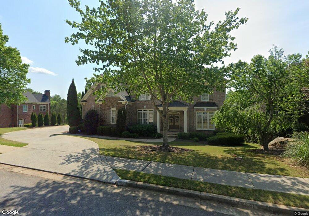
630 Grimsby Ct Suwanee, GA 30024
Estimated Value: $1,136,026 - $1,251,000
5
Beds
5
Baths
5,437
Sq Ft
$221/Sq Ft
Est. Value
About This Home
This home is located at 630 Grimsby Ct, Suwanee, GA 30024 and is currently estimated at $1,203,007, approximately $221 per square foot. 630 Grimsby Ct is a home located in Gwinnett County with nearby schools including Riverside Elementary School, North Gwinnett Middle School, and North Gwinnett High School.
Ownership History
Date
Name
Owned For
Owner Type
Purchase Details
Closed on
Mar 22, 2004
Sold by
Willoughby & Willoughby Hms Inc
Bought by
Runo Michael J and Runo Karen
Current Estimated Value
Home Financials for this Owner
Home Financials are based on the most recent Mortgage that was taken out on this home.
Original Mortgage
$425,000
Outstanding Balance
$195,162
Interest Rate
5.53%
Mortgage Type
New Conventional
Estimated Equity
$1,007,845
Create a Home Valuation Report for This Property
The Home Valuation Report is an in-depth analysis detailing your home's value as well as a comparison with similar homes in the area
Home Values in the Area
Average Home Value in this Area
Purchase History
| Date | Buyer | Sale Price | Title Company |
|---|---|---|---|
| Runo Michael J | $695,100 | -- |
Source: Public Records
Mortgage History
| Date | Status | Borrower | Loan Amount |
|---|---|---|---|
| Open | Runo Michael J | $425,000 |
Source: Public Records
Tax History
| Year | Tax Paid | Tax Assessment Tax Assessment Total Assessment is a certain percentage of the fair market value that is determined by local assessors to be the total taxable value of land and additions on the property. | Land | Improvement |
|---|---|---|---|---|
| 2025 | $14,180 | $500,440 | $84,000 | $416,440 |
| 2024 | $14,699 | $513,000 | $80,000 | $433,000 |
| 2023 | $14,699 | $475,000 | $74,000 | $401,000 |
| 2022 | $0 | $362,600 | $71,600 | $291,000 |
| 2021 | $10,013 | $326,480 | $61,200 | $265,280 |
| 2020 | $10,393 | $292,000 | $61,200 | $230,800 |
| 2019 | $10,032 | $292,000 | $61,200 | $230,800 |
| 2018 | $8,998 | $292,000 | $61,200 | $230,800 |
| 2016 | $10,037 | $290,080 | $58,000 | $232,080 |
| 2015 | $10,157 | $290,080 | $58,000 | $232,080 |
| 2014 | -- | $251,040 | $54,000 | $197,040 |
Source: Public Records
Map
Nearby Homes
- 600 Grimsby Ct
- 4847 Basingstoke Dr
- 5224 Brendlynn Dr
- 5173 Brendlynn Dr
- 891 Woodvale Point
- 861 Woodvale Point
- 811 Woodvale Point
- 840 Woodvale Point
- 4920 Roaring Fork Pass
- 721 Woodvale Point
- 751 Woodvale Point
- 5385 Harbury Ln
- 5004 Gunnison Trace
- 5683 Brendlynn Dr
- 3140 Glastonbury Ln
- 585 Settles Brook Ct
- 989 Middle Fork Trail
- 5566 Aviemore Ct
- 1078 Crescent River Pass
- 731 Hexham Ct
- 5021 Grimsby Cove NW
- 640 Grimsby Ct
- 5021 Grimsby Cove
- 620 Grimsby Ct Unit 524
- 620 Grimsby Ct
- 645 Grimsby Ct
- 635 Grimsby Ct
- 5011 Grimsby Cove NW
- 5011 Grimsby Cove
- 655 Grimsby Ct
- 615 Grimsby Ct
- 610 Grimsby Ct
- 5030 Grimsby Cove
- 5020 Grimsby Cove
- 5010 Grimsby Cove
- 665 Grimsby Ct
- 3417 Binghurst Rd
- 3427 Binghurst Rd
- 605 Grimsby Ct
- 605 Grimsby Ct Unit 1
Your Personal Tour Guide
Ask me questions while you tour the home.