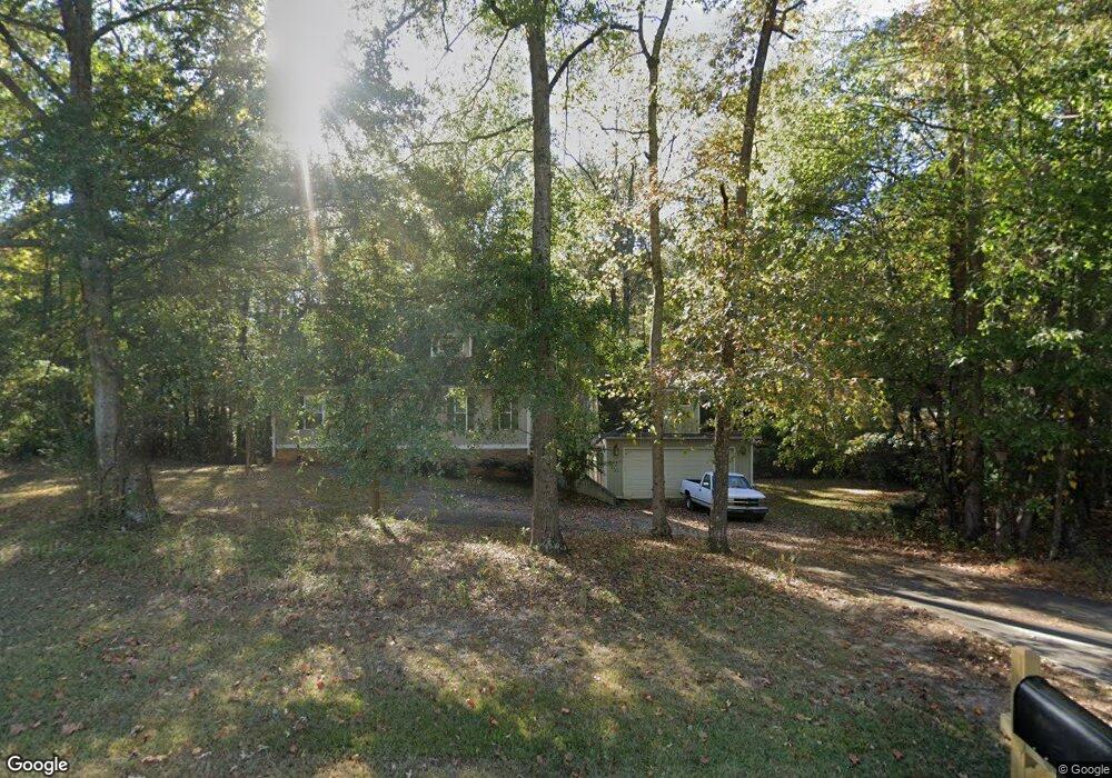
630 Jim Starr Rd Newnan, GA 30263
Estimated Value: $315,000 - $366,000
2
Beds
2
Baths
1,540
Sq Ft
$214/Sq Ft
Est. Value
About This Home
This home is located at 630 Jim Starr Rd, Newnan, GA 30263 and is currently estimated at $329,043, approximately $213 per square foot. 630 Jim Starr Rd is a home located in Coweta County with nearby schools including Brooks Elementary School, Madras Middle School, and Newnan High School.
Ownership History
Date
Name
Owned For
Owner Type
Purchase Details
Closed on
Jul 27, 2007
Sold by
Thompson J Scott
Bought by
Ragan David S
Current Estimated Value
Home Financials for this Owner
Home Financials are based on the most recent Mortgage that was taken out on this home.
Original Mortgage
$127,200
Outstanding Balance
$80,000
Interest Rate
6.71%
Mortgage Type
New Conventional
Estimated Equity
$249,043
Purchase Details
Closed on
Aug 29, 1996
Sold by
Lang James A Estate
Bought by
Lang Melissa Leah
Purchase Details
Closed on
Nov 30, 1993
Sold by
Lang Jimmy and Lang Emily D
Bought by
Lang James A Estate
Create a Home Valuation Report for This Property
The Home Valuation Report is an in-depth analysis detailing your home's value as well as a comparison with similar homes in the area
Home Values in the Area
Average Home Value in this Area
Purchase History
| Date | Buyer | Sale Price | Title Company |
|---|---|---|---|
| Ragan David S | $159,000 | -- | |
| Lang Melissa Leah | -- | -- | |
| Lang James A Estate | -- | -- |
Source: Public Records
Mortgage History
| Date | Status | Borrower | Loan Amount |
|---|---|---|---|
| Open | Ragan David S | $127,200 |
Source: Public Records
Tax History Compared to Growth
Tax History
| Year | Tax Paid | Tax Assessment Tax Assessment Total Assessment is a certain percentage of the fair market value that is determined by local assessors to be the total taxable value of land and additions on the property. | Land | Improvement |
|---|---|---|---|---|
| 2025 | $1,615 | $112,325 | $6,678 | $105,646 |
| 2024 | $1,457 | $105,855 | $6,678 | $99,176 |
| 2023 | $1,457 | $106,232 | $7,965 | $98,268 |
| 2022 | $1,672 | $85,382 | $6,127 | $79,255 |
| 2021 | $1,850 | $74,961 | $5,835 | $69,126 |
| 2020 | $1,686 | $80,382 | $5,835 | $74,547 |
| 2019 | $1,651 | $61,200 | $6,936 | $54,264 |
| 2018 | $1,654 | $61,200 | $6,936 | $54,264 |
| 2017 | $1,654 | $61,200 | $6,935 | $54,265 |
| 2016 | $1,636 | $61,200 | $6,936 | $54,264 |
| 2015 | $1,611 | $61,200 | $6,936 | $54,264 |
| 2014 | $1,601 | $61,200 | $6,936 | $54,264 |
Source: Public Records
Map
Nearby Homes
- 84 Starr Place Unit 21
- 36 Starr Place Unit 25
- 45 Sanders Crossing Unit 13
- 5 Sanders Crossing Unit 10
- LOT 89 Hedge Ct
- 76 Hodges St
- 42 Hodges St
- TISDALE Plan at Genesee
- SONOMA Plan at Genesee
- SAVANNAH II Plan at Genesee
- AMERICANA Plan at Genesee
- ASHLEY Plan at Genesee
- EDINBURGH Plan at Genesee
- 659 Hood Rd
- 220 Sagebrook Ln Unit LOT 21
- 30 Shadybrook Path Unit LOT 30
- 16 Anchor Ct
- 158 Snug Harbor Place
- 203 N Cove Dr
- 153 N Cove Dr
- 684 Jim Starr Rd
- 689 Jim Starr Rd Unit LOT 2
- 4520 Tommy Lee Cook Rd
- 1311 Brimer Rd
- 85 Genesee Point
- 1294 Brimer Rd
- 729 Jim Starr Rd Unit LOT 1
- 4515 Tommy Lee Cook Rd Unit LOT 3
- 1262 Brimer Rd
- 495 Genesee Point
- 123 Genesee Point
- 115 Genesee Point
- 110 Genesee Point
- 124 Genesee Pointe
- 124 Genesee Point
- 132 Genesee Point
- 132 Genesee Pointe
- 89 Genesee Pointe
- 128 Genesee Pointe
- 129 Genesee Pointe