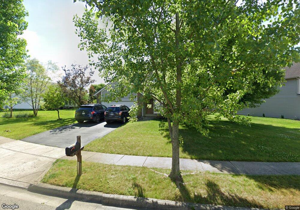
630 Keltonhurst Dr Pataskala, OH 43062
Estimated Value: $356,000 - $389,000
3
Beds
3
Baths
1,618
Sq Ft
$227/Sq Ft
Est. Value
About This Home
This home is located at 630 Keltonhurst Dr, Pataskala, OH 43062 and is currently estimated at $367,257, approximately $226 per square foot. 630 Keltonhurst Dr is a home located in Licking County with nearby schools including North Elementary School, Licking Heights Central, and Licking Heights High School.
Ownership History
Date
Name
Owned For
Owner Type
Purchase Details
Closed on
Feb 25, 2004
Sold by
Centex Homes
Bought by
Kooy Travis D and Kooy Cynthia M
Current Estimated Value
Home Financials for this Owner
Home Financials are based on the most recent Mortgage that was taken out on this home.
Original Mortgage
$145,228
Outstanding Balance
$67,635
Interest Rate
5.62%
Mortgage Type
Unknown
Estimated Equity
$299,622
Create a Home Valuation Report for This Property
The Home Valuation Report is an in-depth analysis detailing your home's value as well as a comparison with similar homes in the area
Home Values in the Area
Average Home Value in this Area
Purchase History
| Date | Buyer | Sale Price | Title Company |
|---|---|---|---|
| Kooy Travis D | $161,400 | Commerce Title |
Source: Public Records
Mortgage History
| Date | Status | Borrower | Loan Amount |
|---|---|---|---|
| Open | Kooy Travis D | $145,228 | |
| Closed | Kooy Travis D | $16,137 |
Source: Public Records
Tax History Compared to Growth
Tax History
| Year | Tax Paid | Tax Assessment Tax Assessment Total Assessment is a certain percentage of the fair market value that is determined by local assessors to be the total taxable value of land and additions on the property. | Land | Improvement |
|---|---|---|---|---|
| 2024 | $5,337 | $104,130 | $26,290 | $77,840 |
| 2023 | $5,535 | $104,130 | $26,290 | $77,840 |
| 2022 | $4,385 | $71,160 | $18,410 | $52,750 |
| 2021 | $4,469 | $71,160 | $18,410 | $52,750 |
| 2020 | $4,417 | $71,160 | $18,410 | $52,750 |
| 2019 | $3,948 | $59,010 | $13,160 | $45,850 |
| 2018 | $3,989 | $0 | $0 | $0 |
| 2017 | $3,582 | $0 | $0 | $0 |
| 2016 | $3,234 | $0 | $0 | $0 |
| 2015 | $3,083 | $0 | $0 | $0 |
| 2014 | $4,044 | $0 | $0 | $0 |
| 2013 | $3,254 | $0 | $0 | $0 |
Source: Public Records
Map
Nearby Homes
- 5284 Taylor Rd SW
- 409 Lockmead Dr
- 705 Woodington Dr
- 213 Kemperwood Dr
- 8810 Greylag Loop
- 101 Barry Knoll Dr
- 181 Brooksedge Dr
- 8661 Greylag St
- 8641 Greylag St
- 8022 Narrow Leaf Dr
- 181 Barry Knoll Dr
- 823 Bent Oak Dr
- 7989 Aspen Ridge Dr
- 1208 Tannic St
- 775 Bent Oak Dr
- 6051 Taylor Rd SW
- 7958 Waggoner Run Dr
- 605 Faith Ann Dr
- 7913 Birch Creek Dr
- 315 Cottage Grove Cir
- 626 Keltonhurst Dr
- 932 Keltonhurst Ct
- 936 Keltonhurst Ct
- 620 Keltonhurst Dr
- 639 Keltonhurst Dr
- 643 Keltonhurst Dr
- 616 Keltonhurst Dr
- 635 Keltonhurst Dr
- 631 Keltonhurst Dr
- 627 Keltonhurst Dr
- 623 Keltonhurst Dr
- 612 Keltonhurst Dr
- 647 Keltonhurst Dr
- 608 Keltonhurst Dr
- 931 Keltonhurst Ct
- 939 Keltonhurst Ct
- 944 Keltonhurst Ct
- 935 Keltonhurst Ct
- 604 Keltonhurst Dr
- 650 Keltonhurst Dr