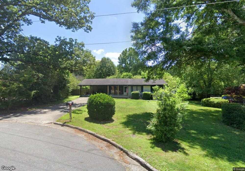
630 Log Cabin Ct NE Unit 2 Kennesaw, GA 30144
Sandy Plains NeighborhoodEstimated Value: $287,000 - $316,000
3
Beds
2
Baths
1,047
Sq Ft
$285/Sq Ft
Est. Value
About This Home
This home is located at 630 Log Cabin Ct NE Unit 2, Kennesaw, GA 30144 and is currently estimated at $298,356, approximately $284 per square foot. 630 Log Cabin Ct NE Unit 2 is a home located in Cobb County with nearby schools including Nicholson Elementary School, McCleskey Middle School, and Kell High School.
Ownership History
Date
Name
Owned For
Owner Type
Purchase Details
Closed on
Feb 27, 2025
Sold by
Kopanski Jon A and Kopanski Rosie
Bought by
Jon And Rose Kopanski Living Trust and Kopanski
Current Estimated Value
Purchase Details
Closed on
Jan 27, 1995
Sold by
Maggart Bryan C Carolyn
Bought by
Kopanski Jon A
Home Financials for this Owner
Home Financials are based on the most recent Mortgage that was taken out on this home.
Original Mortgage
$63,000
Interest Rate
9.21%
Create a Home Valuation Report for This Property
The Home Valuation Report is an in-depth analysis detailing your home's value as well as a comparison with similar homes in the area
Home Values in the Area
Average Home Value in this Area
Purchase History
| Date | Buyer | Sale Price | Title Company |
|---|---|---|---|
| Jon And Rose Kopanski Living Trust | -- | None Listed On Document | |
| Jon And Rose Kopanski Living Trust | -- | None Listed On Document | |
| Kopanski Jon A | $65,000 | -- |
Source: Public Records
Mortgage History
| Date | Status | Borrower | Loan Amount |
|---|---|---|---|
| Previous Owner | Kopanski Jon A | $63,000 |
Source: Public Records
Tax History Compared to Growth
Tax History
| Year | Tax Paid | Tax Assessment Tax Assessment Total Assessment is a certain percentage of the fair market value that is determined by local assessors to be the total taxable value of land and additions on the property. | Land | Improvement |
|---|---|---|---|---|
| 2024 | $2,961 | $98,196 | $26,000 | $72,196 |
| 2023 | $2,542 | $84,308 | $22,000 | $62,308 |
| 2022 | $2,275 | $74,948 | $18,000 | $56,948 |
| 2021 | $1,704 | $56,144 | $14,000 | $42,144 |
| 2020 | $1,665 | $54,852 | $8,000 | $46,852 |
| 2019 | $1,665 | $54,852 | $8,000 | $46,852 |
| 2018 | $1,337 | $44,048 | $8,000 | $36,048 |
| 2017 | $1,266 | $44,048 | $8,000 | $36,048 |
| 2016 | $1,205 | $41,908 | $6,000 | $35,908 |
| 2015 | $1,042 | $35,360 | $6,000 | $29,360 |
| 2014 | $1,051 | $35,360 | $0 | $0 |
Source: Public Records
Map
Nearby Homes
- 4704 Lincoln Dr NE
- The Gavin E Plan at The Village at Shallowford - Signature Series
- The Marion A Plan at The Village at Shallowford - Classic Series
- The Cary A Plan at The Village at Shallowford - Classic Series
- 4669 Blue Topaz Trail
- 639 Tigers Eye Terrace
- 707 Smokey Quartz Way
- 710 Smokey Quartz Way
- 694 Smokey Quartz Way
- 4785 Moonstone NE
- 703 Smokey Quartz Way
- 706 Smokey Quartz Way
- 702 Smokey Quartz Way
- 4778 Moonstone NE
- 4785 Moonstone Trace
- 620 Log Cabin Ct NE Unit 2
- 640 Log Cabin Ct NE
- 4720 Lincoln Dr NE
- 4714 Lincoln Dr NE
- 4710 Lincoln Dr NE
- 610 Log Cabin Ct NE
- 4708 Lincoln Dr NE
- 4726 Lincoln Dr NE
- 641 Log Cabin Ct NE Unit 2
- 615 Log Cabin Ct NE
- 0 Lincoln Dr NE
- 631 Log Cabin Ct NE
- 4820 Lincoln Dr NE Unit 2
- 4770 Lincoln Dr NE
- 650 Rail Splitter Dr NE
- 4780 Lincoln Dr NE
- 664 Rail Splitter Dr NE
- 4700 Lincoln Dr NE
- 680 Abe Cir NE
- 4830 Lincoln Dr NE