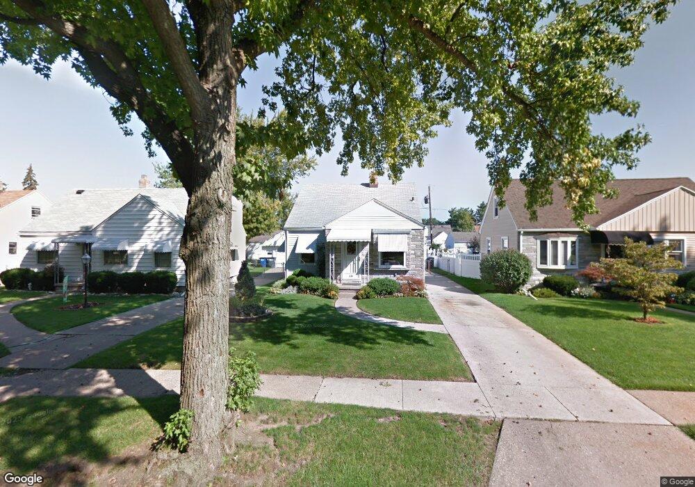
630 Mayfair Blvd Toledo, OH 43612
North Towne NeighborhoodEstimated Value: $112,000 - $130,000
3
Beds
1
Bath
1,036
Sq Ft
$120/Sq Ft
Est. Value
About This Home
This home is located at 630 Mayfair Blvd, Toledo, OH 43612 and is currently estimated at $124,585, approximately $120 per square foot. 630 Mayfair Blvd is a home located in Lucas County with nearby schools including Larchmont Elementary School, Start High School, and Bennett Venture Academy.
Ownership History
Date
Name
Owned For
Owner Type
Purchase Details
Closed on
Jul 28, 2006
Sold by
Harrell Denise A
Bought by
Harrell Denise A and Harrell A
Current Estimated Value
Home Financials for this Owner
Home Financials are based on the most recent Mortgage that was taken out on this home.
Original Mortgage
$72,000
Outstanding Balance
$43,485
Interest Rate
6.87%
Mortgage Type
Purchase Money Mortgage
Estimated Equity
$81,100
Purchase Details
Closed on
May 3, 2005
Sold by
Estate Of Donna M Roderick
Bought by
Harrell Denise A and Bobak Diana L
Purchase Details
Closed on
Feb 13, 1998
Sold by
Gearhart Donald E
Bought by
Roderick Donna M and Gearhart Donna M
Create a Home Valuation Report for This Property
The Home Valuation Report is an in-depth analysis detailing your home's value as well as a comparison with similar homes in the area
Home Values in the Area
Average Home Value in this Area
Purchase History
| Date | Buyer | Sale Price | Title Company |
|---|---|---|---|
| Harrell Denise A | -- | Chicago Title Insurance Comp | |
| Harrell Denise A | $90,000 | Chicago Title Insurance Comp | |
| Harrell Denise A | -- | Chicago Title Insurance Comp | |
| Harrell Denise A | -- | -- | |
| Roderick Donna M | -- | -- |
Source: Public Records
Mortgage History
| Date | Status | Borrower | Loan Amount |
|---|---|---|---|
| Open | Harrell Denise A | $72,000 |
Source: Public Records
Tax History Compared to Growth
Tax History
| Year | Tax Paid | Tax Assessment Tax Assessment Total Assessment is a certain percentage of the fair market value that is determined by local assessors to be the total taxable value of land and additions on the property. | Land | Improvement |
|---|---|---|---|---|
| 2024 | $1,025 | $32,690 | $7,560 | $25,130 |
| 2023 | $1,546 | $23,135 | $6,580 | $16,555 |
| 2022 | $1,540 | $23,135 | $6,580 | $16,555 |
| 2021 | $1,574 | $23,135 | $6,580 | $16,555 |
| 2020 | $1,632 | $21,245 | $4,970 | $16,275 |
| 2019 | $1,595 | $21,245 | $4,970 | $16,275 |
| 2018 | $1,594 | $21,245 | $4,970 | $16,275 |
| 2017 | $1,636 | $20,755 | $4,865 | $15,890 |
| 2016 | $1,632 | $59,300 | $13,900 | $45,400 |
| 2015 | $1,617 | $59,300 | $13,900 | $45,400 |
| 2014 | $1,342 | $20,760 | $4,870 | $15,890 |
| 2013 | $1,342 | $20,760 | $4,870 | $15,890 |
Source: Public Records
Map
Nearby Homes
- 702 Mayfair Blvd
- 741 Cloverdale Rd
- 918 Mayfair Blvd
- 414 Boxhall Rd
- 5454 San Pedro Dr
- 431 Northdale Dr
- 331 Southdale Rd
- 5434 Lewis Ave
- 5534 San Paulo Dr
- 420 Northdale Dr
- 606 W Capistrano Ave
- 5137 Homeside Ave
- 451 W Crawford Ave
- 5138 Hallgate Ave
- 5114 Hallgate Ave
- 223 Northdale Dr
- 303 W Crawford Ave
- 5142 Ford Ave
- 423 W Poinsetta Ave
- 5061 Hallgate Ave
- 626 Mayfair Blvd
- 634 Mayfair Blvd
- 622 Mayfair Blvd
- 640 Mayfair Blvd
- 644 Mayfair Blvd
- 616 Mayfair Blvd
- 629 Sandralee Dr
- 625 Sandralee Dr
- 635 Sandralee Dr
- 619 Sandralee Dr
- 639 Sandralee Dr
- 648 Mayfair Blvd
- 614 Mayfair Blvd
- 615 Sandralee Dr
- 627 Mayfair Blvd
- 631 Mayfair Blvd
- 645 Sandralee Dr
- 623 Mayfair Blvd
- 635 Mayfair Blvd
- 652 Mayfair Blvd