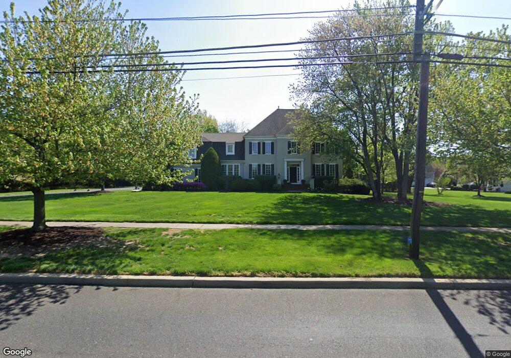
630 New Albany Rd Moorestown, NJ 08057
Estimated Value: $1,279,000 - $1,396,000
4
Beds
5
Baths
3,413
Sq Ft
$387/Sq Ft
Est. Value
About This Home
This home is located at 630 New Albany Rd, Moorestown, NJ 08057 and is currently estimated at $1,321,107, approximately $387 per square foot. 630 New Albany Rd is a home located in Burlington County with nearby schools including George C. Baker Elementary School, Moorestown Upper Elementary School, and William Allen Middle School.
Ownership History
Date
Name
Owned For
Owner Type
Purchase Details
Closed on
Jan 25, 2002
Sold by
Riptide V Llc
Bought by
Martin James E and Martin Paula
Current Estimated Value
Home Financials for this Owner
Home Financials are based on the most recent Mortgage that was taken out on this home.
Original Mortgage
$78,600
Outstanding Balance
$32,707
Interest Rate
7.15%
Mortgage Type
Credit Line Revolving
Estimated Equity
$1,288,400
Purchase Details
Closed on
Nov 28, 2001
Sold by
Steward R Maines Company Inc
Bought by
Riptide V Llc
Home Financials for this Owner
Home Financials are based on the most recent Mortgage that was taken out on this home.
Original Mortgage
$518,750
Outstanding Balance
$215,861
Interest Rate
7.15%
Mortgage Type
Stand Alone First
Estimated Equity
$1,105,246
Create a Home Valuation Report for This Property
The Home Valuation Report is an in-depth analysis detailing your home's value as well as a comparison with similar homes in the area
Home Values in the Area
Average Home Value in this Area
Purchase History
| Date | Buyer | Sale Price | Title Company |
|---|---|---|---|
| Martin James E | $605,000 | Infinity Title Agency Inc | |
| Riptide V Llc | $150,000 | -- |
Source: Public Records
Mortgage History
| Date | Status | Borrower | Loan Amount |
|---|---|---|---|
| Open | Martin James E | $78,600 | |
| Open | Martin James E | $518,750 |
Source: Public Records
Tax History Compared to Growth
Tax History
| Year | Tax Paid | Tax Assessment Tax Assessment Total Assessment is a certain percentage of the fair market value that is determined by local assessors to be the total taxable value of land and additions on the property. | Land | Improvement |
|---|---|---|---|---|
| 2025 | $19,465 | $686,100 | $161,000 | $525,100 |
| 2024 | $18,875 | $686,100 | $161,000 | $525,100 |
| 2023 | $18,875 | $686,100 | $161,000 | $525,100 |
| 2022 | $18,683 | $686,100 | $161,000 | $525,100 |
| 2021 | $18,436 | $686,100 | $161,000 | $525,100 |
| 2020 | $18,319 | $686,100 | $161,000 | $525,100 |
| 2019 | $17,996 | $686,100 | $161,000 | $525,100 |
| 2018 | $17,509 | $686,100 | $161,000 | $525,100 |
| 2017 | $16,121 | $626,300 | $161,000 | $465,300 |
| 2016 | $16,065 | $626,300 | $161,000 | $465,300 |
| 2015 | $15,870 | $626,300 | $161,000 | $465,300 |
| 2014 | $15,069 | $626,300 | $161,000 | $465,300 |
Source: Public Records
Map
Nearby Homes
- 25 Oriole Way
- 2801 Riverton Rd
- 543 Bethel Ave
- 343 Tom Brown Rd
- 863 Golf View Rd
- 347 Tom Brown Rd
- 308 Farmdale Rd
- 316 Farmdale Rd
- 423 Park Blvd
- 744 Signal Light Rd
- 2807 Hunterdon Dr
- 2611 Barton Ct
- 142 Fox Chase Dr
- 205 E Central Ave
- 50 E 3rd St
- 313 Fairview Ave
- 66 E 3rd St
- 82 E 3rd St
- 80 E 3rd St
- 164 Fox Chase Dr