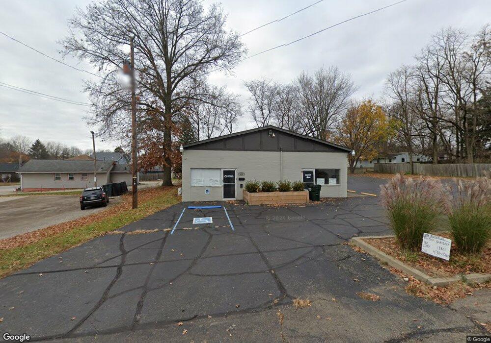
630 Palmer St Wooster, OH 44691
Estimated Value: $113,381
--
Bed
--
Bath
1,900
Sq Ft
$60/Sq Ft
Est. Value
About This Home
This home is located at 630 Palmer St, Wooster, OH 44691 and is currently estimated at $113,381, approximately $59 per square foot. 630 Palmer St is a home located in Wayne County with nearby schools including Melrose Elementary School, Edgewood Middle School, and Wooster High School.
Ownership History
Date
Name
Owned For
Owner Type
Purchase Details
Closed on
Nov 30, 2022
Sold by
Zace Of Spades Ltd
Bought by
630 Palmer Llc
Current Estimated Value
Purchase Details
Closed on
Jan 15, 2021
Sold by
Olson Christopher W
Bought by
Zace Of Spades Ltd
Home Financials for this Owner
Home Financials are based on the most recent Mortgage that was taken out on this home.
Interest Rate
2.79%
Create a Home Valuation Report for This Property
The Home Valuation Report is an in-depth analysis detailing your home's value as well as a comparison with similar homes in the area
Home Values in the Area
Average Home Value in this Area
Purchase History
| Date | Buyer | Sale Price | Title Company |
|---|---|---|---|
| 630 Palmer Llc | -- | -- | |
| Zace Of Spades Ltd | $80,000 | -- |
Source: Public Records
Mortgage History
| Date | Status | Borrower | Loan Amount |
|---|---|---|---|
| Previous Owner | Zace Of Spades Ltd | -- |
Source: Public Records
Tax History Compared to Growth
Tax History
| Year | Tax Paid | Tax Assessment Tax Assessment Total Assessment is a certain percentage of the fair market value that is determined by local assessors to be the total taxable value of land and additions on the property. | Land | Improvement |
|---|---|---|---|---|
| 2024 | $2,284 | $31,230 | $6,400 | $24,830 |
| 2023 | $2,284 | $31,230 | $6,400 | $24,830 |
| 2022 | $2,295 | $31,230 | $6,400 | $24,830 |
| 2021 | $2,321 | $31,230 | $6,400 | $24,830 |
| 2020 | $2,174 | $31,230 | $6,400 | $24,830 |
| 2019 | $1,938 | $25,750 | $5,120 | $20,630 |
| 2018 | $1,929 | $25,750 | $5,120 | $20,630 |
| 2017 | $1,956 | $25,750 | $5,120 | $20,630 |
| 2016 | $2,021 | $25,750 | $5,120 | $20,630 |
| 2015 | $1,988 | $25,750 | $5,120 | $20,630 |
| 2014 | $1,988 | $25,750 | $5,120 | $20,630 |
| 2013 | $1,826 | $24,020 | $4,330 | $19,690 |
Source: Public Records
Map
Nearby Homes
- 1029 E University St
- 1132 E University St
- 804 Belmont Ave
- 733 Spink St
- 638 High St
- 202 Palmer St
- 548 Spring St
- 554 Nold Ave
- 211 Minerva St
- 329 E Bowman St
- 336 Spring St
- 657 N Bever St
- 708 N Bever St
- 1507 Bellevue Dr
- 534 N Buckeye St
- 423 N Market St
- 1104 Hedgecliff Dr
- 900 Quinby Ave
- 1117 Quinby Ave
- 1123 Quinby Ave
- 638 Palmer St
- 627 Mckinley St
- 1108 E Bowman St
- 637 Mckinley St
- 1102 E Bowman St
- 630 Mckinley St
- 1034 E Bowman St
- 632 Mckinley St
- 1113 E Bowman St
- 1113 E Bowman St
- 1026 E Bowman St
- 1131 E Bowman St
- 1109 E Bowman St
- 1109 E Bowman St
- 1035 E Bowman St
- 1020 E Bowman St
- 674 Palmer St
- 654 Mckinley St
- 556 Palmer St
- 526 Mckinley St