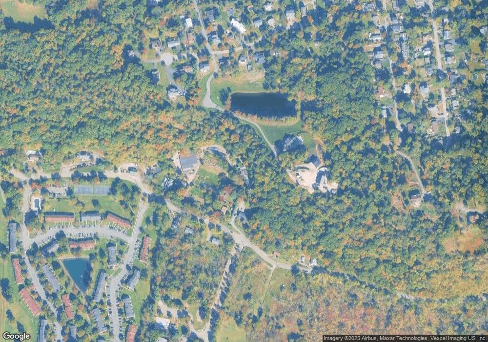
630 Pine Brook Rd Lincoln Park, NJ 07035
Estimated Value: $481,000 - $659,000
--
Bed
--
Bath
1,874
Sq Ft
$298/Sq Ft
Est. Value
About This Home
This home is located at 630 Pine Brook Rd, Lincoln Park, NJ 07035 and is currently estimated at $559,102, approximately $298 per square foot. 630 Pine Brook Rd is a home located in Morris County with nearby schools including Lincoln Park Elementary School, Lincoln Park Middle School, and Apple Montessori School of Towaco.
Ownership History
Date
Name
Owned For
Owner Type
Purchase Details
Closed on
Dec 27, 2024
Sold by
Mckenna Gina and Warbeck Gina
Bought by
Elefante Andrew and Elefante Jacqueline Donna
Current Estimated Value
Purchase Details
Closed on
Mar 4, 2008
Sold by
Estate Of Vivian Elefante and Elefante Frank
Bought by
Elefante Frank and Vivian Elefante Testamentary Trust
Purchase Details
Closed on
Mar 21, 2001
Sold by
Elefante Frank and Elefante James A
Bought by
Warbeck Jon and Warbeck Gina
Create a Home Valuation Report for This Property
The Home Valuation Report is an in-depth analysis detailing your home's value as well as a comparison with similar homes in the area
Home Values in the Area
Average Home Value in this Area
Purchase History
| Date | Buyer | Sale Price | Title Company |
|---|---|---|---|
| Elefante Andrew | $453,750 | None Listed On Document | |
| Elefante James | -- | None Listed On Document | |
| Elefante Frank | -- | None Available | |
| Warbeck Jon | -- | -- |
Source: Public Records
Tax History Compared to Growth
Tax History
| Year | Tax Paid | Tax Assessment Tax Assessment Total Assessment is a certain percentage of the fair market value that is determined by local assessors to be the total taxable value of land and additions on the property. | Land | Improvement |
|---|---|---|---|---|
| 2025 | $11,815 | $558,500 | $245,400 | $313,100 |
| 2024 | $13,386 | $547,500 | $240,100 | $307,400 |
| 2023 | $13,386 | $439,600 | $177,300 | $262,300 |
| 2022 | $11,844 | $439,600 | $177,300 | $262,300 |
| 2021 | $11,844 | $439,600 | $177,300 | $262,300 |
| 2020 | $12,410 | $439,600 | $177,300 | $262,300 |
| 2019 | $12,159 | $439,600 | $177,300 | $262,300 |
| 2018 | $11,821 | $439,600 | $177,300 | $262,300 |
| 2017 | $11,531 | $439,600 | $177,300 | $262,300 |
| 2016 | $11,386 | $439,600 | $177,300 | $262,300 |
| 2015 | $11,227 | $439,600 | $177,300 | $262,300 |
| 2014 | $10,986 | $439,600 | $177,300 | $262,300 |
Source: Public Records
Map
Nearby Homes
- 94 Mountain Heights Ave
- 1 Robertson Way
- 65 Robertson Way Unit F2
- 78 Main St
- 144 Gettysburg Way Unit 1804
- 161 Robertson Way
- 35 Rosenbrook Dr
- 166 Robertson Way
- 141 Robertson Way Unit C3
- 23 Bristol Ct Unit 23
- 3 Windsor Dr Unit R49
- 26 Windsor Dr
- 54 Bellows Ln
- 52 Bellows Ln
- 36 Bellows Ln
- 20 Peace Valley Rd
- 5 Berlin Ln
- 18 Ellice St
- 46 W William St
- 3 Undercliff Ln
- 624 Pine Brook Rd
- 628 Pine Brook Rd
- 633 Pine Brook Rd
- 650 Pine Brook Rd
- 612 Pine Brook Rd
- 639 Pine Brook Rd
- 641 Pine Brook Rd
- 608 Pine Brook Rd
- 83 Mountain Heights Ave
- 4 Clark Way
- 79 Mountain Heights Ave
- 73 Mountain Heights Ave
- 387 Gettysburg Way
- 388 Gettysburg Way
- 95 Mountain Heights Ave
- 386 Gettysburg Way
- 384 Gettysburg Way
- 97 Mountain Heights Ave
- 11 Toms Point Ln
- 69 Mountain Heights Ave
