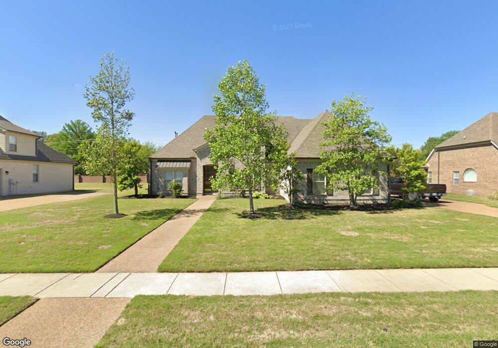
630 Riverwest Cir Marion, AR 72364
Estimated Value: $358,692 - $458,000
4
Beds
3
Baths
2,974
Sq Ft
$132/Sq Ft
Est. Value
About This Home
This home is located at 630 Riverwest Cir, Marion, AR 72364 and is currently estimated at $392,423, approximately $131 per square foot. 630 Riverwest Cir is a home located in Crittenden County with nearby schools including Herbert Carter Global Community Magnet School, Marion Visual Performing Arts Magnet, and Marion Junior High School.
Ownership History
Date
Name
Owned For
Owner Type
Purchase Details
Closed on
Nov 24, 2020
Sold by
Reinhart David M and Reinhart Whitney B
Bought by
Riggs L Hayes Jr Trust
Current Estimated Value
Purchase Details
Closed on
Apr 29, 2019
Sold by
Caves Dean
Bought by
Reinhart David M and Reinhart Whitney B
Purchase Details
Closed on
Aug 29, 2017
Sold by
Haynes Nickolas R and Haynes Pamela L
Bought by
Daves Dean
Create a Home Valuation Report for This Property
The Home Valuation Report is an in-depth analysis detailing your home's value as well as a comparison with similar homes in the area
Home Values in the Area
Average Home Value in this Area
Purchase History
| Date | Buyer | Sale Price | Title Company |
|---|---|---|---|
| Riggs L Hayes Jr Trust | $318,000 | Cowling Title | |
| Reinhart David M | $293,000 | None Available | |
| Daves Dean | -- | -- |
Source: Public Records
Tax History Compared to Growth
Tax History
| Year | Tax Paid | Tax Assessment Tax Assessment Total Assessment is a certain percentage of the fair market value that is determined by local assessors to be the total taxable value of land and additions on the property. | Land | Improvement |
|---|---|---|---|---|
| 2024 | $3,215 | $54,740 | $9,600 | $45,140 |
| 2023 | $3,215 | $54,740 | $9,600 | $45,140 |
| 2022 | $3,215 | $54,740 | $9,600 | $45,140 |
| 2021 | $3,215 | $54,740 | $9,600 | $45,140 |
| 2020 | $3,071 | $54,740 | $9,600 | $45,140 |
| 2019 | $2,481 | $48,550 | $9,000 | $39,550 |
| 2018 | $2,609 | $48,550 | $9,000 | $39,550 |
| 2017 | $2,260 | $48,550 | $9,000 | $39,550 |
| 2016 | $2,260 | $48,550 | $9,000 | $39,550 |
| 2015 | $2,279 | $48,550 | $9,000 | $39,550 |
| 2014 | $238 | $43,890 | $8,600 | $35,290 |
Source: Public Records
Map
Nearby Homes
- 683 Riverwest Cir
- 694 Riverwest Cir
- 132 Morningside Dr
- 2011 State Highway 77
- 1901 State Highway 77
- 103 Stonehenge Cove
- 105 Morningside Dr
- 822 Grandee Cir
- 524 Apperson Cove
- 713 Carter Dr
- 715 Carter Dr
- 283 Rivertrace Dr
- 618 Big Lake Rd
- 806 Cherokee Trace
- 256 Rivertrace Dr
- 271 Rivertrace Dr
- 610 Big Lake Dr
- 111 Primo Cir
- 235 Blair Dr
- 218 Blair Dr
- 632 Riverwest Cir
- 628 Riverwest Cir
- 631 Riverwest Cir
- 626 Riverwest Cir
- 634 Riverwest Cir
- 633 Riverwest Cir
- 601 River Oaks Dr
- 635 Riverwest Cir
- 624 Riverwest Cir
- 1895 E Military Rd
- 600 River Oaks Dr
- 637 Riverwest Cir
- 615 River Birch Dr
- 613 River Birch Dr
- 638 Riverwest Cir
- 603 River Oaks Dr
- 611 River Birch Dr
- 602 River Oaks Dr
- 639 Riverwest Cir
- 609 River Birch Dr