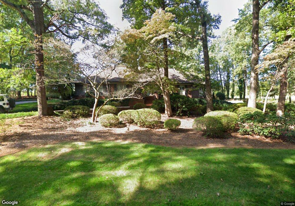
630 Saint Andrews Rd Statesville, NC 28625
Estimated Value: $615,000 - $883,000
4
Beds
4
Baths
3,193
Sq Ft
$215/Sq Ft
Est. Value
About This Home
This home is located at 630 Saint Andrews Rd, Statesville, NC 28625 and is currently estimated at $687,536, approximately $215 per square foot. 630 Saint Andrews Rd is a home located in Iredell County with nearby schools including East Iredell Elementary School, East Iredell Middle School, and Statesville High School.
Ownership History
Date
Name
Owned For
Owner Type
Purchase Details
Closed on
Jul 19, 2001
Sold by
Epps Harry E and Epps Ann M
Bought by
Wright Francis P and Wright Gloria L
Current Estimated Value
Home Financials for this Owner
Home Financials are based on the most recent Mortgage that was taken out on this home.
Original Mortgage
$250,000
Outstanding Balance
$96,484
Interest Rate
7.16%
Estimated Equity
$591,052
Purchase Details
Closed on
Nov 1, 1993
Purchase Details
Closed on
Dec 1, 1983
Purchase Details
Closed on
May 1, 1959
Create a Home Valuation Report for This Property
The Home Valuation Report is an in-depth analysis detailing your home's value as well as a comparison with similar homes in the area
Home Values in the Area
Average Home Value in this Area
Purchase History
| Date | Buyer | Sale Price | Title Company |
|---|---|---|---|
| Wright Francis P | $380,000 | -- | |
| -- | $265,000 | -- | |
| -- | $23,500 | -- | |
| -- | $7,000 | -- |
Source: Public Records
Mortgage History
| Date | Status | Borrower | Loan Amount |
|---|---|---|---|
| Open | Wright Francis P | $250,000 |
Source: Public Records
Tax History Compared to Growth
Tax History
| Year | Tax Paid | Tax Assessment Tax Assessment Total Assessment is a certain percentage of the fair market value that is determined by local assessors to be the total taxable value of land and additions on the property. | Land | Improvement |
|---|---|---|---|---|
| 2024 | $5,308 | $518,550 | $91,800 | $426,750 |
| 2023 | $5,337 | $518,550 | $91,800 | $426,750 |
| 2022 | $4,838 | $434,730 | $91,800 | $342,930 |
| 2021 | $4,894 | $434,730 | $91,800 | $342,930 |
| 2020 | $4,894 | $434,730 | $91,800 | $342,930 |
| 2019 | $4,851 | $434,730 | $91,800 | $342,930 |
| 2018 | $4,513 | $430,440 | $102,000 | $328,440 |
| 2017 | $4,423 | $430,440 | $102,000 | $328,440 |
| 2016 | $4,423 | $430,440 | $102,000 | $328,440 |
| 2015 | $4,087 | $430,440 | $102,000 | $328,440 |
| 2014 | $4,373 | $482,820 | $120,000 | $362,820 |
Source: Public Records
Map
Nearby Homes
- 627 Saint Andrews Rd
- 625 Saint Andrews Rd
- 720 Saint Cloud Dr
- 522 Saint Cloud Dr
- 605 Saint Cloud Dr
- 629 Saint Andrews Rd
- 3229 Broadmoor Dr
- 154 Carters Farm Dr
- 000 Saint Andrews Place
- 135 Carters Farm Dr
- Lot 368 Camden Rd
- Lot 370 Camden Rd
- Lot 371 Camden Rd
- L367 Camden Rd
- 517 Augusta Dr
- 3027 Findley Rd
- 251 Gleneagles Rd E
- 220 Augusta Dr
- 206 White Apple Way
- 199 Bell Farm Rd
- 618 St Andrews Rd
- 618 Saint Andrews Rd
- 705 Saint Andrews Rd Unit Lot429
- 634 Saint Cloud Dr Unit 265
- 634 Saint Cloud Dr
- 706 Saint Cloud Dr
- 630 Saint Cloud Dr
- 714 Saint Cloud Dr
- 624 Saint Cloud Dr
- 715 Saint Andrews Rd
- 715 Saint Andrews Rd Unit 326
- 536 Innisbrook Rd
- 532 Innisbrook Rd
- 631 Saint Cloud Dr
- 618 Saint Cloud Dr Unit 268
- 720 Saint Cloud Dr Unit 323
- 611 Saint Andrews Rd
- 728 Saint Andrews Rd
- 528 Innisbrook Rd
- 528 Innisbrook Dr