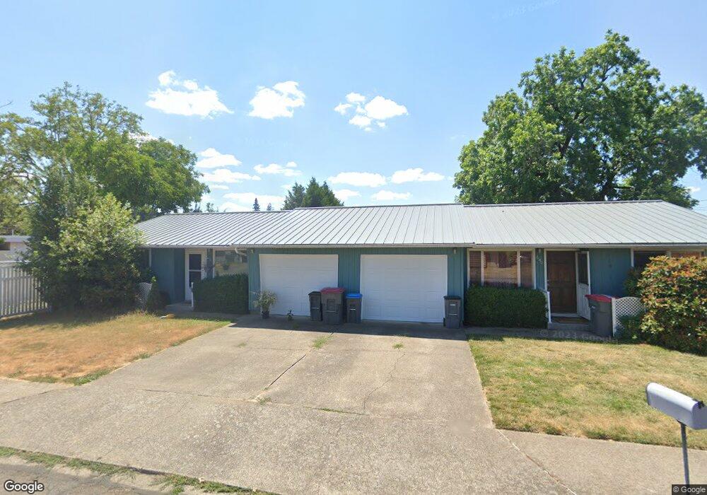
630 SW Derby St McMinnville, OR 97128
Estimated Value: $471,000 - $494,000
4
Beds
2
Baths
1,790
Sq Ft
$268/Sq Ft
Est. Value
About This Home
This home is located at 630 SW Derby St, McMinnville, OR 97128 and is currently estimated at $480,504, approximately $268 per square foot. 630 SW Derby St is a home located in Yamhill County with nearby schools including Newby Elementary School, Duniway Middle School, and McMinnville High School.
Ownership History
Date
Name
Owned For
Owner Type
Purchase Details
Closed on
Sep 20, 2018
Sold by
Thompson Grant D and The Residence Trust Doris S Th
Bought by
Henkle Thomas R and Henkle Judith E
Current Estimated Value
Home Financials for this Owner
Home Financials are based on the most recent Mortgage that was taken out on this home.
Original Mortgage
$195,000
Outstanding Balance
$169,701
Interest Rate
4.5%
Mortgage Type
New Conventional
Estimated Equity
$310,803
Purchase Details
Closed on
Aug 3, 2017
Sold by
Thompson Doris S
Bought by
Thompson Grand T and Doris S Thompson Irrevocable Trust
Create a Home Valuation Report for This Property
The Home Valuation Report is an in-depth analysis detailing your home's value as well as a comparison with similar homes in the area
Home Values in the Area
Average Home Value in this Area
Purchase History
| Date | Buyer | Sale Price | Title Company |
|---|---|---|---|
| Henkle Thomas R | $295,000 | Ticor Title | |
| Thompson Grand T | -- | None Available |
Source: Public Records
Mortgage History
| Date | Status | Borrower | Loan Amount |
|---|---|---|---|
| Open | Henkle Thomas R | $195,000 |
Source: Public Records
Tax History Compared to Growth
Tax History
| Year | Tax Paid | Tax Assessment Tax Assessment Total Assessment is a certain percentage of the fair market value that is determined by local assessors to be the total taxable value of land and additions on the property. | Land | Improvement |
|---|---|---|---|---|
| 2024 | $3,696 | $212,621 | -- | -- |
| 2023 | $3,489 | $206,428 | $0 | $0 |
| 2022 | $2,896 | $200,416 | $0 | $0 |
| 2021 | $2,840 | $194,579 | $0 | $0 |
| 2020 | $2,817 | $188,912 | $0 | $0 |
| 2019 | $2,741 | $183,410 | $0 | $0 |
| 2018 | $2,686 | $178,068 | $0 | $0 |
| 2017 | $2,593 | $172,882 | $0 | $0 |
| 2016 | $2,500 | $147,689 | $0 | $0 |
| 2015 | $2,439 | $143,388 | $0 | $0 |
| 2014 | $2,308 | $139,213 | $0 | $0 |
Source: Public Records
Map
Nearby Homes
- 718 SW Cedarwood Ave
- 724 SW Edmunston St
- 1116 SW Russ Ln
- 218 NW Ash St
- 2894 NW Shadden Dr
- 1036 SW 2nd St
- 323 SE Cowls St
- 170 SW Eckman St
- 1110 SW 2nd St
- 315 SE Davis St
- 126 SW Fleishauer Ln
- 1220 SW Melrose Ave
- 240 SE Davis St
- 708 SE Davis St
- 1501 SW Baker St Unit 11
- 1501 SW Baker St Unit 50
- 1501 SW Baker St Unit 38
- 1501 SW Baker St Unit 13
- 1501 SW Baker (#50) St Unit 50
- 708 SW Taft St
- 624 SW Cedarwood Ave
- -1 SW Derby St
- 601 SW Drumwood Ave
- 625 SW Drumwood Ave
- 526 SW Cedarwood Ave
- 0 SW Cedarwood Unit 7605945-11509530
- 0 SW Cedarwood Unit 7605945-11351254
- 639 SW Derby St
- 547 SW Drumwood Ave
- 603 SW Cedarwood Ave
- 637 SW Drumwood Ave
- 635 SW Cedarwood Ave
- 555 SW Cedarwood Ave
- 522 SW Cedarwood Ave
- 509 SW Drumwood Ave
- 715 Drumwood (- 727) Ave
- 545 SW Drumwood Ave
- 715 SW Drumwood Ave
- 630 SW Brockwood Ave
- 634 SW Brockwood Ave