Estimated Value: $163,000 - $179,106
--
Bed
2
Baths
1,864
Sq Ft
$91/Sq Ft
Est. Value
About This Home
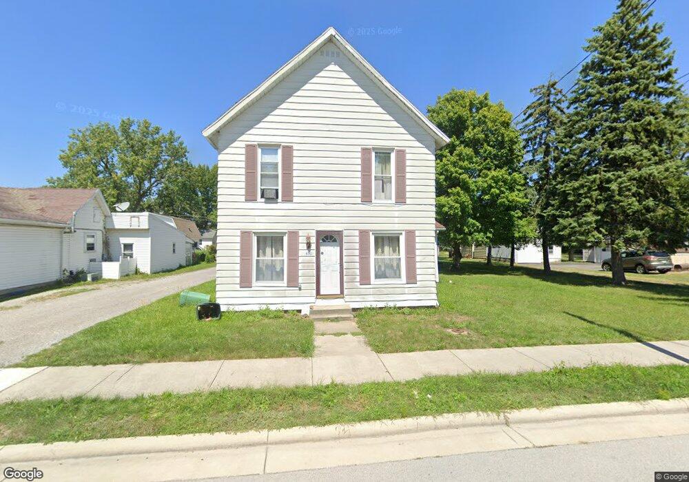
This home is located at 630 W Main St, Cairo, OH 45820 and is currently estimated at $170,277, approximately $91 per square foot. 630 W Main St is a home with nearby schools including Bath Elementary School, Bath Middle School, and Bath High School.
Ownership History
Date
Name
Owned For
Owner Type
Purchase Details
Closed on
Apr 29, 1999
Sold by
Earl Joseph
Bought by
Eblnig Joshua and Eblnig Amy
Current Estimated Value
Home Financials for this Owner
Home Financials are based on the most recent Mortgage that was taken out on this home.
Original Mortgage
$60,000
Interest Rate
7.05%
Mortgage Type
New Conventional
Purchase Details
Closed on
Jan 18, 1995
Sold by
Nungester Richard
Bought by
Snider John and Snider Robin
Home Financials for this Owner
Home Financials are based on the most recent Mortgage that was taken out on this home.
Original Mortgage
$35,000
Interest Rate
9.2%
Mortgage Type
New Conventional
Purchase Details
Closed on
Oct 14, 1992
Bought by
Nungester Richard L
Create a Home Valuation Report for This Property
The Home Valuation Report is an in-depth analysis detailing your home's value as well as a comparison with similar homes in the area
Home Values in the Area
Average Home Value in this Area
Purchase History
| Date | Buyer | Sale Price | Title Company |
|---|---|---|---|
| Eblnig Joshua | $78,000 | -- | |
| Snider John | $58,500 | -- | |
| Nungester Richard L | -- | -- |
Source: Public Records
Mortgage History
| Date | Status | Borrower | Loan Amount |
|---|---|---|---|
| Closed | Eblnig Joshua | $60,000 | |
| Previous Owner | Snider John | $35,000 |
Source: Public Records
Tax History Compared to Growth
Tax History
| Year | Tax Paid | Tax Assessment Tax Assessment Total Assessment is a certain percentage of the fair market value that is determined by local assessors to be the total taxable value of land and additions on the property. | Land | Improvement |
|---|---|---|---|---|
| 2024 | $3,803 | $48,930 | $2,870 | $46,060 |
| 2023 | $3,369 | $34,690 | $2,030 | $32,660 |
| 2022 | $3,384 | $34,690 | $2,030 | $32,660 |
| 2021 | $3,400 | $34,690 | $2,030 | $32,660 |
| 2020 | $3,259 | $28,910 | $1,960 | $26,950 |
| 2019 | $3,259 | $28,910 | $1,960 | $26,950 |
| 2018 | $3,224 | $28,910 | $1,960 | $26,950 |
| 2017 | $3,055 | $25,310 | $1,960 | $23,350 |
| 2016 | $3,384 | $25,310 | $1,960 | $23,350 |
| 2015 | $2,963 | $25,310 | $1,960 | $23,350 |
| 2014 | $2,963 | $25,590 | $1,860 | $23,730 |
| 2013 | $2,907 | $25,590 | $1,860 | $23,730 |
Source: Public Records
Map
Nearby Homes
- 6585 Ottawa Rd
- 300 Sweaney Ave
- 309 Wall St
- 201 Wall St
- 220 Parklane Dr
- 3456 Shearin Ave
- 3798 Kissing Hollow Dr
- 3270 Bonnieview Dr
- 4080 Brookshore Dr
- 4050 Brookshore Dr
- 1679 E Bluelick Rd
- 0 Fraunfelter Unit 307817
- 0 N Eastown Rd Unit 1034495
- 2525 W Lincoln Hwy
- 108 Highland Lakes Dr
- 1129 W Bluelick Rd
- 2467 Greendale St
- 2370 N McDonel St
- 168 Lyre Bird Ln
- 2718 Carolyn Dr