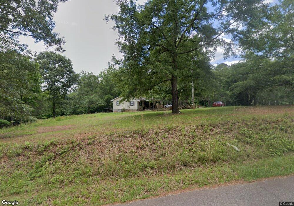
630 Wall Cir Chesnee, SC 29323
Estimated Value: $169,000 - $237,000
3
Beds
2
Baths
1,120
Sq Ft
$181/Sq Ft
Est. Value
About This Home
This home is located at 630 Wall Cir, Chesnee, SC 29323 and is currently estimated at $203,230, approximately $181 per square foot. 630 Wall Cir is a home located in Spartanburg County with nearby schools including Cooley Springs-Fingerville Elementary School, Chesnee Middle School, and Chesnee High School.
Ownership History
Date
Name
Owned For
Owner Type
Purchase Details
Closed on
Feb 20, 2018
Sold by
Wyatt Darrell
Bought by
Stewart Matthew E
Current Estimated Value
Home Financials for this Owner
Home Financials are based on the most recent Mortgage that was taken out on this home.
Original Mortgage
$84,848
Outstanding Balance
$71,859
Interest Rate
3.99%
Mortgage Type
New Conventional
Estimated Equity
$131,371
Purchase Details
Closed on
Sep 4, 2008
Sold by
Wall Dorothy C
Bought by
Wyatt Darrell
Create a Home Valuation Report for This Property
The Home Valuation Report is an in-depth analysis detailing your home's value as well as a comparison with similar homes in the area
Home Values in the Area
Average Home Value in this Area
Purchase History
| Date | Buyer | Sale Price | Title Company |
|---|---|---|---|
| Stewart Matthew E | $84,000 | None Available | |
| Wyatt Darrell | -- | -- |
Source: Public Records
Mortgage History
| Date | Status | Borrower | Loan Amount |
|---|---|---|---|
| Open | Stewart Matthew E | $84,848 |
Source: Public Records
Tax History Compared to Growth
Tax History
| Year | Tax Paid | Tax Assessment Tax Assessment Total Assessment is a certain percentage of the fair market value that is determined by local assessors to be the total taxable value of land and additions on the property. | Land | Improvement |
|---|---|---|---|---|
| 2025 | $664 | $3,864 | $1,143 | $2,721 |
| 2024 | $664 | $3,864 | $1,143 | $2,721 |
| 2023 | $664 | $3,864 | $1,143 | $2,721 |
| 2022 | $601 | $3,360 | $720 | $2,640 |
| 2021 | $601 | $3,360 | $720 | $2,640 |
| 2020 | $587 | $3,360 | $720 | $2,640 |
| 2019 | $587 | $3,708 | $1,067 | $2,641 |
| 2018 | $2,010 | $5,561 | $1,600 | $3,961 |
| 2017 | $247 | $3,224 | $1,028 | $2,196 |
| 2016 | $247 | $3,224 | $1,028 | $2,196 |
| 2015 | $242 | $3,224 | $1,028 | $2,196 |
| 2014 | $237 | $3,224 | $1,028 | $2,196 |
Source: Public Records
Map
Nearby Homes
- 0 Fosters Grove Rd Unit SPN329427
- 0 Hwy 11 W Unit SPN321718
- 1010 Wall Cir
- 6370 Parris Bridge Rd
- 750 Mason Rd
- 169 Lakeshore Dr
- 120 Lakeshore Dr
- 1215 Buck Creek Rd
- 1754 Fish Camp Rd
- 509 Sedona Ct
- 1750 Fish Camp Rd
- 1746 Fish Camp Rd
- 1740 Fish Camp Rd
- 171 Aldrich Rd
- 373 Saddlers Run
- 221 W Ridge Water Dr
- 211 W Ridge Water Dr
- 2019 Meadow Glen Ct
- 385 Country Oak Rd
- 620 Wall Cir
- 721 Sand Bar Rd
- 625 Wall Cir
- Wall Circle Wall Cir
- 122 Pastorale Dr
- 480 Wall Cir
- 732 Pastorale Dr
- 425 Wall Cir
- 00 Sand Bar Rd
- 132 Pastorale Dr
- 515 Pastorale Dr
- 115 Pastorale Dr
- 430 Wall Cir
- 725 Sand Bar Rd
- 109 Pastorale Dr
- 403 Wall Cir
- 735 Sand Bar Rd
- 0 Wall Cir Lot 1 Unit 197386
- 0 Wall Cir Lot 1b Unit 197385
- 0 Wall Cir Lot 1a Unit 197384