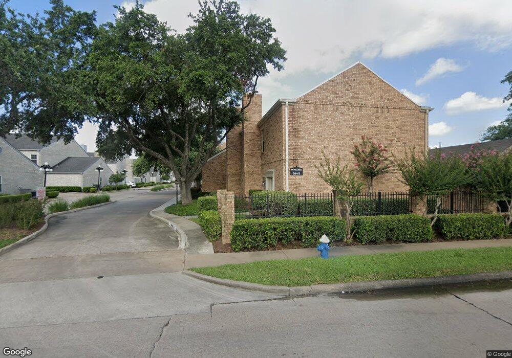
630 Wilcrest Dr Unit 630 Houston, TX 77042
Briar Forest NeighborhoodEstimated Value: $185,195 - $207,000
2
Beds
3
Baths
1,740
Sq Ft
$113/Sq Ft
Est. Value
About This Home
This home is located at 630 Wilcrest Dr Unit 630, Houston, TX 77042 and is currently estimated at $196,549, approximately $112 per square foot. 630 Wilcrest Dr Unit 630 is a home located in Harris County with nearby schools including Askew Elementary School, Paul Revere Middle School, and Westside High School.
Ownership History
Date
Name
Owned For
Owner Type
Purchase Details
Closed on
Mar 3, 2006
Sold by
Patterson Norris
Bought by
Gaffney Michael C
Current Estimated Value
Home Financials for this Owner
Home Financials are based on the most recent Mortgage that was taken out on this home.
Original Mortgage
$100,000
Outstanding Balance
$56,248
Interest Rate
6.09%
Mortgage Type
Fannie Mae Freddie Mac
Estimated Equity
$140,301
Purchase Details
Closed on
Jul 11, 2003
Sold by
Ellis David Kipp and Ellis Angela Gail
Bought by
Patterson Norris
Home Financials for this Owner
Home Financials are based on the most recent Mortgage that was taken out on this home.
Original Mortgage
$107,200
Interest Rate
5.23%
Mortgage Type
Purchase Money Mortgage
Create a Home Valuation Report for This Property
The Home Valuation Report is an in-depth analysis detailing your home's value as well as a comparison with similar homes in the area
Home Values in the Area
Average Home Value in this Area
Purchase History
| Date | Buyer | Sale Price | Title Company |
|---|---|---|---|
| Gaffney Michael C | -- | Alamo Title Company | |
| Patterson Norris | -- | Alamo Title Company |
Source: Public Records
Mortgage History
| Date | Status | Borrower | Loan Amount |
|---|---|---|---|
| Open | Gaffney Michael C | $100,000 | |
| Previous Owner | Patterson Norris | $107,200 |
Source: Public Records
Tax History Compared to Growth
Tax History
| Year | Tax Paid | Tax Assessment Tax Assessment Total Assessment is a certain percentage of the fair market value that is determined by local assessors to be the total taxable value of land and additions on the property. | Land | Improvement |
|---|---|---|---|---|
| 2025 | $2,382 | $189,776 | $36,057 | $153,719 |
| 2024 | $2,382 | $193,820 | $36,826 | $156,994 |
| 2023 | $2,382 | $197,105 | $37,450 | $159,655 |
| 2022 | $3,836 | $174,193 | $33,097 | $141,096 |
| 2021 | $3,697 | $158,638 | $30,141 | $128,497 |
| 2020 | $3,857 | $159,289 | $30,265 | $129,024 |
| 2019 | $3,959 | $156,464 | $29,728 | $126,736 |
| 2018 | $2,797 | $152,311 | $28,939 | $123,372 |
| 2017 | $3,733 | $152,311 | $28,939 | $123,372 |
| 2016 | $3,394 | $146,161 | $27,771 | $118,390 |
| 2015 | $2,114 | $146,161 | $27,771 | $118,390 |
| 2014 | $2,114 | $129,643 | $24,632 | $105,011 |
Source: Public Records
Map
Nearby Homes
- 600 Wilcrest Dr Unit 66
- 580 Wilcrest Dr Unit 580
- 360 Wilcrest Dr Unit 360
- 11418 Lakeside Place Dr
- 1306 Riverview Ct
- 11422 Lakeside Place Dr
- 1506 Haven Lock Dr
- 210 Big Hollow Ln
- 11206 Mattina Dr
- 11418 Long Pine Dr
- 203 Cove Creek Ln
- 11603 Lakeside Place Dr
- 1325 Chardonnay Dr
- 1515 Sandy Springs Rd Unit 1808
- 1515 Sandy Springs Rd Unit 1102
- 1515 Sandy Springs Rd Unit 3003
- 1515 Sandy Springs Rd Unit 2002
- 1515 Sandy Springs Rd Unit 3001
- 1336 Chardonnay Dr
- 1353 Chardonnay Dr
- 632 Wilcrest Dr Unit 632
- 634 Wilcrest Dr Unit 634
- 640 Wilcrest Dr Unit 640
- 636 Wilcrest Dr Unit 636
- 644 Wilcrest Dr Unit 644
- 638 Wilcrest Dr Unit 638
- 11306 Riverview Dr
- 646 Wilcrest Dr Unit 646
- 652 Wilcrest Dr Unit 652
- 650 Wilcrest Dr Unit 650
- 654 Wilcrest Dr Unit 654
- 616 Wilcrest Dr Unit 616
- 626 Wilcrest Dr Unit 626
- 618 Wilcrest Dr Unit 618
- 11310 Riverview Dr
- 622 Wilcrest Dr Unit 622
- 624 Wilcrest Dr Unit 624
- 642 Wilcrest Dr Unit 642
- 11302 Riverview Dr
- 656 Wilcrest Dr Unit 656