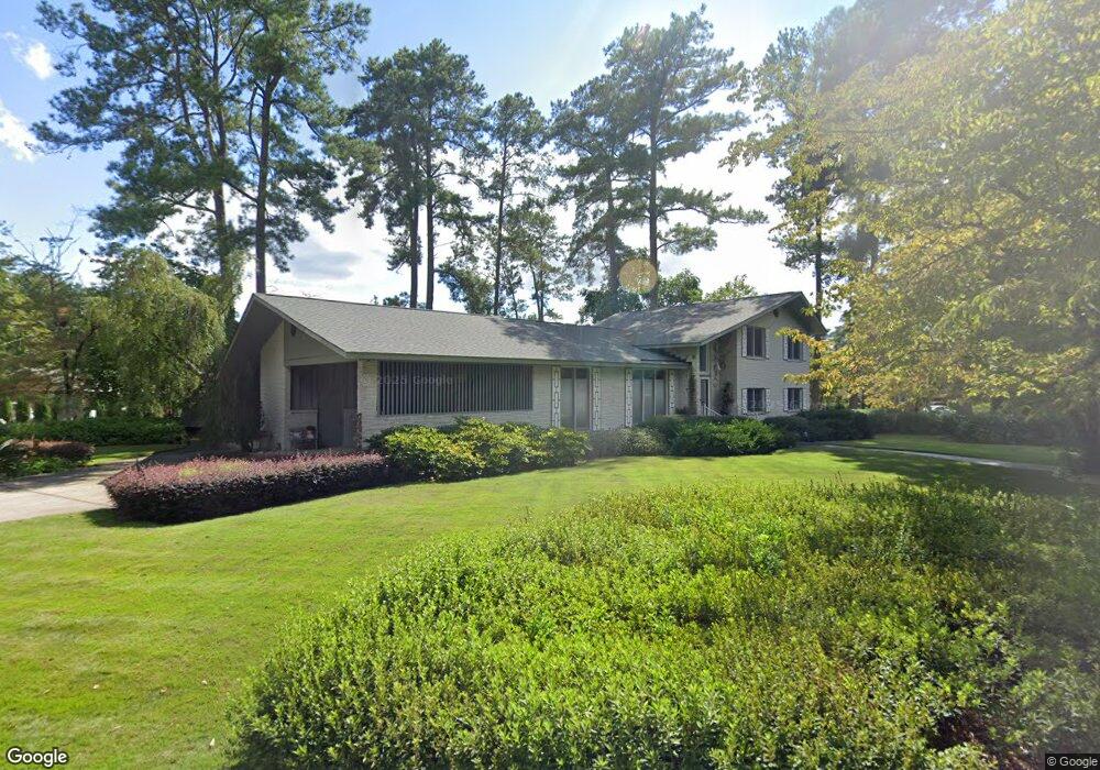
6300 Macon Rd Columbia, SC 29209
The Hamptons NeighborhoodEstimated Value: $477,000 - $669,000
4
Beds
5
Baths
3,950
Sq Ft
$141/Sq Ft
Est. Value
About This Home
This home is located at 6300 Macon Rd, Columbia, SC 29209 and is currently estimated at $558,333, approximately $141 per square foot. 6300 Macon Rd is a home located in Richland County with nearby schools including Meadowfield Elementary School, Hand Middle School, and Dreher High School.
Ownership History
Date
Name
Owned For
Owner Type
Purchase Details
Closed on
Dec 13, 2024
Sold by
Gibbons Geneva F
Bought by
Joseph H Gibbons And Geneva F Gibbons Trust and Gibbons
Current Estimated Value
Purchase Details
Closed on
Jul 16, 2024
Sold by
Gibbons Geneva F
Bought by
Joseph And Geneva F Gibbons Trust
Purchase Details
Closed on
Mar 7, 2000
Sold by
Peckham Emerson E
Bought by
Peckham Hollis C
Create a Home Valuation Report for This Property
The Home Valuation Report is an in-depth analysis detailing your home's value as well as a comparison with similar homes in the area
Home Values in the Area
Average Home Value in this Area
Purchase History
| Date | Buyer | Sale Price | Title Company |
|---|---|---|---|
| Joseph H Gibbons And Geneva F Gibbons Trust | -- | None Listed On Document | |
| Joseph H Gibbons And Geneva F Gibbons Trust | -- | None Listed On Document | |
| Joseph And Geneva F Gibbons Trust | -- | None Listed On Document | |
| Joseph H Gibbons And Geneva F Gibbons Trust | -- | None Listed On Document | |
| Peckham Hollis C | $25,000 | -- |
Source: Public Records
Tax History Compared to Growth
Tax History
| Year | Tax Paid | Tax Assessment Tax Assessment Total Assessment is a certain percentage of the fair market value that is determined by local assessors to be the total taxable value of land and additions on the property. | Land | Improvement |
|---|---|---|---|---|
| 2023 | $2,131 | $0 | $0 | $0 |
| 2021 | $1,882 | $12,050 | $0 | $0 |
| 2020 | $1,985 | $12,050 | $0 | $0 |
| 2019 | $1,999 | $12,050 | $0 | $0 |
| 2018 | $1,725 | $10,480 | $0 | $0 |
| 2017 | $1,680 | $10,480 | $0 | $0 |
| 2016 | $1,620 | $10,480 | $0 | $0 |
| 2015 | $1,620 | $10,480 | $0 | $0 |
| 2014 | $1,619 | $262,000 | $0 | $0 |
| 2013 | -- | $10,480 | $0 | $0 |
Source: Public Records
Map
Nearby Homes
- 405 Black Friars Rd
- 6603 Christie Rd
- 6627 Christie Rd
- 6400 Saye Cut
- 497 Galway Ln
- 513 Knollwood Dr
- 109 Rosebank Dr
- 604 Hampton Trace Ln
- 444 Cami Forest Ln
- 821 Walters Ln
- 104 Preserve Ln
- 622 Chimney Hill Rd
- 811 Rockwood Rd
- 416 Tamarack Dr
- 509 Burnside Dr
- 9 Ansley Ct
- 918 Cedar Terrace
- 755 Burnside Dr
- 206 Hampton Forest Dr
- 1040 Coatesdale Rd