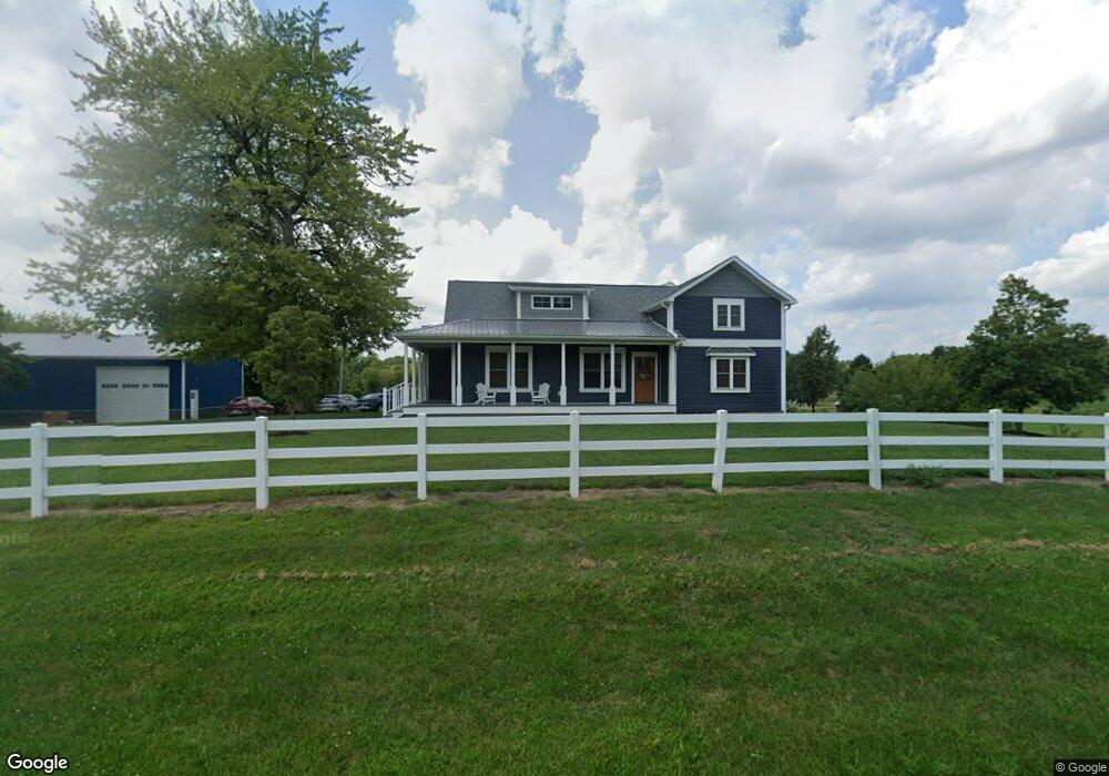
6300 Treat Hwy Adrian, MI 49221
Estimated Value: $339,000 - $433,128
3
Beds
2
Baths
4,074
Sq Ft
$95/Sq Ft
Est. Value
About This Home
This home is located at 6300 Treat Hwy, Adrian, MI 49221 and is currently estimated at $386,064, approximately $94 per square foot. 6300 Treat Hwy is a home located in Lenawee County with nearby schools including Ruth McGregor Elementary School and Sand Creek High School.
Ownership History
Date
Name
Owned For
Owner Type
Purchase Details
Closed on
Apr 17, 2014
Sold by
Willett Daniel L and Willett Linda
Bought by
Townsend Daryl J and Townsend Nicole
Current Estimated Value
Home Financials for this Owner
Home Financials are based on the most recent Mortgage that was taken out on this home.
Original Mortgage
$68,000
Outstanding Balance
$51,634
Interest Rate
4.31%
Mortgage Type
New Conventional
Estimated Equity
$334,430
Create a Home Valuation Report for This Property
The Home Valuation Report is an in-depth analysis detailing your home's value as well as a comparison with similar homes in the area
Home Values in the Area
Average Home Value in this Area
Purchase History
| Date | Buyer | Sale Price | Title Company |
|---|---|---|---|
| Townsend Daryl J | $85,000 | None Available |
Source: Public Records
Mortgage History
| Date | Status | Borrower | Loan Amount |
|---|---|---|---|
| Open | Townsend Daryl J | $68,000 |
Source: Public Records
Tax History Compared to Growth
Tax History
| Year | Tax Paid | Tax Assessment Tax Assessment Total Assessment is a certain percentage of the fair market value that is determined by local assessors to be the total taxable value of land and additions on the property. | Land | Improvement |
|---|---|---|---|---|
| 2025 | $2,328 | $211,500 | $0 | $0 |
| 2024 | $975 | $217,700 | $0 | $0 |
| 2022 | $920 | $198,300 | $0 | $0 |
| 2021 | $2,196 | $79,900 | $0 | $0 |
| 2020 | $1,412 | $69,500 | $0 | $0 |
| 2019 | $213,557 | $84,300 | $0 | $0 |
| 2018 | $3,213 | $84,333 | $0 | $0 |
| 2017 | $3,134 | $85,222 | $0 | $0 |
| 2016 | $3,038 | $82,583 | $0 | $0 |
| 2014 | -- | $86,280 | $0 | $0 |
Source: Public Records
Map
Nearby Homes
- 3822 Sharp Rd
- 4070 Sharp Rd
- 4225 Treat Hwy
- 2711 E Carleton Rd
- 5611 S Adrian Hwy
- 2329 Wood Ridge Dr
- 1755 E Carleton Rd
- 7489 Jefferson St
- 1704 E Carleton Rd
- 3381 Ogden Hwy Unit Valley Heights Dr
- 1883 Harold St
- 280 San Antonio River Dr
- 243 Kirk
- 141 Concord
- 71 Oneida
- 5000 BLK LOT B S Adrian Hwy
- 5000 BLK LOT C S Adrian Hwy
- 5000 BLK LOT D S Adrian Hwy
- 980 State St
- 6000 Blk Palmyra Rd
- 6033 Treat Hwy
- 6361 Treat Hwy
- 6244 Treat Hwy
- 6011 Treat Hwy
- 6220 Treat Hwy
- 6115 Treat Hwy
- 5995 Treat Hwy
- 5941 Treat Hwy
- 6000 Treat Hwy Unit BLK
- 6000 Treat Hwy Unit BLK
- 5889 Treat Hwy
- 6010 Treat Hwy
- 5990 Treat Hwy
- 5990 Treat Hwy Unit TREAT
- 5851 Treat Hwy
- 5942 Treat Hwy
- 5942 Treat Hwy Unit 5942 Treat Highway
- 6297 Treat Hwy
- 5888 Treat Hwy
- 5862 Treat Hwy