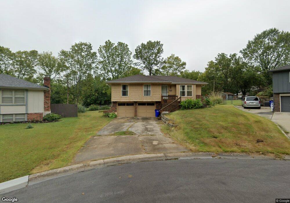
6301 E 134th St Grandview, MO 64030
Estimated Value: $169,000 - $225,000
3
Beds
2
Baths
1,127
Sq Ft
$184/Sq Ft
Est. Value
About This Home
This home is located at 6301 E 134th St, Grandview, MO 64030 and is currently estimated at $207,027, approximately $183 per square foot. 6301 E 134th St is a home located in Jackson County with nearby schools including Meadowmere Elementary School, Grandview Middle, and Grandview High School.
Ownership History
Date
Name
Owned For
Owner Type
Purchase Details
Closed on
Sep 19, 2023
Sold by
Carson James R
Bought by
Carson James R and Carson Jacob Sterling
Current Estimated Value
Purchase Details
Closed on
Sep 21, 2019
Sold by
Carson Kimberly L and Carson Kimberly Lane
Bought by
Carson James R
Home Financials for this Owner
Home Financials are based on the most recent Mortgage that was taken out on this home.
Original Mortgage
$91,575
Interest Rate
3.6%
Mortgage Type
FHA
Create a Home Valuation Report for This Property
The Home Valuation Report is an in-depth analysis detailing your home's value as well as a comparison with similar homes in the area
Home Values in the Area
Average Home Value in this Area
Purchase History
| Date | Buyer | Sale Price | Title Company |
|---|---|---|---|
| Carson James R | -- | None Listed On Document | |
| Carson James R | -- | First United Title Agcy Llc |
Source: Public Records
Mortgage History
| Date | Status | Borrower | Loan Amount |
|---|---|---|---|
| Previous Owner | Carson James R | $91,575 |
Source: Public Records
Tax History
| Year | Tax Paid | Tax Assessment Tax Assessment Total Assessment is a certain percentage of the fair market value that is determined by local assessors to be the total taxable value of land and additions on the property. | Land | Improvement |
|---|---|---|---|---|
| 2025 | $2,265 | $30,153 | $4,125 | $26,028 |
| 2024 | $2,226 | $27,854 | $2,953 | $24,901 |
| 2023 | $2,226 | $27,854 | $1,355 | $26,499 |
| 2022 | $1,958 | $22,800 | $5,111 | $17,689 |
| 2021 | $1,956 | $22,800 | $5,111 | $17,689 |
| 2020 | $1,758 | $21,708 | $5,111 | $16,597 |
| 2019 | $1,695 | $21,708 | $5,111 | $16,597 |
| 2018 | $1,120 | $13,343 | $2,582 | $10,761 |
| 2016 | $1,006 | $11,738 | $3,114 | $8,624 |
Source: Public Records
Map
Nearby Homes
- 13424 Parker Ave
- 13420 Belmead Ave
- 6105 E 136th St
- 13218 Craig Ave
- 6712 E 134th St
- 6701 E 136th St
- 14925 S U S 71 Hwy
- 13408 Bristol Ave
- 12217 Bennington Ave
- 13804 Bennington Ave
- 12200 Craig Dr
- 13726 Winchester Ave
- 13952 Falkirk Cir
- 13516 12th St
- 13302 11th St
- 13919 Falkirk Cir
- 6206 E 140th Terrace
- 6008 E 129th St
- 1004 E 135th St
- 13205 Byars Rd
- 6305 E 134th St
- 13328 Applewood Dr
- 6307 E 134th St
- 13329 Applewood Dr
- 13324 Applewood Dr
- 13325 Applewood Dr
- 13320 Applewood Dr
- 13321 Applewood Dr
- 13328 Lowell Ave
- 13321 Parker Ave
- 13404 Lowell Ave
- 13323 Parker Ave
- 13317 Parker Ave
- 13408 Lowell Ave
- 13401 Parker Ave
- 13311 Parker Ave
- 13412 Lowell Ave
- 13316 Applewood Dr
- 13324 Lowell Ave
Your Personal Tour Guide
Ask me questions while you tour the home.