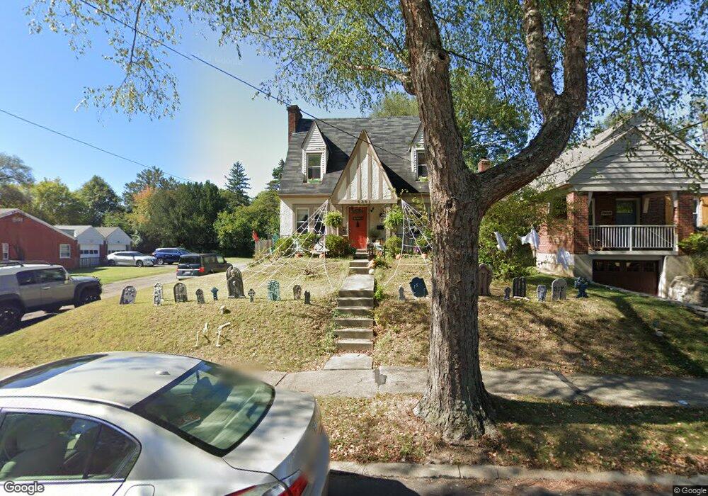
6301 Fairhurst Ave Cincinnati, OH 45213
Pleasant Ridge NeighborhoodEstimated Value: $260,263 - $287,000
2
Beds
1
Bath
1,134
Sq Ft
$238/Sq Ft
Est. Value
About This Home
This home is located at 6301 Fairhurst Ave, Cincinnati, OH 45213 and is currently estimated at $269,816, approximately $237 per square foot. 6301 Fairhurst Ave is a home located in Hamilton County with nearby schools including Pleasant Ridge Montessori School, Shroder High School, and Clark Montessori High School.
Ownership History
Date
Name
Owned For
Owner Type
Purchase Details
Closed on
Jan 26, 2007
Sold by
True Potential Real Estate Llc
Bought by
Smith Eric C
Current Estimated Value
Home Financials for this Owner
Home Financials are based on the most recent Mortgage that was taken out on this home.
Original Mortgage
$140,000
Outstanding Balance
$83,994
Interest Rate
6.19%
Mortgage Type
Unknown
Estimated Equity
$185,822
Purchase Details
Closed on
Jul 14, 2006
Sold by
Morgan Janice Louise
Bought by
True Potential Real Estate Llc
Home Financials for this Owner
Home Financials are based on the most recent Mortgage that was taken out on this home.
Original Mortgage
$82,800
Interest Rate
6.5%
Mortgage Type
Unknown
Create a Home Valuation Report for This Property
The Home Valuation Report is an in-depth analysis detailing your home's value as well as a comparison with similar homes in the area
Home Values in the Area
Average Home Value in this Area
Purchase History
| Date | Buyer | Sale Price | Title Company |
|---|---|---|---|
| Smith Eric C | -- | Fidelity Land Title Agency O | |
| True Potential Real Estate Llc | $92,000 | None Available |
Source: Public Records
Mortgage History
| Date | Status | Borrower | Loan Amount |
|---|---|---|---|
| Open | Smith Eric C | $140,000 | |
| Previous Owner | True Potential Real Estate Llc | $82,800 |
Source: Public Records
Tax History Compared to Growth
Tax History
| Year | Tax Paid | Tax Assessment Tax Assessment Total Assessment is a certain percentage of the fair market value that is determined by local assessors to be the total taxable value of land and additions on the property. | Land | Improvement |
|---|---|---|---|---|
| 2024 | $3,535 | $58,227 | $16,888 | $41,339 |
| 2023 | $3,610 | $58,227 | $16,888 | $41,339 |
| 2022 | $3,401 | $49,197 | $12,744 | $36,453 |
| 2021 | $3,263 | $49,197 | $12,744 | $36,453 |
| 2020 | $3,354 | $49,197 | $12,744 | $36,453 |
| 2019 | $3,138 | $42,049 | $10,892 | $31,157 |
| 2018 | $3,142 | $42,049 | $10,892 | $31,157 |
| 2017 | $2,986 | $42,049 | $10,892 | $31,157 |
| 2016 | $2,839 | $39,368 | $10,857 | $28,511 |
| 2015 | $2,561 | $39,368 | $10,857 | $28,511 |
| 2014 | $2,579 | $39,368 | $10,857 | $28,511 |
| 2013 | $2,498 | $37,492 | $10,339 | $27,153 |
Source: Public Records
Map
Nearby Homes
- 6317 Girard Ave
- 2604 Saint Albans Ave
- 2783 Losantiridge Ave
- 2652 Cedarbrook Dr
- 2834 Cortelyou Place
- 2758 Losantiridge Ave
- 2524 Ardmore Ave
- 6235 Ridgeacres Dr
- 2424 Canterbury Ave
- 2425 Bremont Ave
- 6119 Ridgeacres Dr
- 6314 Hammel Ave
- 2421 Ardmore Ave
- 6047 Yosemite Dr
- 6143 Tulane Rd
- 3131 Troy Ave
- 5819 Montgomery Rd
- 5807 Montgomery Rd
- 2410 Langdon Farm Rd
- 6243 Graceland Ave
- 6305 Fairhurst Ave
- 6307 Fairhurst Ave
- 6241 Fairhurst Ave
- 6311 Fairhurst Ave
- 6313 Fairhurst Ave
- 6300 Englewood Ave
- 6306 Englewood Ave
- 6317 Fairhurst Ave
- 6235 Fairhurst Ave
- 6236 Englewood Ave
- 6314 Englewood Ave
- 6234 Englewood Ave
- 6240 Fairhurst Ave
- 6231 Fairhurst Ave
- 6310 Fairhurst Ave
- 6314 Fairhurst Ave
- 6318 Englewood Ave
- 6238 Fairhurst Ave
- 6232 Englewood Ave
- 6316 Fairhurst Ave