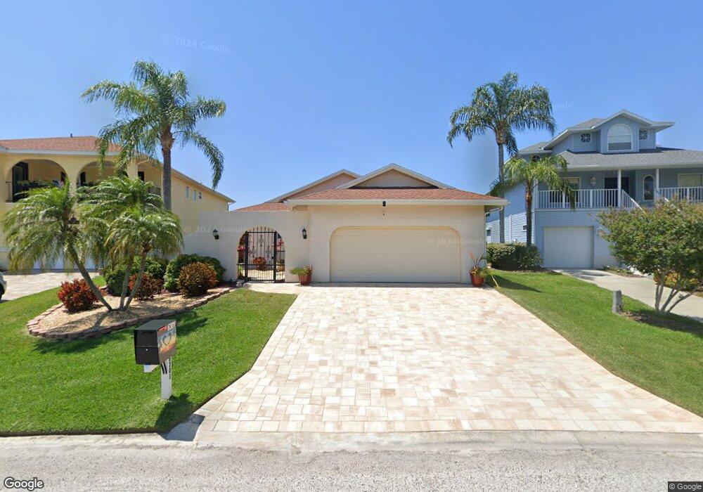
6301 Garland Ct New Port Richey, FL 34652
New Port Richey West NeighborhoodEstimated Value: $637,338 - $849,000
3
Beds
2
Baths
2,676
Sq Ft
$281/Sq Ft
Est. Value
About This Home
This home is located at 6301 Garland Ct, New Port Richey, FL 34652 and is currently estimated at $752,585, approximately $281 per square foot. 6301 Garland Ct is a home located in Pasco County with nearby schools including Richey Elementary School, Gulf Middle School, and Gulf High School.
Ownership History
Date
Name
Owned For
Owner Type
Purchase Details
Closed on
Oct 4, 2012
Sold by
Miller Anthony E and Miller Jane E
Bought by
Kelleher John and Kelleher Arlene M
Current Estimated Value
Home Financials for this Owner
Home Financials are based on the most recent Mortgage that was taken out on this home.
Original Mortgage
$232,000
Outstanding Balance
$161,633
Interest Rate
3.64%
Mortgage Type
New Conventional
Estimated Equity
$590,952
Purchase Details
Closed on
Apr 24, 2002
Sold by
Rj Land Group Inc C
Bought by
Nguyen John C
Purchase Details
Closed on
Jul 17, 2001
Sold by
Land G R J
Bought by
Schram Robert and Schram Kirk L
Home Financials for this Owner
Home Financials are based on the most recent Mortgage that was taken out on this home.
Original Mortgage
$75,000
Interest Rate
7.23%
Mortgage Type
Purchase Money Mortgage
Purchase Details
Closed on
Oct 8, 1999
Sold by
Pratt Kenneth H
Bought by
Miller Anthony E and Miller Jane E
Purchase Details
Closed on
Jan 21, 1997
Sold by
Garey Frank and Garey Diana
Bought by
Pratt Kenneth H and Pratt Suerita A
Create a Home Valuation Report for This Property
The Home Valuation Report is an in-depth analysis detailing your home's value as well as a comparison with similar homes in the area
Home Values in the Area
Average Home Value in this Area
Purchase History
| Date | Buyer | Sale Price | Title Company |
|---|---|---|---|
| Kelleher John | $290,000 | Attorney | |
| Nguyen John C | -- | -- | |
| Schram Robert | $75,000 | -- | |
| Miller Anthony E | $166,785 | -- | |
| Pratt Kenneth H | $150,000 | -- |
Source: Public Records
Mortgage History
| Date | Status | Borrower | Loan Amount |
|---|---|---|---|
| Open | Kelleher John | $232,000 | |
| Previous Owner | Pratt Kenneth H | $63,000 | |
| Previous Owner | Pratt Kenneth H | $200,000 | |
| Previous Owner | Pratt Kenneth H | $75,000 |
Source: Public Records
Tax History Compared to Growth
Tax History
| Year | Tax Paid | Tax Assessment Tax Assessment Total Assessment is a certain percentage of the fair market value that is determined by local assessors to be the total taxable value of land and additions on the property. | Land | Improvement |
|---|---|---|---|---|
| 2025 | $9,238 | $588,460 | -- | -- |
| 2024 | $9,238 | $571,880 | -- | -- |
| 2023 | $8,916 | $555,230 | $0 | $0 |
| 2022 | $7,950 | $533,711 | $219,302 | $314,409 |
| 2021 | $5,915 | $357,573 | $133,451 | $224,122 |
| 2020 | $5,477 | $330,203 | $129,785 | $200,418 |
| 2019 | $5,399 | $322,258 | $129,785 | $192,473 |
| 2018 | $5,252 | $312,338 | $129,785 | $182,553 |
| 2017 | $5,007 | $291,577 | $129,785 | $161,792 |
| 2016 | $5,017 | $290,387 | $129,785 | $160,602 |
| 2015 | $4,981 | $282,259 | $129,785 | $152,474 |
| 2014 | $4,599 | $264,948 | $127,370 | $137,578 |
Source: Public Records
Map
Nearby Homes
- 6306 Garland Ct
- 6170 Seaside Dr
- 6208 Spoonbill Dr
- 6209 Spoonbill Dr
- 6340 Garland Ct
- 4425 Gulfside Dr
- 4335 Sanddollar Ct
- 6116 Seaside Dr
- 6244 Spoonbill Dr
- 4330 Sanddollar Ct
- 6312 Spoonbill Dr
- 6316 Spoonbill Dr
- 4400 Sanddollar Ct
- 6241 Bayside Dr
- 6225 Bayside Dr
- 6340 Spoonbill Dr
- 6517 Channelside Dr
- 6344 Spoonbill Dr
- 5925 Seaside Dr
- 6513 Sand Shore Ln
- 6305 Garland Ct
- 6245 Garland Ct
- 6239 Garland Ct
- 6311 Garland Ct
- 6235 Garland Ct
- 6315 Garland Ct
- 6244 Garland Ct
- 6231 Garland Ct
- 6238 Garland Ct
- 6321 Garland Ct
- 6310 Garland Ct
- 6234 Garland Ct
- 6316 Garland Ct
- 6331 Garland Ct
- 6320 Garland Ct
- 6335 Garland Ct
- 6326 Garland Ct
- 6200 Spoonbill Dr
- 6201 Spoonbill Dr