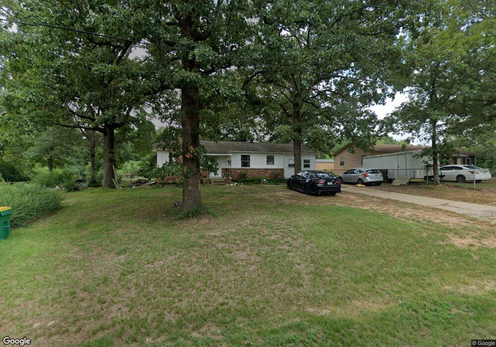
6304 Hudman Rd North Little Rock, AR 72118
Estimated Value: $101,393 - $126,000
--
Bed
1
Bath
1,116
Sq Ft
$102/Sq Ft
Est. Value
About This Home
This home is located at 6304 Hudman Rd, North Little Rock, AR 72118 and is currently estimated at $113,848, approximately $102 per square foot. 6304 Hudman Rd is a home located in Pulaski County with nearby schools including Oak Grove Elementary School, Maumelle Middle School, and Maumelle High School.
Ownership History
Date
Name
Owned For
Owner Type
Purchase Details
Closed on
Jan 9, 2001
Sold by
Jones Gregory Steele and Jones Deborah Kay
Bought by
Johnson Travis B and Johnson Lisa
Current Estimated Value
Home Financials for this Owner
Home Financials are based on the most recent Mortgage that was taken out on this home.
Original Mortgage
$50,050
Outstanding Balance
$18,480
Interest Rate
7.55%
Mortgage Type
FHA
Estimated Equity
$95,368
Create a Home Valuation Report for This Property
The Home Valuation Report is an in-depth analysis detailing your home's value as well as a comparison with similar homes in the area
Home Values in the Area
Average Home Value in this Area
Purchase History
| Date | Buyer | Sale Price | Title Company |
|---|---|---|---|
| Johnson Travis B | -- | Stewart Title |
Source: Public Records
Mortgage History
| Date | Status | Borrower | Loan Amount |
|---|---|---|---|
| Open | Johnson Travis B | $50,050 |
Source: Public Records
Tax History Compared to Growth
Tax History
| Year | Tax Paid | Tax Assessment Tax Assessment Total Assessment is a certain percentage of the fair market value that is determined by local assessors to be the total taxable value of land and additions on the property. | Land | Improvement |
|---|---|---|---|---|
| 2025 | $830 | $17,450 | $2,392 | $15,058 |
| 2024 | $766 | $17,450 | $2,392 | $15,058 |
| 2023 | $766 | $17,450 | $2,392 | $15,058 |
| 2022 | $852 | $17,450 | $2,392 | $15,058 |
| 2021 | $763 | $12,560 | $920 | $11,640 |
| 2020 | $763 | $12,560 | $920 | $11,640 |
| 2019 | $745 | $12,560 | $920 | $11,640 |
| 2018 | $697 | $12,560 | $920 | $11,640 |
| 2017 | $624 | $12,560 | $920 | $11,640 |
| 2016 | $577 | $9,380 | $2,940 | $6,440 |
| 2015 | $477 | $9,380 | $2,940 | $6,440 |
| 2014 | $477 | $9,380 | $2,940 | $6,440 |
Source: Public Records
Map
Nearby Homes
- 0 Macarthur Unit 25004179
- 7932 Macarthur Dr
- 8016 Highway 365
- 00 Trapp Rd
- 5503 Taril Ln
- 5901 Kelly Rd
- 0 Westwind Dr Unit 25030537
- 5119 Vaughn Rd
- 7213 Westwind Dr
- 00 Interstate 40
- 4901 Vaughn Rd
- 30 Silver Ridge Cove
- 29 Prospect Trail
- 7417 Service Rd
- 6824 Drew Ln
- 5517 McMurtrey Dr
- 95 Prospect Trail
- 62 Lucia Ln
- 7423 Service Rd
- 123 Natural Trail
- 6218 Hudman Rd
- 6312 Hudman Rd
- 6212 Hudman Rd
- 6211 Hudman Rd
- 6207 Hudman Rd
- 6110 Hudman Rd
- 6105 Hudman Rd
- 10609 Mac Arthur Dr
- 10609 Macarthur Dr
- 6004 Hudman Rd
- 10707 Mac Arthur Dr
- N Highway 365
- 10514 Mac Arthur Dr
- 10514 Macarthur Dr
- 8412 Highway 365 Dr N
- 10604 Mac Arthur Dr
- 10612 Mac Arthur Dr
- 6716 Hudman Rd
- 8824 Daniel Rd
- 10805 Mac Arthur Dr