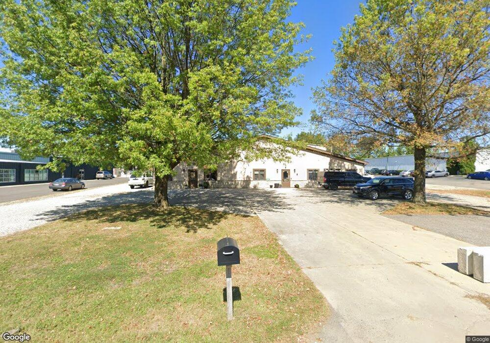
6305 Frost Rd Westerville, OH 43082
Genoa NeighborhoodEstimated Value: $1,047,133
--
Bed
--
Bath
9,190
Sq Ft
$114/Sq Ft
Est. Value
About This Home
This home is located at 6305 Frost Rd, Westerville, OH 43082 and is currently estimated at $1,047,133, approximately $113 per square foot. 6305 Frost Rd is a home located in Delaware County with nearby schools including Alcott Elementary School, Genoa Middle School, and Westerville Central High School.
Ownership History
Date
Name
Owned For
Owner Type
Purchase Details
Closed on
Feb 26, 2021
Sold by
Wondervich Llc
Bought by
Board Of County Commissioners Of De Cnty
Current Estimated Value
Purchase Details
Closed on
Jan 30, 2018
Sold by
Linxus Communications Llc
Bought by
Wondervich Llc
Purchase Details
Closed on
Dec 9, 2016
Sold by
Leark Ltd
Bought by
Linxus Communications Llc
Purchase Details
Closed on
Jan 20, 2015
Sold by
Deim Edward B
Bought by
Leark Ltd
Purchase Details
Closed on
Jan 22, 2010
Sold by
Deim Cheryl C
Bought by
Deim Edward B
Purchase Details
Closed on
Jun 1, 1999
Sold by
T A Title Agency Inc Trs
Bought by
Deim Edward B and Deim Cheryl C
Create a Home Valuation Report for This Property
The Home Valuation Report is an in-depth analysis detailing your home's value as well as a comparison with similar homes in the area
Home Values in the Area
Average Home Value in this Area
Purchase History
| Date | Buyer | Sale Price | Title Company |
|---|---|---|---|
| Board Of County Commissioners Of De Cnty | -- | Valley Title & Escrow | |
| Board Of County Commissioners Of Delaware Cou | -- | Valley Title | |
| Wondervich Llc | -- | -- | |
| Linxus Communications Llc | -- | Hummel Title | |
| Leark Ltd | $520,000 | None Available | |
| Deim Edward B | -- | Attorney | |
| Deim Edward B | $190,000 | -- |
Source: Public Records
Tax History Compared to Growth
Tax History
| Year | Tax Paid | Tax Assessment Tax Assessment Total Assessment is a certain percentage of the fair market value that is determined by local assessors to be the total taxable value of land and additions on the property. | Land | Improvement |
|---|---|---|---|---|
| 2024 | -- | $296,210 | $37,770 | $258,440 |
| 2023 | $19,357 | $296,210 | $37,770 | $258,440 |
| 2022 | $0 | $240,070 | $30,980 | $209,090 |
| 2021 | $19,357 | $227,510 | $30,980 | $196,530 |
| 2020 | $19,265 | $227,510 | $30,980 | $196,530 |
| 2019 | $19,176 | $227,510 | $30,980 | $196,530 |
| 2018 | $18,796 | $227,510 | $30,980 | $196,530 |
| 2017 | $16,998 | $182,010 | $30,980 | $151,030 |
| 2016 | $15,718 | $182,010 | $30,980 | $151,030 |
| 2015 | $15,519 | $182,010 | $30,980 | $151,030 |
| 2014 | $14,063 | $164,930 | $30,980 | $133,950 |
| 2013 | $13,832 | $164,930 | $30,980 | $133,950 |
Source: Public Records
Map
Nearby Homes
- 6735 Alberta Place
- 6867 Sherbrook Dr
- 0 Paul Rd Unit 225001038
- 763 Kingsmead Rd
- 6410 Steinbeck Way
- 752 Kingsmead Rd Unit 18752
- 6251 Steinbeck Way
- 764 Mill Crossing Dr
- 705 N State St Unit 211
- 6623 Henschen Cir
- 7268 Clancy Way
- 5552 Quail Hollow Way
- 5515 Stillwater Ave
- 5444 Quail Hollow Way
- 7356 Park Bend Dr
- 6525 Colonial Place
- 6086 Hemingway Place
- 7524 Center Green Dr
- 518 Kingfisher Dr
- 6460 Bromfield Dr
- 6300 Frost Rd
- 6326 Mount Royal Ave
- 6404 Mount Royal Ave Unit 6404
- 6282 Mount Royal Ave
- 6366 Mount Royal Ave
- 6364 Mount Royal Ave Unit 6364
- 6362 Mount Royal Ave Unit 6362
- 6360 Mount Royal Ave
- 6286 Mount Royal Ave
- 6284 Mount Royal Ave
- 6282 Mount Royal Ave Unit 6282
- 6280 Mount Royal Ave Unit 6280
- 6406 Mount Royal Ave Unit 6406
- 6320 Mount Royal Ave
- 6324 Mount Royal Ave
- 6402 Mount Royal Ave Unit 6402
- 6322 Mount Royal Ave
- 6322 Mount Royal Ave
- 6400 Mount Royal Ave Unit 6400
- 6442 Mount Royal Ave