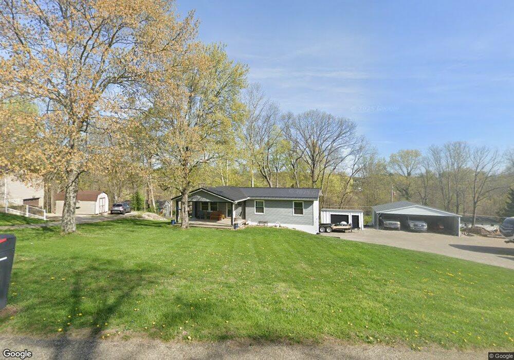
6305 Windsong Way Nashport, OH 43830
Estimated Value: $224,000 - $269,645
3
Beds
2
Baths
1,056
Sq Ft
$226/Sq Ft
Est. Value
About This Home
This home is located at 6305 Windsong Way, Nashport, OH 43830 and is currently estimated at $238,911, approximately $226 per square foot. 6305 Windsong Way is a home located in Muskingum County with nearby schools including Tri-Valley High School.
Ownership History
Date
Name
Owned For
Owner Type
Purchase Details
Closed on
Dec 24, 1996
Sold by
Adams William D
Bought by
King Richard R
Current Estimated Value
Home Financials for this Owner
Home Financials are based on the most recent Mortgage that was taken out on this home.
Original Mortgage
$68,367
Outstanding Balance
$6,974
Interest Rate
7.74%
Mortgage Type
FHA
Estimated Equity
$231,937
Purchase Details
Closed on
Sep 23, 1996
Sold by
Kirkbride Alfred L
Bought by
Adams William D
Home Financials for this Owner
Home Financials are based on the most recent Mortgage that was taken out on this home.
Original Mortgage
$51,644
Interest Rate
7.93%
Mortgage Type
New Conventional
Create a Home Valuation Report for This Property
The Home Valuation Report is an in-depth analysis detailing your home's value as well as a comparison with similar homes in the area
Home Values in the Area
Average Home Value in this Area
Purchase History
| Date | Buyer | Sale Price | Title Company |
|---|---|---|---|
| King Richard R | $69,500 | -- | |
| Adams William D | $51,000 | -- |
Source: Public Records
Mortgage History
| Date | Status | Borrower | Loan Amount |
|---|---|---|---|
| Open | King Richard R | $68,367 | |
| Previous Owner | Adams William D | $51,644 |
Source: Public Records
Tax History Compared to Growth
Tax History
| Year | Tax Paid | Tax Assessment Tax Assessment Total Assessment is a certain percentage of the fair market value that is determined by local assessors to be the total taxable value of land and additions on the property. | Land | Improvement |
|---|---|---|---|---|
| 2024 | $2,111 | $57,750 | $10,465 | $47,285 |
| 2023 | $1,720 | $42,805 | $4,830 | $37,975 |
| 2022 | $1,682 | $42,805 | $4,830 | $37,975 |
| 2021 | $1,501 | $41,965 | $4,830 | $37,135 |
| 2020 | $1,335 | $36,470 | $4,200 | $32,270 |
| 2019 | $1,335 | $36,470 | $4,200 | $32,270 |
| 2018 | $1,165 | $36,470 | $4,200 | $32,270 |
| 2017 | $1,041 | $28,214 | $4,204 | $24,010 |
| 2016 | $1,051 | $28,110 | $4,100 | $24,010 |
| 2015 | $1,049 | $28,110 | $4,100 | $24,010 |
| 2013 | $1,492 | $24,680 | $4,100 | $20,580 |
Source: Public Records
Map
Nearby Homes
- 6355 Brentcrest Dr
- 6250 Tanglewood Dr
- 6365 Brentcrest Dr
- 6740 Swing A Long Ln
- 6730 Dillon Hills Dr
- 6850 Newark Rd
- 6805 Dillon Hills Dr
- 6080 Poplar Dr
- 5605 Pleasant View Dr
- 5295 Milford Dr
- 5880 Ballard Rd
- 0 Newark Rd
- 5290 Hampton Ct
- 5220 Hampton Ct
- 5240 Stonegate Dr
- 5050 Wilshire Dr
- 5260 Stonegate Dr
- 5270 Stonegate Dr
- 5255 Stonegate Dr
- 5265 Stonegate Dr
- 6315 Windsong Way
- 6345 Tanglewood Dr
- 6325 Windsong Way
- 6285 Windsong Way
- 6355 Tanglewood Dr
- 6310 Windsong Way
- 6325 Tanglewood Dr
- 6290 Windsong Way
- 6335 Windsong Way
- 6320 Windsong Way
- 6365 Tanglewood Dr
- 6275 Windsong Way
- 6315 Tanglewood Dr
- 6345 Windsong Way
- 6330 Windsong Way
- 6280 Windsong Way
- 6295 Tanglewood Dr
- 6255 Windsong Way
- 6245 Windsong Way
- 6315 Brentcrest Dr