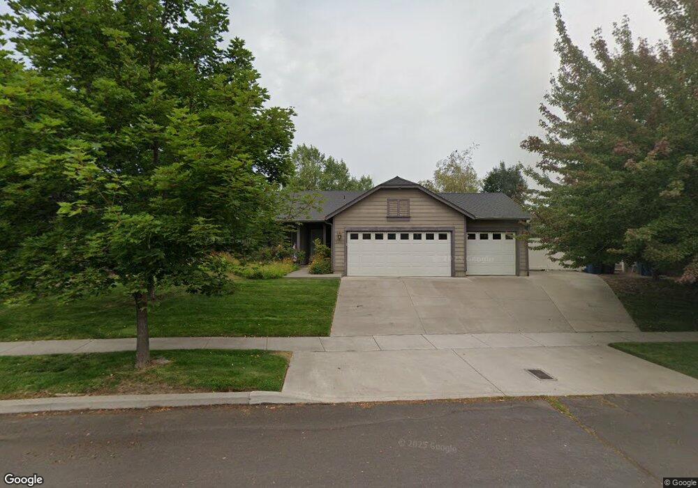
63055 Wild Buckwheat Ct Bend, OR 97701
Boyd Acres NeighborhoodEstimated Value: $607,000 - $654,000
3
Beds
2
Baths
1,642
Sq Ft
$384/Sq Ft
Est. Value
About This Home
This home is located at 63055 Wild Buckwheat Ct, Bend, OR 97701 and is currently estimated at $630,105, approximately $383 per square foot. 63055 Wild Buckwheat Ct is a home located in Deschutes County with nearby schools including Ponderosa Elementary School, Sky View Middle School, and Mountain View Senior High School.
Ownership History
Date
Name
Owned For
Owner Type
Purchase Details
Closed on
Nov 30, 2021
Sold by
Moyer Jimmie Allen and Moye Susan
Bought by
Jimmie Allen Moyer And Susan Elaine Moyer Liv
Current Estimated Value
Home Financials for this Owner
Home Financials are based on the most recent Mortgage that was taken out on this home.
Original Mortgage
$876,000
Interest Rate
1.72%
Mortgage Type
Credit Line Revolving
Purchase Details
Closed on
May 9, 2016
Sold by
Moyer Jimmie A and Moyer Susan E
Bought by
Moyer Jimmie Allen and Moyer Susan
Purchase Details
Closed on
Nov 22, 2004
Sold by
Scott Regan L and Scott Lynn O
Bought by
Moyer Jim A and Moyer Sue E
Create a Home Valuation Report for This Property
The Home Valuation Report is an in-depth analysis detailing your home's value as well as a comparison with similar homes in the area
Home Values in the Area
Average Home Value in this Area
Purchase History
| Date | Buyer | Sale Price | Title Company |
|---|---|---|---|
| Jimmie Allen Moyer And Susan Elaine Moyer Liv | -- | None Listed On Document | |
| Moyer Jimmie Allen | -- | None Available | |
| Moyer Jim A | $225,000 | Amerititle |
Source: Public Records
Mortgage History
| Date | Status | Borrower | Loan Amount |
|---|---|---|---|
| Open | Jimmie Allen Moyer And Susan Elaine Moyer Liv | $876,000 | |
| Previous Owner | Jimmie Allen Moyer And Susan Elaine Moyer Liv | $876,000 |
Source: Public Records
Tax History Compared to Growth
Tax History
| Year | Tax Paid | Tax Assessment Tax Assessment Total Assessment is a certain percentage of the fair market value that is determined by local assessors to be the total taxable value of land and additions on the property. | Land | Improvement |
|---|---|---|---|---|
| 2025 | $4,408 | $260,880 | -- | -- |
| 2024 | $4,241 | $253,290 | -- | -- |
| 2023 | $3,931 | $245,920 | $0 | $0 |
| 2022 | $3,668 | $231,810 | $0 | $0 |
| 2021 | $3,674 | $225,060 | $0 | $0 |
| 2020 | $3,485 | $225,060 | $0 | $0 |
| 2019 | $3,388 | $218,510 | $0 | $0 |
| 2018 | $3,293 | $212,150 | $0 | $0 |
| 2017 | $3,196 | $205,980 | $0 | $0 |
| 2016 | $3,048 | $199,990 | $0 | $0 |
| 2015 | $2,964 | $194,170 | $0 | $0 |
| 2014 | $2,876 | $188,520 | $0 | $0 |
Source: Public Records
Map
Nearby Homes
- 20939 Blue Bush Ct
- 63103 Watercress Way
- 20974 NE Marsh Orchid Ct
- 63157 Watercress Way
- 2044 NE Cradle Mountain Way
- 62906 Bilyeu Way
- 20751 Boulderfield Ave
- 3280 NE Jonahs Ct
- 21620 NE Butler Market Rd
- 21072 NE High Desert Ln
- 21010 Yeoman Rd
- 63150 Peale St
- 3073 NE Quiet Canyon Dr
- 20663 NE Sierra Dr
- 63190 Carly Ln
- 63326 NE Brightwater Dr
- 1482 NE Rumgay Ln
- 2976 NE Bluebell Ln
- Avery Plan at Acadia Pointe
- Jade Plan at Acadia Pointe
- 63053 Marsh Orchid Dr
- 63059 Wild Buckwheat Ct
- 63065 Marsh Orchid Dr
- 63047 Marsh Orchid Dr
- 63048 Marsh Orchid Dr
- 63054 Marsh Orchid Dr
- 63054 Marsh Orchid Dr
- 63052 Wild Buckwheat Ct
- 63063 Wild Buckwheat Ct
- 63071 Marsh Orchid Dr
- 63041 Marsh Orchid Dr
- 63066 Marsh Orchid Dr
- 63037 Marsh Orchid Dr
- 63077 Marsh Orchid Dr
- 20886 Lupine Ave
- 0 Lupine Ave NE
- 20898 Lupine Ave
- 63069 Wild Buckwheat Ct
- 63033 Marsh Orchid Dr
- 63072 Marsh Orchid Dr