Estimated Value: $447,398 - $568,000
3
Beds
2
Baths
1,836
Sq Ft
$283/Sq Ft
Est. Value
About This Home
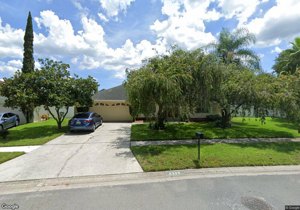
This home is located at 6306 Forrestal Dr, Tampa, FL 33625 and is currently estimated at $518,850, approximately $282 per square foot. 6306 Forrestal Dr is a home located in Hillsborough County with nearby schools including Citrus Park Elementary School, Sgt. Paul R. Smith Middle School, and Sickles High School.
Ownership History
Date
Name
Owned For
Owner Type
Purchase Details
Closed on
Jul 31, 1995
Sold by
Prossick Nancy A
Bought by
Baik Mahmood and Baik Cindy S
Current Estimated Value
Home Financials for this Owner
Home Financials are based on the most recent Mortgage that was taken out on this home.
Original Mortgage
$106,400
Interest Rate
7.46%
Purchase Details
Closed on
Nov 5, 1993
Sold by
Lane Stephen F and Lane Sandra L
Bought by
Prossick Nancy A
Home Financials for this Owner
Home Financials are based on the most recent Mortgage that was taken out on this home.
Original Mortgage
$104,500
Interest Rate
6.97%
Create a Home Valuation Report for This Property
The Home Valuation Report is an in-depth analysis detailing your home's value as well as a comparison with similar homes in the area
Home Values in the Area
Average Home Value in this Area
Purchase History
| Date | Buyer | Sale Price | Title Company |
|---|---|---|---|
| Baik Mahmood | $112,000 | -- | |
| Prossick Nancy A | $110,000 | -- |
Source: Public Records
Mortgage History
| Date | Status | Borrower | Loan Amount |
|---|---|---|---|
| Closed | Baik Mahmood | $106,400 | |
| Previous Owner | Prossick Nancy A | $104,500 |
Source: Public Records
Tax History Compared to Growth
Tax History
| Year | Tax Paid | Tax Assessment Tax Assessment Total Assessment is a certain percentage of the fair market value that is determined by local assessors to be the total taxable value of land and additions on the property. | Land | Improvement |
|---|---|---|---|---|
| 2024 | $2,513 | $149,845 | -- | -- |
| 2023 | $2,402 | $145,481 | $0 | $0 |
| 2022 | $2,238 | $141,244 | $0 | $0 |
| 2021 | $2,193 | $137,130 | $0 | $0 |
| 2020 | $2,111 | $135,237 | $0 | $0 |
| 2019 | $2,020 | $132,196 | $0 | $0 |
| 2018 | $1,967 | $129,731 | $0 | $0 |
| 2017 | $1,932 | $176,792 | $0 | $0 |
| 2016 | $1,897 | $124,450 | $0 | $0 |
| 2015 | $1,916 | $123,585 | $0 | $0 |
| 2014 | $1,891 | $122,604 | $0 | $0 |
| 2013 | -- | $120,792 | $0 | $0 |
Source: Public Records
Map
Nearby Homes
- 6208 Forrestal Dr
- 15106 Nighthawk Dr
- 6226 Eaglebrook Ave
- 15005 Redcliff Dr
- 15013 Redcliff Dr
- 15028 Redcliff Dr
- 5825 Bitter Orange Ave
- 7520 Ashbrooke Pine Loop
- 16002 Armistead Ln
- 5816 Silver Moon Ave
- 5533 Pentail Cir
- 0 Avonwood St Unit MFRTB8441766
- 0 Avonwood St Unit MFRTB8407681
- 0 Avonwood St Unit MFRTB8401926
- 0 Avonwood St Unit MFRTB8401922
- 0 Avonwood St Unit MFRTB8401932
- 0 Avonwood St Unit MFRTB8401830
- 16006 Armistead Ln
- 14916 Rocky Ledge Dr
- 0 Ardenwood St
- 6308 Forrestal Dr
- 6304 Forrestal Dr
- 15125 Heathridge Dr
- 15123 Heathridge Dr
- 6310 Forrestal Dr
- 15127 Heathridge Dr
- 6303 Forrestal Dr
- 15106 Redvale Dr
- 15121 Heathridge Dr
- 15104 Redvale Dr
- 6301 Forrestal Dr
- 6305 Forrestal Dr
- 6305 Forrestal Dr Unit zz
- 15129 Heathridge Dr
- 6312 Forrestal Dr
- 15119 Heathridge Dr
- 6211 Forrestal Dr
- 6307 Forrestal Dr
- 15201 Heathridge Dr
- 15126 Heathridge Dr