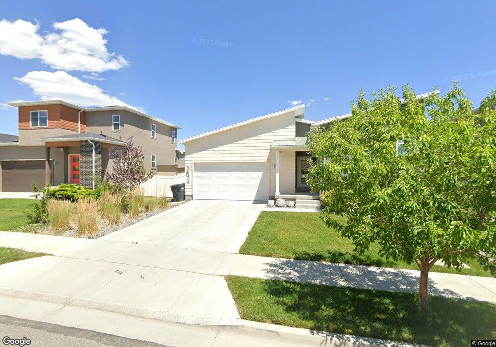
6306 W 7860 S West Jordan, UT 84081
Jordan Hills NeighborhoodEstimated Value: $542,000 - $622,000
3
Beds
2
Baths
1,473
Sq Ft
$394/Sq Ft
Est. Value
About This Home
This home is located at 6306 W 7860 S, West Jordan, UT 84081 and is currently estimated at $580,665, approximately $394 per square foot. 6306 W 7860 S is a home with nearby schools including Fox Hollow School, Sunset Ridge Middle School, and Copper Hills High School.
Ownership History
Date
Name
Owned For
Owner Type
Purchase Details
Closed on
Apr 1, 2024
Sold by
Mcdaniel Ryan and Post Rebecca
Bought by
Mcdaniel Post Family Trust and Mcdaniel
Current Estimated Value
Purchase Details
Closed on
Aug 26, 2019
Sold by
Mcdaniel Ryan and Post Rebecca
Bought by
Mcdaniel Ryan and Post Rebecca
Home Financials for this Owner
Home Financials are based on the most recent Mortgage that was taken out on this home.
Original Mortgage
$348,250
Interest Rate
3.8%
Mortgage Type
New Conventional
Purchase Details
Closed on
Oct 17, 2018
Sold by
Garbett Land Investments Lc
Bought by
Mcdaniel Ryan and Post Rebecca
Home Financials for this Owner
Home Financials are based on the most recent Mortgage that was taken out on this home.
Original Mortgage
$344,433
Interest Rate
4.5%
Mortgage Type
New Conventional
Create a Home Valuation Report for This Property
The Home Valuation Report is an in-depth analysis detailing your home's value as well as a comparison with similar homes in the area
Home Values in the Area
Average Home Value in this Area
Purchase History
| Date | Buyer | Sale Price | Title Company |
|---|---|---|---|
| Mcdaniel Post Family Trust | -- | None Listed On Document | |
| Mcdaniel Ryan | -- | Amrock Inc | |
| Mcdaniel Ryan | -- | Meridian Title |
Source: Public Records
Mortgage History
| Date | Status | Borrower | Loan Amount |
|---|---|---|---|
| Previous Owner | Mcdaniel Ryan | $348,250 | |
| Previous Owner | Mcdaniel Ryan | $344,433 |
Source: Public Records
Tax History Compared to Growth
Tax History
| Year | Tax Paid | Tax Assessment Tax Assessment Total Assessment is a certain percentage of the fair market value that is determined by local assessors to be the total taxable value of land and additions on the property. | Land | Improvement |
|---|---|---|---|---|
| 2025 | $2,809 | $559,300 | $136,700 | $422,600 |
| 2024 | $2,809 | $540,400 | $132,700 | $407,700 |
| 2023 | $2,809 | $514,000 | $127,600 | $386,400 |
| 2022 | $2,932 | $523,100 | $125,100 | $398,000 |
| 2021 | $2,362 | $383,600 | $98,500 | $285,100 |
| 2020 | $2,200 | $335,300 | $98,500 | $236,800 |
| 2019 | $2,221 | $331,900 | $98,500 | $233,400 |
| 2018 | $1,190 | $97,000 | $97,000 | $0 |
| 2017 | $0 | $0 | $0 | $0 |
Source: Public Records
Map
Nearby Homes
- 6343 W 7900 S
- 6064 W Sapphire St
- 6064 W Sapphire St Unit 339
- 6058 W Sapphire St
- 6058 W Sapphire St Unit 340
- 6052 W Sapphire St Unit 341
- 6046 W Sapphire St
- 6046 W Sapphire St Unit 342
- 6042 W Sapphire St Unit 343
- 6036 W Sapphire St Unit 344
- 6463 W Maple Valley Cir Unit 1030
- 6412 W Chan Reese Dr
- 7991 S Ambrosia Ln
- 6593 W 7870 S
- 6602 W Braeburn Way
- 8043 S Ambrosia Ln
- 6071 W Garnet Grove Way Unit 230
- 6621 W Braeburn Way
- 6067 W Garnet Grove Way Unit 229
- 6067 W Garnet Grove Way