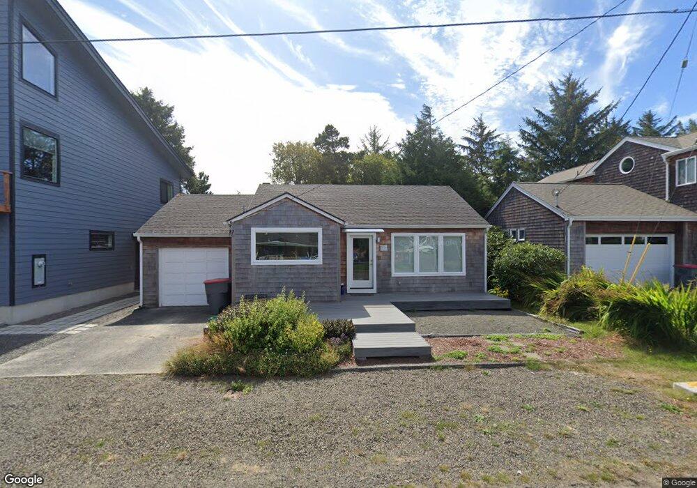
631 25th Ave Seaside, OR 97138
Estimated Value: $372,068 - $420,000
3
Beds
1
Bath
1,154
Sq Ft
$341/Sq Ft
Est. Value
About This Home
This home is located at 631 25th Ave, Seaside, OR 97138 and is currently estimated at $393,767, approximately $341 per square foot. 631 25th Ave is a home located in Clatsop County with nearby schools including Seaside High School.
Ownership History
Date
Name
Owned For
Owner Type
Purchase Details
Closed on
Aug 10, 2021
Sold by
Card Rebecca S
Bought by
Fantz Roger H and Fantz Catherine E
Current Estimated Value
Purchase Details
Closed on
Oct 28, 2015
Sold by
Larfield Jon Bruce
Bought by
Card Rebecca S
Home Financials for this Owner
Home Financials are based on the most recent Mortgage that was taken out on this home.
Original Mortgage
$195,000
Interest Rate
3.87%
Mortgage Type
New Conventional
Create a Home Valuation Report for This Property
The Home Valuation Report is an in-depth analysis detailing your home's value as well as a comparison with similar homes in the area
Home Values in the Area
Average Home Value in this Area
Purchase History
| Date | Buyer | Sale Price | Title Company |
|---|---|---|---|
| Fantz Roger H | $100,000 | Pacific County Title Co | |
| Card Rebecca S | $245,000 | Pacific Title Company |
Source: Public Records
Mortgage History
| Date | Status | Borrower | Loan Amount |
|---|---|---|---|
| Previous Owner | Card Rebecca S | $195,000 |
Source: Public Records
Tax History Compared to Growth
Tax History
| Year | Tax Paid | Tax Assessment Tax Assessment Total Assessment is a certain percentage of the fair market value that is determined by local assessors to be the total taxable value of land and additions on the property. | Land | Improvement |
|---|---|---|---|---|
| 2024 | $2,025 | $140,928 | -- | -- |
| 2023 | $1,965 | $136,825 | $0 | $0 |
| 2022 | $1,911 | $132,841 | $0 | $0 |
| 2021 | $1,871 | $128,973 | $0 | $0 |
| 2020 | $2,425 | $166,201 | $0 | $0 |
| 2019 | $2,359 | $161,361 | $0 | $0 |
| 2018 | $2,265 | $156,662 | $0 | $0 |
| 2017 | $2,149 | $152,100 | $0 | $0 |
| 2016 | $1,880 | $147,671 | $89,466 | $58,205 |
| 2015 | $1,811 | $143,371 | $86,861 | $56,510 |
| 2014 | $1,846 | $139,197 | $0 | $0 |
| 2013 | -- | $135,143 | $0 | $0 |
Source: Public Records
Map
Nearby Homes
- 000 Neawanna St
- 802 25th Ave
- 2549 Neawanna St
- 2469 Pine St
- 2624 Neawanna St
- 623 Indian Way
- 2657 Highway 101 N Unit 42
- 782 Woodland Ct
- 814 17th Ave
- 790 17th Ave
- 0 Wellington Ave Unit 25-48
- 0 Wellington Ave Unit 1202
- 1265 D St
- 821 13th Ave
- 0 N Wahanna Rd
- 337 16th Ave
- 0 Vacant Land Unit 159249124
- 310 15th Ave
- 196 Dylan Ct
- 717 12th Ave
- 665 25th Ave
- 630 25th Ave
- 627 25th Ave
- 0 Neawanna St Unit 23490319
- 0 Neawanna St Unit 22334480
- 0 Neawanna St Unit 21482935
- 0 Neawanna St Unit 778180
- LOT Neawanna St
- 0 Neawanna St Unit 11209643
- 0 Neawanna St Unit 10020572
- 0 Neawanna St Unit 9023614
- 0 Neawanna St Unit 9013764
- 0 Neawanna St Unit 596732
- 0 Neawanna St Unit 596735
- 0 Neawanna St Unit 9069755
- 0 Neawanna St Unit 9069754
- 0 Neawanna St Unit 11640190
- 0 Neawanna St Unit 7 13604230
- 0 Neawanna St Unit 6 13128935
- 0 Neawanna St Unit 7