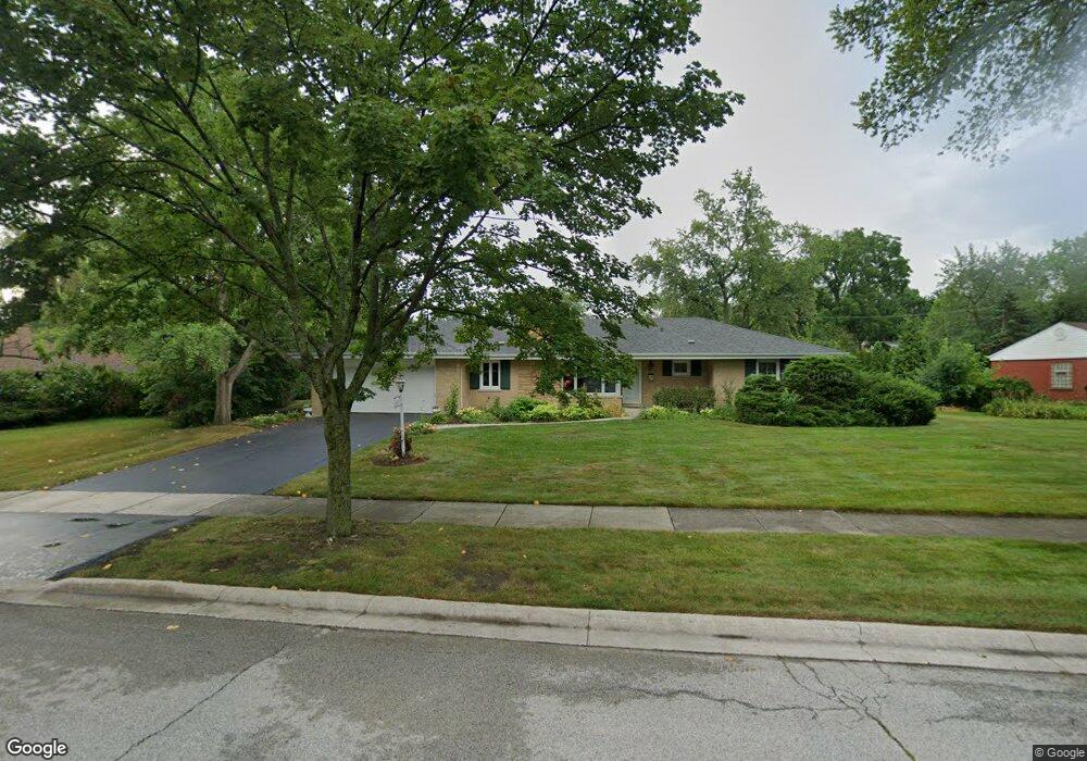
631 Burns Ave Flossmoor, IL 60422
Estimated Value: $336,000 - $362,000
3
Beds
2
Baths
2,045
Sq Ft
$170/Sq Ft
Est. Value
About This Home
This home is located at 631 Burns Ave, Flossmoor, IL 60422 and is currently estimated at $347,531, approximately $169 per square foot. 631 Burns Ave is a home located in Cook County with nearby schools including Western Avenue Elementary School, Parker Junior High School, and Homewood-Flossmoor High School.
Ownership History
Date
Name
Owned For
Owner Type
Purchase Details
Closed on
Mar 28, 2011
Sold by
Voight Kenneth R and Voight Donna E
Bought by
Stewart Dana Nelson and Stewart Zayda Cecilia
Current Estimated Value
Home Financials for this Owner
Home Financials are based on the most recent Mortgage that was taken out on this home.
Original Mortgage
$172,025
Outstanding Balance
$112,691
Interest Rate
3.75%
Mortgage Type
FHA
Estimated Equity
$234,840
Create a Home Valuation Report for This Property
The Home Valuation Report is an in-depth analysis detailing your home's value as well as a comparison with similar homes in the area
Home Values in the Area
Average Home Value in this Area
Purchase History
| Date | Buyer | Sale Price | Title Company |
|---|---|---|---|
| Stewart Dana Nelson | $176,500 | Chicago Title Insurance Co |
Source: Public Records
Mortgage History
| Date | Status | Borrower | Loan Amount |
|---|---|---|---|
| Open | Stewart Dana Nelson | $172,025 |
Source: Public Records
Tax History Compared to Growth
Tax History
| Year | Tax Paid | Tax Assessment Tax Assessment Total Assessment is a certain percentage of the fair market value that is determined by local assessors to be the total taxable value of land and additions on the property. | Land | Improvement |
|---|---|---|---|---|
| 2024 | $10,229 | $30,000 | $9,650 | $20,350 |
| 2023 | $6,766 | $30,000 | $9,650 | $20,350 |
| 2022 | $6,766 | $18,736 | $6,141 | $12,595 |
| 2021 | $6,865 | $18,735 | $6,140 | $12,595 |
| 2020 | $6,788 | $18,735 | $6,140 | $12,595 |
| 2019 | $7,196 | $19,526 | $5,702 | $13,824 |
| 2018 | $6,920 | $19,526 | $5,702 | $13,824 |
| 2017 | $8,224 | $19,526 | $5,702 | $13,824 |
| 2016 | $9,300 | $20,058 | $5,263 | $14,795 |
| 2015 | $9,278 | $20,058 | $5,263 | $14,795 |
| 2014 | $9,131 | $20,058 | $5,263 | $14,795 |
| 2013 | $10,106 | $21,152 | $5,263 | $15,889 |
Source: Public Records
Map
Nearby Homes
- 2619 Alexander St
- 18530 Stedhall Rd
- 710 Bruce Ave
- 18509 Stedhall Rd
- 18450 Stedhall Rd
- 625 Perth Ave
- 18418 Clyde Rd
- 2807 Willow Rd Unit 103
- 18400 Cherry Creek Dr Unit 105
- 802 Argyle Ave
- 18340 Cherry Creek Dr Unit 7
- 846 Park Dr
- 18330 Perth Ave
- 18314 Dundee Ave
- 3007 Monterey Dr
- 3013 Carmel Dr
- 18210 Perth Ave
- 926 Braemar Rd
- 18157 Rockwell Ave
- 2640 Central Dr Unit 1-N