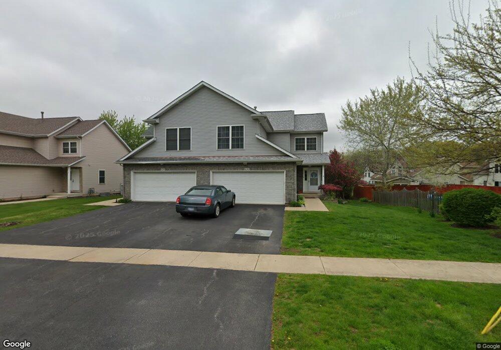
631 E Blair St Unit 152 West Chicago, IL 60185
Chicago West NeighborhoodEstimated Value: $304,000 - $310,000
2
Beds
4
Baths
1,107
Sq Ft
$276/Sq Ft
Est. Value
About This Home
This home is located at 631 E Blair St Unit 152, West Chicago, IL 60185 and is currently estimated at $305,863, approximately $276 per square foot. 631 E Blair St Unit 152 is a home located in DuPage County with nearby schools including Indian Knoll Elementary School, Leman Middle School, and West Chicago Community High School.
Ownership History
Date
Name
Owned For
Owner Type
Purchase Details
Closed on
Apr 27, 2022
Sold by
Mander Laurel E
Bought by
Ross Laurel and Schaults Jon
Current Estimated Value
Purchase Details
Closed on
Feb 21, 2006
Sold by
Sherby Donald J and Sherby Betty L
Bought by
Mander Laurel E
Home Financials for this Owner
Home Financials are based on the most recent Mortgage that was taken out on this home.
Original Mortgage
$168,000
Interest Rate
9.4%
Mortgage Type
Fannie Mae Freddie Mac
Purchase Details
Closed on
Jul 1, 2002
Sold by
State Bank Of Illinois
Bought by
Sherby Donald J and Sherby Betty L
Create a Home Valuation Report for This Property
The Home Valuation Report is an in-depth analysis detailing your home's value as well as a comparison with similar homes in the area
Home Values in the Area
Average Home Value in this Area
Purchase History
| Date | Buyer | Sale Price | Title Company |
|---|---|---|---|
| Ross Laurel | -- | Lacava Law Firm Llc | |
| Mander Laurel E | $210,000 | Midwest Title Services Llc | |
| Sherby Donald J | $170,000 | -- |
Source: Public Records
Mortgage History
| Date | Status | Borrower | Loan Amount |
|---|---|---|---|
| Previous Owner | Mander Laurel E | $168,000 |
Source: Public Records
Tax History Compared to Growth
Tax History
| Year | Tax Paid | Tax Assessment Tax Assessment Total Assessment is a certain percentage of the fair market value that is determined by local assessors to be the total taxable value of land and additions on the property. | Land | Improvement |
|---|---|---|---|---|
| 2024 | $6,019 | $75,724 | $11,486 | $64,238 |
| 2023 | $5,673 | $69,160 | $10,490 | $58,670 |
| 2022 | $5,439 | $63,470 | $9,630 | $53,840 |
| 2021 | $5,230 | $60,840 | $9,230 | $51,610 |
| 2020 | $5,120 | $58,990 | $8,950 | $50,040 |
| 2019 | $4,962 | $56,170 | $8,520 | $47,650 |
| 2018 | $4,650 | $52,010 | $7,890 | $44,120 |
| 2017 | $4,525 | $49,420 | $7,500 | $41,920 |
| 2016 | $4,379 | $46,080 | $6,990 | $39,090 |
| 2015 | $4,265 | $42,650 | $6,470 | $36,180 |
| 2014 | $4,107 | $41,020 | $6,220 | $34,800 |
| 2013 | $4,170 | $42,520 | $6,450 | $36,070 |
Source: Public Records
Map
Nearby Homes
- 550 Main St Unit 215
- 810 Main St
- 515 Main St Unit 402
- 29W139 Barnes Ave
- 29W034 Lester St
- 143 Conde St
- 821 Bishop St
- 144 E Pomeroy St
- 228 Chicago St
- 128 S Oakwood Ave
- 129 W Blair St
- 200 Fulton St
- 433 Virgie Place
- 247 N Neltnor Blvd Unit H1C
- S639 Prince Crossing Rd
- 34 S Lake Dr
- 209 E Washington St
- 130 Sophia St
- 28W605 Barnes Ave
- 1N175 Ridgeland Ave
- 629 E Blair St
- 625 E Blair St
- 623 E Blair St
- 417 Kammes Ct Unit 122
- 396 Ridgeland Ave
- 419 Kammes Ct Unit 121
- 402 Ridgeland Ave Unit 402
- 410 Ridgeland Ave
- 410 Ridgeland Ave Unit 410
- 412 Ridgeland Ave
- 423 Kammes Ct Unit 112
- 423 Kammes Ct Unit 423
- 423 Kammes Ct Unit 2
- 425 Kammes Ct
- 611 E Blair St
- 611 E Blair St Unit 2
- 0N356 Ridgeland Ave
- 0N331 Easton Ave
- 29W321 Blair St
- 410 Kammes Ct Unit 31