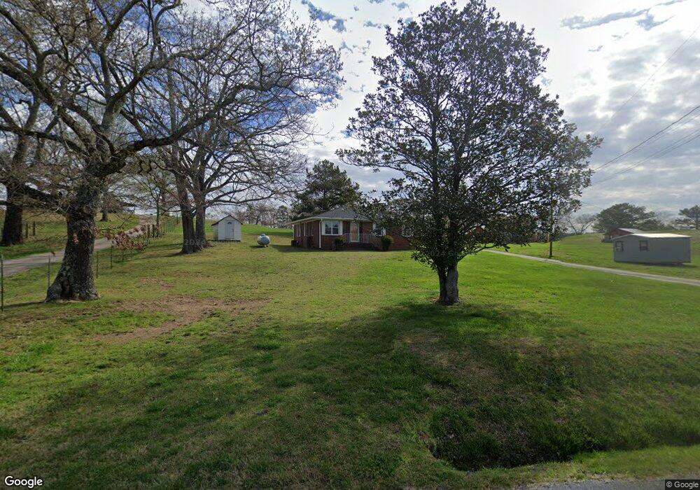
631 Huntington Rd Cedartown, GA 30125
Estimated Value: $173,000 - $224,000
2
Beds
1
Bath
1,204
Sq Ft
$164/Sq Ft
Est. Value
About This Home
This home is located at 631 Huntington Rd, Cedartown, GA 30125 and is currently estimated at $197,256, approximately $163 per square foot. 631 Huntington Rd is a home located in Polk County.
Ownership History
Date
Name
Owned For
Owner Type
Purchase Details
Closed on
May 8, 2002
Sold by
Bentley Eugene T and Bentley Geneva
Bought by
Nale Lonnie J and *Survivor Carolyn R
Current Estimated Value
Purchase Details
Closed on
Aug 14, 1998
Sold by
Nale Lonnie and Carolyn Elizabeth
Bought by
Bentley Eugene T and Bentley Geneva
Purchase Details
Closed on
Dec 11, 1995
Sold by
Jones Peggy Executrix
Bought by
Nale Lonnie
Purchase Details
Closed on
Dec 6, 1995
Sold by
Jarrell Roy E and Bessie Jarrell Smith
Bought by
Nale Lonnie
Purchase Details
Closed on
Apr 26, 1976
Sold by
Jarrell Frank
Bought by
Jarrell Martha
Purchase Details
Closed on
Mar 16, 1955
Bought by
Jarrell Frank
Create a Home Valuation Report for This Property
The Home Valuation Report is an in-depth analysis detailing your home's value as well as a comparison with similar homes in the area
Home Values in the Area
Average Home Value in this Area
Purchase History
| Date | Buyer | Sale Price | Title Company |
|---|---|---|---|
| Nale Lonnie J | $65,000 | -- | |
| Bentley Eugene T | $60,000 | -- | |
| Nale Lonnie | $26,000 | -- | |
| Nale Lonnie | -- | -- | |
| Jarrell Martha | -- | -- | |
| Jarrell Frank | -- | -- |
Source: Public Records
Tax History Compared to Growth
Tax History
| Year | Tax Paid | Tax Assessment Tax Assessment Total Assessment is a certain percentage of the fair market value that is determined by local assessors to be the total taxable value of land and additions on the property. | Land | Improvement |
|---|---|---|---|---|
| 2024 | -- | $55,131 | $5,565 | $49,566 |
| 2023 | $0 | $36,387 | $5,565 | $30,822 |
| 2022 | $718 | $29,852 | $3,710 | $26,142 |
| 2021 | $718 | $29,852 | $3,710 | $26,142 |
| 2020 | $397 | $29,852 | $3,710 | $26,142 |
| 2019 | $248 | $22,572 | $3,710 | $18,862 |
| 2018 | $237 | $21,948 | $3,710 | $18,238 |
| 2017 | $230 | $21,948 | $3,710 | $18,238 |
| 2016 | $311 | $24,939 | $6,701 | $18,238 |
| 2015 | $292 | $24,217 | $6,701 | $17,516 |
| 2014 | $611 | $24,217 | $6,701 | $17,516 |
Source: Public Records
Map
Nearby Homes
- 00 Antioch Rd
- 95 Wieuca Way
- 160 Tate Rd
- 0 Wieuca Way Unit 10614129
- 000 Wieuca Way
- 0 Buchanan Hwy Unit 10558945
- 0 Youngs Farm Rd Unit 24829378
- 142 Acres On Judkin Mill Rd
- 766 Antioch Rd
- 00 Buchanan Hwy
- 1987 Buchanan Hwy
- 35 Old Mill Rd
- 4550 Buchanan Hwy
- 497 Judkin Mill Rd
- 4267 Buchanan Hwy
- 203 Cason Rd
- 117 Cason Rd
- 0 Old Esom Hill Loop Unit 7654342
- 0 Old Esom Hill Loop Unit 10611077
- 0 Judkin Mill Rd Unit LotWP001 19369404
- 647 Huntington Rd
- 615 Huntington Rd
- 612 Huntington Rd
- 677 Huntington Rd
- 682 Huntington Rd
- 689 Huntington Rd
- 696 Huntington Rd
- 38 Chess Jones Rd
- 642 Huntington Rd
- 709 Huntington Rd
- 520 Huntington Rd
- 728 Huntington Rd
- 3045 Buchanan Hwy
- 775 Huntington Rd
- 100 Chess Jones Rd
- 100 Chess Jones Rd
- 3041 0buchanan Hwy
- 3041 Buchanan Hwy
- 516 Huntington Rd
- 500 Huntington Rd