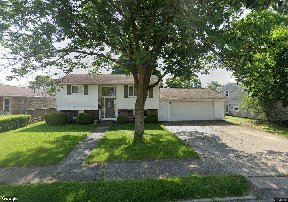
Estimated Value: $217,000 - $242,000
3
Beds
2
Baths
1,652
Sq Ft
$142/Sq Ft
Est. Value
About This Home
This home is located at 631 Maplecrest Dr, Troy, OH 45373 and is currently estimated at $234,180, approximately $141 per square foot. 631 Maplecrest Dr is a home located in Miami County with nearby schools including Cookson Elementary School, Troy Junior High School, and Van Cleve Elementary School.
Ownership History
Date
Name
Owned For
Owner Type
Purchase Details
Closed on
Nov 8, 2007
Sold by
Residential Funding Co Llc
Bought by
Burch Lori M
Current Estimated Value
Home Financials for this Owner
Home Financials are based on the most recent Mortgage that was taken out on this home.
Original Mortgage
$117,000
Outstanding Balance
$74,256
Interest Rate
6.44%
Mortgage Type
New Conventional
Estimated Equity
$159,924
Purchase Details
Closed on
Jun 21, 2007
Sold by
Tepelides Michael
Bought by
Residential Funding Co Llc
Purchase Details
Closed on
Sep 18, 2006
Sold by
Daughenbaugh David and Daughenbaugh Karen
Bought by
Tepelides Michael
Purchase Details
Closed on
Aug 10, 1994
Sold by
Davis Alice M
Bought by
Daughenbaugh David and Daughenbaugh Karen
Create a Home Valuation Report for This Property
The Home Valuation Report is an in-depth analysis detailing your home's value as well as a comparison with similar homes in the area
Home Values in the Area
Average Home Value in this Area
Purchase History
| Date | Buyer | Sale Price | Title Company |
|---|---|---|---|
| Burch Lori M | $121,000 | -- | |
| Residential Funding Co Llc | $100,000 | -- | |
| Tepelides Michael | $147,500 | -- | |
| Daughenbaugh David | $81,500 | -- |
Source: Public Records
Mortgage History
| Date | Status | Borrower | Loan Amount |
|---|---|---|---|
| Open | Tepelides Michael | $117,000 | |
| Closed | Daughenbaugh David | -- |
Source: Public Records
Tax History Compared to Growth
Tax History
| Year | Tax Paid | Tax Assessment Tax Assessment Total Assessment is a certain percentage of the fair market value that is determined by local assessors to be the total taxable value of land and additions on the property. | Land | Improvement |
|---|---|---|---|---|
| 2024 | $1,962 | $50,680 | $12,320 | $38,360 |
| 2023 | $1,962 | $50,680 | $12,320 | $38,360 |
| 2022 | $1,618 | $50,680 | $12,320 | $38,360 |
| 2021 | $1,316 | $39,000 | $9,490 | $29,510 |
| 2020 | $1,318 | $39,000 | $9,490 | $29,510 |
| 2019 | $1,329 | $39,000 | $9,490 | $29,510 |
| 2018 | $1,202 | $33,850 | $9,450 | $24,400 |
| 2017 | $1,214 | $33,850 | $9,450 | $24,400 |
| 2016 | $1,196 | $33,850 | $9,450 | $24,400 |
| 2015 | $1,156 | $31,330 | $8,750 | $22,580 |
| 2014 | $1,156 | $31,330 | $8,750 | $22,580 |
| 2013 | $1,163 | $31,330 | $8,750 | $22,580 |
Source: Public Records
Map
Nearby Homes
- 1075 Crestview Dr
- 1002 Frontier Dr
- 1133 Lee Rd
- 1597 Old Staunton Rd
- 1206 Heritage Dr
- 708 N Market St
- 604 N Market St
- 1329 Lee Rd
- 1482 Lee Rd
- 1947 Woodcliffe Dr
- 199 Finsbury Ln
- 1728 Hunters Ridge Dr
- 996 Stony Brook Ln
- 1160 Waterloo St
- 1164 Waterloo St
- 755 W Bentley Cir
- 118 S Walnut St
- 1400 Troy Urbana Rd
- 1137 Auburn St
- 813 W Bentley Cir
- 617 Maplecrest Dr
- 908 Linwood Dr
- 632 Locust Ln
- 618 Locust Ln
- 920 Linwood Dr
- 603 Maplecrest Dr
- 632 Maplecrest Dr
- 604 Locust Ln
- 618 Maplecrest Dr
- 878 Linwood Dr
- 909 Linwood Dr
- 597 Maplecrest Dr
- 604 Maplecrest Dr
- 917 Linwood Dr
- 598 Locust Ln
- 877 Linwood Dr
- 927 Linwood Dr
- 689 Maplecrest Dr
- 598 Maplecrest Dr
- 631 Locust Ln
