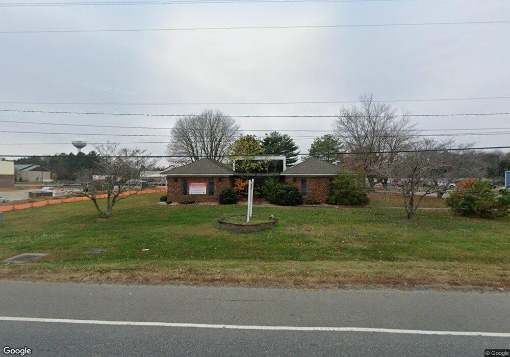
631 N Main St Kilmarnock, VA 22482
--
Bed
4
Baths
3,320
Sq Ft
1.14
Acres
About This Home
This home is located at 631 N Main St, Kilmarnock, VA 22482. 631 N Main St is a home located in Lancaster County with nearby schools including Lancaster Primary School, Lancaster Middle School, and Lancaster High School.
Ownership History
Date
Name
Owned For
Owner Type
Purchase Details
Closed on
Jul 29, 2025
Sold by
Hawthorne Commons Kva Llc
Bought by
Lot 1 Hckva Llc
Home Financials for this Owner
Home Financials are based on the most recent Mortgage that was taken out on this home.
Original Mortgage
$514,250
Outstanding Balance
$513,812
Interest Rate
6.81%
Mortgage Type
New Conventional
Purchase Details
Closed on
Apr 21, 2020
Sold by
Hawthorne Farms Inc
Bought by
Hawthorne Commons Kva Llc
Home Financials for this Owner
Home Financials are based on the most recent Mortgage that was taken out on this home.
Original Mortgage
$1,525,000
Interest Rate
3.6%
Mortgage Type
Purchase Money Mortgage
Create a Home Valuation Report for This Property
The Home Valuation Report is an in-depth analysis detailing your home's value as well as a comparison with similar homes in the area
Home Values in the Area
Average Home Value in this Area
Purchase History
| Date | Buyer | Sale Price | Title Company |
|---|---|---|---|
| Lot 1 Hckva Llc | -- | None Listed On Document | |
| Hawthorne Commons Kva Llc | $2,175,000 | American Title Of Lancaster |
Source: Public Records
Mortgage History
| Date | Status | Borrower | Loan Amount |
|---|---|---|---|
| Open | Lot 1 Hckva Llc | $514,250 | |
| Previous Owner | Hawthorne Commons Kva Llc | $1,525,000 |
Source: Public Records
Tax History Compared to Growth
Tax History
| Year | Tax Paid | Tax Assessment Tax Assessment Total Assessment is a certain percentage of the fair market value that is determined by local assessors to be the total taxable value of land and additions on the property. | Land | Improvement |
|---|---|---|---|---|
| 2024 | $4,128 | $750,600 | $546,200 | $204,400 |
| 2023 | $3,430 | $544,500 | $248,300 | $296,200 |
| 2022 | $3,430 | $544,500 | $248,300 | $296,200 |
| 2021 | $3,430 | $544,500 | $248,300 | $296,200 |
| 2020 | $3,430 | $544,500 | $248,300 | $296,200 |
| 2019 | $3,282 | $521,000 | $224,800 | $296,200 |
| 2018 | $2,764 | $468,500 | $224,800 | $243,700 |
| 2017 | $2,764 | $468,500 | $224,800 | $243,700 |
| 2016 | -- | $468,500 | $224,800 | $243,700 |
| 2014 | -- | $0 | $0 | $0 |
| 2013 | -- | $0 | $0 | $0 |
Source: Public Records
Map
Nearby Homes
- #29-28 Mary Ball Rd
- Lot 15 Oak Ln
- Lot 45 N Main St
- 1965 Goodluck Rd
- 1965 Goodluck Rd
- 1025 Goodluck Rd
- 86 Venable Dr
- 89 N Main St
- 99 Byway Cir
- 104 Byway Cir
- 98 Byway Cir
- 24 Byway Cir
- 101 Our Way Dr
- 301 E Church St
- 82 Our Way Dr
- 58A Church St
- 16 Our Way Dr
- 300 Irvington Rd
- 0 Yorkshire St
- Perry Plan at Springwood of Kilmarnock
- 30 Hawthorne Ave
- 652 N Main St
- 672 N Main St
- 680 N Main St
- 612 N Main St
- 676 N Main St
- 000 Hawthorne Ave
- lot 23 Hawthorne Ave
- 684 N Main St
- 608 N Main St
- 120 Hawthorne Ave
- 00 Hawthorne Ave
- 0 Hawthorne Ave
- 278 Hawthorne Ave
- 584 N Main St
- 180 Lee Rd
- Tax Map Mary Ball Rd
- lot 47A Mary Ball Rd
- 0 Mary Ball Rd
- 291 Hawthorne Ave