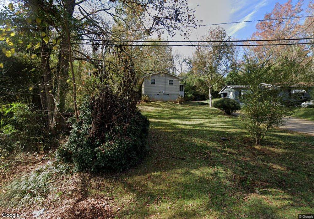
631 Pear St West Point, GA 31833
Estimated Value: $53,078 - $68,000
2
Beds
1
Bath
660
Sq Ft
$92/Sq Ft
Est. Value
About This Home
This home is located at 631 Pear St, West Point, GA 31833 and is currently estimated at $60,539, approximately $91 per square foot. 631 Pear St is a home located in Troup County with nearby schools including West Point Elementary School, Long Cane Elementary School, and Whitesville Road Elementary School.
Ownership History
Date
Name
Owned For
Owner Type
Purchase Details
Closed on
Feb 8, 2023
Sold by
Lewis John
Bought by
Sherwood Forest Property Grp Of Georgia
Current Estimated Value
Purchase Details
Closed on
Mar 18, 2008
Sold by
Citibank
Bought by
Lewis John
Purchase Details
Closed on
Aug 11, 2000
Sold by
Barber Jimmie B
Bought by
Barber Jimmie B
Purchase Details
Closed on
Dec 31, 1998
Sold by
Jimmie Williams
Bought by
Barber Jimmie B
Purchase Details
Closed on
Jun 10, 1980
Bought by
Jimmie Williams
Purchase Details
Closed on
Sep 30, 1976
Purchase Details
Closed on
Jan 1, 1971
Sold by
Skinner O G
Create a Home Valuation Report for This Property
The Home Valuation Report is an in-depth analysis detailing your home's value as well as a comparison with similar homes in the area
Home Values in the Area
Average Home Value in this Area
Purchase History
| Date | Buyer | Sale Price | Title Company |
|---|---|---|---|
| Sherwood Forest Property Grp Of Georgia | -- | -- | |
| Lewis John | $10,000 | -- | |
| Barber Jimmie B | -- | -- | |
| Barber Jimmie B | -- | -- | |
| Jimmie Williams | -- | -- | |
| -- | -- | -- | |
| -- | -- | -- |
Source: Public Records
Tax History Compared to Growth
Tax History
| Year | Tax Paid | Tax Assessment Tax Assessment Total Assessment is a certain percentage of the fair market value that is determined by local assessors to be the total taxable value of land and additions on the property. | Land | Improvement |
|---|---|---|---|---|
| 2024 | $467 | $13,200 | $1,760 | $11,440 |
| 2023 | $359 | $13,160 | $1,760 | $11,400 |
| 2022 | $349 | $12,520 | $1,760 | $10,760 |
| 2021 | $375 | $12,440 | $1,760 | $10,680 |
| 2020 | $304 | $10,080 | $920 | $9,160 |
| 2019 | $286 | $9,472 | $952 | $8,520 |
| 2018 | $274 | $9,072 | $952 | $8,120 |
| 2017 | $274 | $9,072 | $952 | $8,120 |
| 2016 | $266 | $8,810 | $952 | $7,858 |
| 2015 | $266 | $8,810 | $952 | $7,858 |
| 2014 | $254 | $8,396 | $952 | $7,444 |
| 2013 | -- | $8,958 | $952 | $8,006 |
Source: Public Records
Map
Nearby Homes
- 509 Cleveland St
- 0 Arrowhead Dr Unit 10451860
- 804 E 6th St
- 713 Avenue H
- 0 Sunset Dr Unit 10451831
- 1008 E 12th St
- 311 E 4th St
- 112 Hillcrest Rd
- 128 Highland Dr
- 4517 Georgia 18
- 4509 Georgia 18
- 4523 Georgia 18
- 4527 Georgia 18
- 1505 Wisteria Dr
- 107 Garden Walk
- 712 4th Ave
- 508 Pine St
- 1007 4th Ave
- Winfield Plan at The Villages at Harris Creek
- Cecil Plan at The Villages at Harris Creek
- 629 Pear St Unit 33
- 633 Pear St
- 635 Pear St
- 625 Pear St
- 624 Frank Hall Jr St
- 626 Frank Hall Jr St
- 637 Pear St
- 622 Frank Hall Jr St
- 628 Frank Hall Jr St
- 620 Frank Hall Jr St
- 630 Frank Hall Jr St
- 619 Frank Hall Jr St
- 621 Frank Hall Jr St
- 617 Frank Hall Jr St
- 616 Frank Hall Jr St
- 623 Frank Hall Jr St
- 617 Pear St
- 625 Frank Hall Jr St
- 701 Frank Hall Jr St
- 622 Martin Luther King Dr