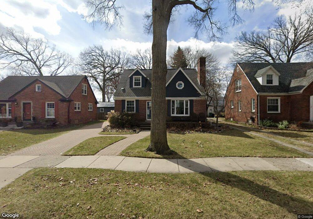
631 W Breckenridge St Ferndale, MI 48220
Estimated Value: $403,000 - $456,000
3
Beds
3
Baths
1,296
Sq Ft
$333/Sq Ft
Est. Value
About This Home
This home is located at 631 W Breckenridge St, Ferndale, MI 48220 and is currently estimated at $431,003, approximately $332 per square foot. 631 W Breckenridge St is a home located in Oakland County with nearby schools including Ferndale Lower Elementary Campus, Ferndale Upper Elementary Campus, and Ferndale Middle School.
Ownership History
Date
Name
Owned For
Owner Type
Purchase Details
Closed on
Jun 21, 2007
Sold by
Arnold Paul R and Arnold Judith
Bought by
Mannino Sebastian
Current Estimated Value
Home Financials for this Owner
Home Financials are based on the most recent Mortgage that was taken out on this home.
Original Mortgage
$208,425
Outstanding Balance
$128,017
Interest Rate
6.26%
Mortgage Type
Purchase Money Mortgage
Estimated Equity
$302,986
Purchase Details
Closed on
Apr 30, 1999
Sold by
Brooks Catherine M
Bought by
Robinson Judith M
Create a Home Valuation Report for This Property
The Home Valuation Report is an in-depth analysis detailing your home's value as well as a comparison with similar homes in the area
Home Values in the Area
Average Home Value in this Area
Purchase History
| Date | Buyer | Sale Price | Title Company |
|---|---|---|---|
| Mannino Sebastian | $277,900 | Metropolitan Title Company | |
| Robinson Judith M | $175,000 | -- |
Source: Public Records
Mortgage History
| Date | Status | Borrower | Loan Amount |
|---|---|---|---|
| Open | Mannino Sebastian | $208,425 |
Source: Public Records
Tax History Compared to Growth
Tax History
| Year | Tax Paid | Tax Assessment Tax Assessment Total Assessment is a certain percentage of the fair market value that is determined by local assessors to be the total taxable value of land and additions on the property. | Land | Improvement |
|---|---|---|---|---|
| 2024 | $5,051 | $186,700 | $0 | $0 |
| 2023 | $4,912 | $176,910 | $0 | $0 |
| 2022 | $4,943 | $163,270 | $0 | $0 |
| 2021 | $4,973 | $160,710 | $0 | $0 |
| 2020 | $4,709 | $161,580 | $0 | $0 |
| 2019 | $4,787 | $151,760 | $0 | $0 |
| 2018 | $4,806 | $142,350 | $0 | $0 |
| 2017 | $4,745 | $140,120 | $0 | $0 |
| 2016 | $4,692 | $122,660 | $0 | $0 |
| 2015 | -- | $98,720 | $0 | $0 |
| 2014 | -- | $88,490 | $0 | $0 |
| 2011 | -- | $74,540 | $0 | $0 |
Source: Public Records
Map
Nearby Homes
- 619 Withington St
- 630 W Troy St
- 1924 Pinecrest Dr
- 629 W Lewiston Ave
- 475 W Breckenridge St
- 367 W Cambourne St
- 487 W Troy St
- 571 W Saratoga St
- 853 Leroy St
- 437 W Drayton St
- 546 Leroy St
- 256 Withington St
- 1364 W Saratoga St
- 2015 Central St
- 910 W Maplehurst St
- 815 W Oakridge St
- 1416 Leroy St
- 964 W Marshall St
- 203 E Lewiston Ave
- 1114 W Lewiston Ave
- 619 West Breckenridg 619 West Breckenridge St
- 619 W Breckenridge St
- 641 W Breckenridge St
- 651 W Breckenridge St
- 630 Withington St
- 661 W Breckenridge St
- 636 Withington St
- 616 Withington St
- W Breckenridge
- 650 Withington St
- 671 W Breckenridge St
- 656 Withington St
- 640 W Breckenridge St
- 630 W Breckenridge St
- 595 W Breckenridge St
- 650 W Breckenridge St
- 594 Withington St
- 681 W Breckenridge St
- 660 W Breckenridge St
- 585 W Breckenridge St