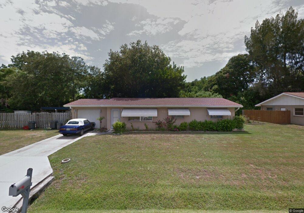
6310 Camphor Ave Sarasota, FL 34231
Estimated Value: $411,000 - $448,350
3
Beds
2
Baths
1,350
Sq Ft
$324/Sq Ft
Est. Value
About This Home
This home is located at 6310 Camphor Ave, Sarasota, FL 34231 and is currently estimated at $437,338, approximately $323 per square foot. 6310 Camphor Ave is a home located in Sarasota County with nearby schools including Gulf Gate Elementary School, Riverview High School, and Brookside Middle School.
Ownership History
Date
Name
Owned For
Owner Type
Purchase Details
Closed on
May 19, 2017
Sold by
Wild Jeffrey and Wild Katherine
Bought by
Zoria Larissa
Current Estimated Value
Purchase Details
Closed on
Nov 12, 1998
Sold by
Keller Ray E and Keller Sue Ellen
Bought by
Wild Jeffrey and Wild Katherine
Home Financials for this Owner
Home Financials are based on the most recent Mortgage that was taken out on this home.
Original Mortgage
$109,547
Interest Rate
6.47%
Mortgage Type
FHA
Create a Home Valuation Report for This Property
The Home Valuation Report is an in-depth analysis detailing your home's value as well as a comparison with similar homes in the area
Home Values in the Area
Average Home Value in this Area
Purchase History
| Date | Buyer | Sale Price | Title Company |
|---|---|---|---|
| Zoria Larissa | $285,000 | Alliance Group Title Llc | |
| Wild Jeffrey | $110,000 | -- |
Source: Public Records
Mortgage History
| Date | Status | Borrower | Loan Amount |
|---|---|---|---|
| Previous Owner | Wild Jeffrey | $109,547 |
Source: Public Records
Tax History Compared to Growth
Tax History
| Year | Tax Paid | Tax Assessment Tax Assessment Total Assessment is a certain percentage of the fair market value that is determined by local assessors to be the total taxable value of land and additions on the property. | Land | Improvement |
|---|---|---|---|---|
| 2024 | $4,486 | $308,925 | -- | -- |
| 2023 | $4,295 | $366,500 | $191,400 | $175,100 |
| 2022 | $4,035 | $346,100 | $187,400 | $158,700 |
| 2021 | $3,451 | $249,800 | $133,700 | $116,100 |
| 2020 | $3,117 | $211,000 | $84,600 | $126,400 |
| 2019 | $3,153 | $217,400 | $107,600 | $109,800 |
| 2018 | $3,155 | $219,300 | $96,600 | $122,700 |
| 2017 | $1,405 | $112,863 | $0 | $0 |
| 2016 | $1,393 | $159,300 | $89,300 | $70,000 |
| 2015 | $1,412 | $151,500 | $85,000 | $66,500 |
| 2014 | $1,405 | $107,294 | $0 | $0 |
Source: Public Records
Map
Nearby Homes
- 6220 Murdock Ave
- 3024 Williamsburg St
- 2833 Valley Forge St
- 2918 Williamsburg St
- 3040 New England St
- 6051 Carlton Ave
- 3274 Savage Rd
- 2938 Clark Rd Unit 103
- 2924 Clark Rd Unit 205
- 6711 S Lockwood Ridge Rd
- 2460 Terry Ln
- 3231 Yorktown St
- 2065 Sun Home St Unit Lot A-23
- 0 Albert Place
- 5635 Ashton Lake Dr Unit 4
- 5685 Ashton Lake Dr Unit 2
- 2227 Circlewood Dr Unit 52
- 6947 Woodwind Dr Unit 77
- 6906 Woodwind Dr Unit 12
- 5736 Ashton Lake Dr Unit 8
- 6226 Camphor Ave
- 6311 Seagate Ave
- 2841 Seaspray St
- 6311 Camphor Ave
- 6237 Camphor Ave
- 6323 Camphor Ave
- 6214 Camphor Ave
- 6329 Seagate Ave
- 6225 Camphor Ave
- 2938 Mayflower St
- 2938 Street
- 6335 Camphor Ave
- 2835 Seaspray St
- 6308 Pauline Ave
- 6240 Pauline Ave
- 2932 Mayflower St
- 6320 Pauline Ave
- 6213 Camphor Ave
- 6318 Seagate Ave