Estimated Value: $350,000 - $382,000
4
Beds
2
Baths
2,020
Sq Ft
$181/Sq Ft
Est. Value
About This Home
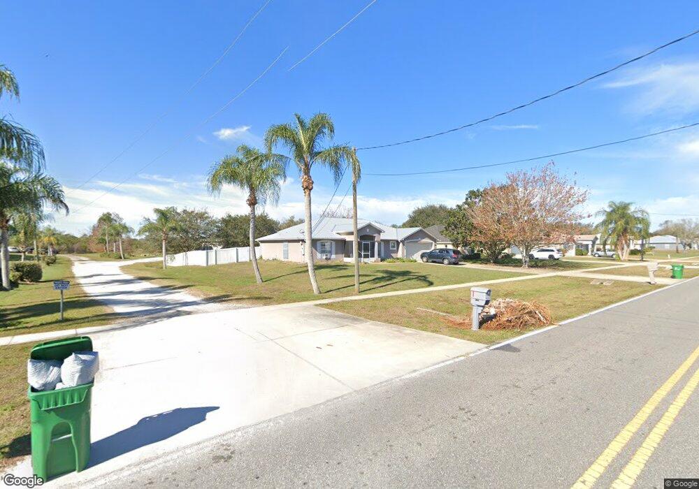
This home is located at 6310 Homestead Ave Unit 6, Cocoa, FL 32927 and is currently estimated at $365,384, approximately $180 per square foot. 6310 Homestead Ave Unit 6 is a home located in Brevard County with nearby schools including Enterprise Elementary School, Space Coast Junior/Senior High School, and East Atlantic Prep of Brevard County.
Ownership History
Date
Name
Owned For
Owner Type
Purchase Details
Closed on
Dec 7, 2011
Sold by
Coffy Thomas E and Coffy Darcy L
Bought by
Little Susan M
Current Estimated Value
Home Financials for this Owner
Home Financials are based on the most recent Mortgage that was taken out on this home.
Original Mortgage
$99,920
Outstanding Balance
$68,810
Interest Rate
4.15%
Estimated Equity
$296,574
Purchase Details
Closed on
Jan 3, 2003
Sold by
Holiday Bldr Inc
Bought by
Coffy Thomas E and Coffy Darcy L
Home Financials for this Owner
Home Financials are based on the most recent Mortgage that was taken out on this home.
Original Mortgage
$117,905
Interest Rate
5.99%
Mortgage Type
Purchase Money Mortgage
Purchase Details
Closed on
Aug 23, 2002
Sold by
Miller Harold F and Miller Connie A
Bought by
Holiday Bldr Inc
Create a Home Valuation Report for This Property
The Home Valuation Report is an in-depth analysis detailing your home's value as well as a comparison with similar homes in the area
Home Values in the Area
Average Home Value in this Area
Purchase History
| Date | Buyer | Sale Price | Title Company |
|---|---|---|---|
| Little Susan M | $124,900 | Liberty Title | |
| Coffy Thomas E | $125,100 | -- | |
| Holiday Bldr Inc | $20,500 | -- |
Source: Public Records
Mortgage History
| Date | Status | Borrower | Loan Amount |
|---|---|---|---|
| Open | Little Susan M | $99,920 | |
| Previous Owner | Coffy Thomas E | $117,905 |
Source: Public Records
Tax History Compared to Growth
Tax History
| Year | Tax Paid | Tax Assessment Tax Assessment Total Assessment is a certain percentage of the fair market value that is determined by local assessors to be the total taxable value of land and additions on the property. | Land | Improvement |
|---|---|---|---|---|
| 2025 | $1,718 | $122,200 | -- | -- |
| 2024 | $1,677 | $118,760 | -- | -- |
| 2023 | $1,677 | $115,310 | $0 | $0 |
| 2022 | $1,568 | $111,960 | $0 | $0 |
| 2021 | $1,572 | $108,700 | $0 | $0 |
| 2020 | $1,497 | $107,200 | $0 | $0 |
| 2019 | $1,434 | $104,790 | $0 | $0 |
| 2018 | $1,427 | $102,840 | $0 | $0 |
| 2017 | $1,422 | $100,730 | $0 | $0 |
| 2016 | $1,427 | $98,660 | $19,800 | $78,860 |
| 2015 | $1,447 | $97,980 | $16,500 | $81,480 |
| 2014 | $1,449 | $97,210 | $12,100 | $85,110 |
Source: Public Records
Map
Nearby Homes
- 6365 Homestead Ave
- 23-35-21-JX-B-2 Aruin St
- 5915 Akers St
- 6010 Fay Blvd
- 6545 Addie Ave
- 6309 Alleghany Ave
- 5720 Flint Rd
- 6198 Dees Rd
- 5715 Fairbridge St
- 6665 Addie Ave
- 6105 Banyan St
- 4650 N Highway 1 Hwy
- 6118 Dees Rd
- 6115 Allmont St
- 5955 Keystone Ave
- 6003 Gilson
- 5575 Curtis Blvd
- 6070 Baltimore Ave
- 5940 Fisherman Ln
- 00000 Golfview Ave
- 6310 Homestead Ave
- 6320 Homestead Ave
- 6280 Homestead Ave
- 6330 Homestead Ave
- 6300 Homestead Ave
- 6295 Homestead Ave
- 6305 Homestead Ave
- 6270 Homestead Ave
- 6285 Homestead Ave
- 6325 Homestead Ave
- 5985 Aruin St
- 5975 Aruin St
- 6345 Homestead Ave
- 6260 Homestead Ave
- 5995 Aruin St
- 6265 Homestead Ave
- 6332 Bamboo Ave
- 6290 Homestead Ave
- 6344 Bamboo Ave
- 6320 Bamboo Ave