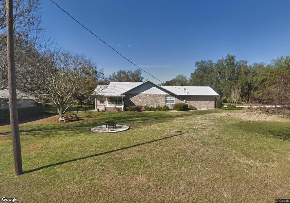
6311 Payne Rd Keystone Heights, FL 32656
Estimated Value: $400,000 - $505,000
3
Beds
2
Baths
2,094
Sq Ft
$212/Sq Ft
Est. Value
About This Home
This home is located at 6311 Payne Rd, Keystone Heights, FL 32656 and is currently estimated at $444,385, approximately $212 per square foot. 6311 Payne Rd is a home located in Clay County with nearby schools including Keystone Heights Elementary School and Keystone Heights Junior/Senior High School.
Ownership History
Date
Name
Owned For
Owner Type
Purchase Details
Closed on
Mar 8, 2024
Sold by
Pepe Lynda M
Bought by
Davis George Alan and Davis Coy Lee
Current Estimated Value
Purchase Details
Closed on
Aug 15, 2008
Sold by
Myer Robert E and Myer Barbara J
Bought by
Pepe Lynda M
Home Financials for this Owner
Home Financials are based on the most recent Mortgage that was taken out on this home.
Original Mortgage
$150,000
Interest Rate
6.32%
Mortgage Type
Unknown
Create a Home Valuation Report for This Property
The Home Valuation Report is an in-depth analysis detailing your home's value as well as a comparison with similar homes in the area
Home Values in the Area
Average Home Value in this Area
Purchase History
| Date | Buyer | Sale Price | Title Company |
|---|---|---|---|
| Davis George Alan | -- | None Listed On Document | |
| Davis George Alan | -- | None Listed On Document | |
| Pepe Lynda M | $245,000 | Keystone Title Of Keystone H |
Source: Public Records
Mortgage History
| Date | Status | Borrower | Loan Amount |
|---|---|---|---|
| Previous Owner | Pepe Lynda M | $150,000 |
Source: Public Records
Tax History Compared to Growth
Tax History
| Year | Tax Paid | Tax Assessment Tax Assessment Total Assessment is a certain percentage of the fair market value that is determined by local assessors to be the total taxable value of land and additions on the property. | Land | Improvement |
|---|---|---|---|---|
| 2024 | $2,205 | $173,369 | -- | -- |
| 2023 | $2,205 | $168,320 | $0 | $0 |
| 2022 | $2,089 | $163,418 | $0 | $0 |
| 2021 | $2,080 | $158,659 | $0 | $0 |
| 2020 | $2,011 | $156,469 | $0 | $0 |
| 2019 | $1,979 | $152,952 | $0 | $0 |
| 2018 | $1,814 | $150,100 | $0 | $0 |
| 2017 | $1,802 | $147,013 | $0 | $0 |
| 2016 | $1,797 | $143,989 | $0 | $0 |
| 2015 | $1,846 | $142,988 | $0 | $0 |
| 2014 | $1,799 | $141,853 | $0 | $0 |
Source: Public Records
Map
Nearby Homes
- 6266 Little Lake Geneva Rd
- 6335 Payne Rd
- 7086 Sewanee St
- 7058 Sewanee St
- 6615 Camelot Ct
- 6213 Oglethorpe Ave
- 7195 Gas Line Rd
- 00 Northwestern Ave
- 6218 Northwestern Ave
- 6470 Brooklyn Bay Rd
- 6294 Alliance Ave
- 7060 Stetson St
- 6222 Oberlin Ave
- 6330 Alliance Ave
- 6236 Oberlin Ave
- 6358 Reed Dr
- 7120 Gas Line Rd
- 7142 Knox St
- 7157 Wesleyan Rd
- 7011 State Rd 21
- 6313 Payne Rd
- 6299 Payne Rd
- 6305 Payne Rd
- 6303 Payne Rd
- 6307 Payne Rd
- 6322 Payne Rd
- 6285 Payne Rd
- 0 Coopenhagan Ct Unit 1201558
- 0 Coopenhagan Ct Unit GC509583
- 0 Coopenhagan Ct Unit 117962
- 0 Coopenhagan Ct Unit 1019254
- 6244 Little Lake Geneva Rd
- 6320 Payne Rd
- 6323 Payne Rd
- 6283 Payne Rd
- 6277 Payne Rd
- 6294 Little Lake Geneva Rd
- 6284 Payne Rd
- 6222 Little Lake Geneva Rd
- 6239 Little Lake Geneva Rd