Estimated Value: $266,343 - $317,000
3
Beds
2
Baths
1,168
Sq Ft
$250/Sq Ft
Est. Value
About This Home
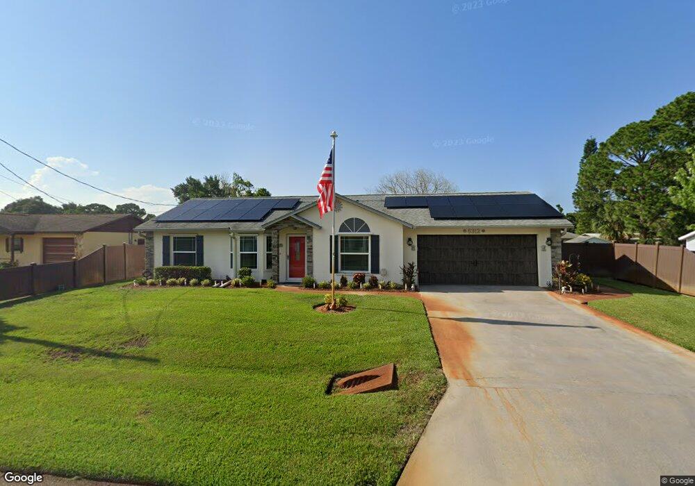
This home is located at 6312 Hudson Rd, Cocoa, FL 32927 and is currently estimated at $291,586, approximately $249 per square foot. 6312 Hudson Rd is a home located in Brevard County with nearby schools including Enterprise Elementary School, Space Coast Junior/Senior High School, and East Atlantic Prep of Brevard County.
Ownership History
Date
Name
Owned For
Owner Type
Purchase Details
Closed on
Oct 31, 1997
Sold by
Romar Homes Inc
Bought by
Donovan Theresa M and Buttermore Catherine C
Current Estimated Value
Home Financials for this Owner
Home Financials are based on the most recent Mortgage that was taken out on this home.
Original Mortgage
$72,000
Outstanding Balance
$11,931
Interest Rate
7.39%
Estimated Equity
$279,655
Purchase Details
Closed on
Oct 21, 1997
Sold by
R J M Inv Inc
Bought by
Romar Homes Inc
Home Financials for this Owner
Home Financials are based on the most recent Mortgage that was taken out on this home.
Original Mortgage
$72,000
Outstanding Balance
$11,931
Interest Rate
7.39%
Estimated Equity
$279,655
Create a Home Valuation Report for This Property
The Home Valuation Report is an in-depth analysis detailing your home's value as well as a comparison with similar homes in the area
Home Values in the Area
Average Home Value in this Area
Purchase History
| Date | Buyer | Sale Price | Title Company |
|---|---|---|---|
| Donovan Theresa M | -- | -- | |
| Donovan Theresa M | $76,500 | -- | |
| Romar Homes Inc | $8,500 | -- |
Source: Public Records
Mortgage History
| Date | Status | Borrower | Loan Amount |
|---|---|---|---|
| Open | Donovan Theresa M | $72,000 |
Source: Public Records
Tax History
| Year | Tax Paid | Tax Assessment Tax Assessment Total Assessment is a certain percentage of the fair market value that is determined by local assessors to be the total taxable value of land and additions on the property. | Land | Improvement |
|---|---|---|---|---|
| 2025 | $1,037 | $81,810 | -- | -- |
| 2024 | $1,017 | $74,570 | -- | -- |
| 2023 | $1,017 | $72,400 | $0 | $0 |
| 2022 | $959 | $70,300 | $0 | $0 |
| 2021 | $961 | $68,260 | $0 | $0 |
| 2020 | $916 | $67,320 | $0 | $0 |
| 2019 | $863 | $65,810 | $0 | $0 |
| 2018 | $864 | $64,590 | $0 | $0 |
| 2017 | $866 | $63,270 | $0 | $0 |
| 2016 | $873 | $61,970 | $18,000 | $43,970 |
| 2015 | $880 | $61,540 | $15,000 | $46,540 |
| 2014 | $884 | $61,060 | $11,000 | $50,060 |
Source: Public Records
Map
Nearby Homes
- 5720 Flint Rd
- 5601 Banos Ave
- 5680 Banos Ave
- 0 Aruin St Unit 1222557
- 5715 Fairbridge St
- 6438 Hudson Rd
- 23-35-21-JX-B-2 Aruin St
- 6470 Bamboo Ave
- 6481 La Brea Ave
- 6460 Homestead Ave
- 6085 Edison St
- 5946 Deer Ln
- 6574 Bamboo Ave
- 6545 Addie Ave
- 6581 Bancroft Ave
- 5945 Coker Ave
- 6200 Edison St
- 5812 Homestead Ave
- 6450 Ember Ave
- 5221 Carrick Rd
- 6318 Hudson Rd
- 6306 Hudson Rd
- 6217 Gayle Dr
- 6225 Gayle Dr
- 6209 Gayle Dr
- 6324 Hudson Rd
- 6300 Hudson Rd
- 6313 Hudson Rd
- 6319 Hudson Rd
- 6307 Hudson Rd
- 6233 Gayle Dr
- 6339 Alleghany Ave
- 6325 Hudson Rd
- 6309 Alleghany Ave
- 6330 Hudson Rd
- 6241 Gayle Dr
- 6329 Hudson Rd
- 6359 Alleghany Ave
- 6315 Macauley Ave
- 6326 Alleghany Ave
Your Personal Tour Guide
Ask me questions while you tour the home.