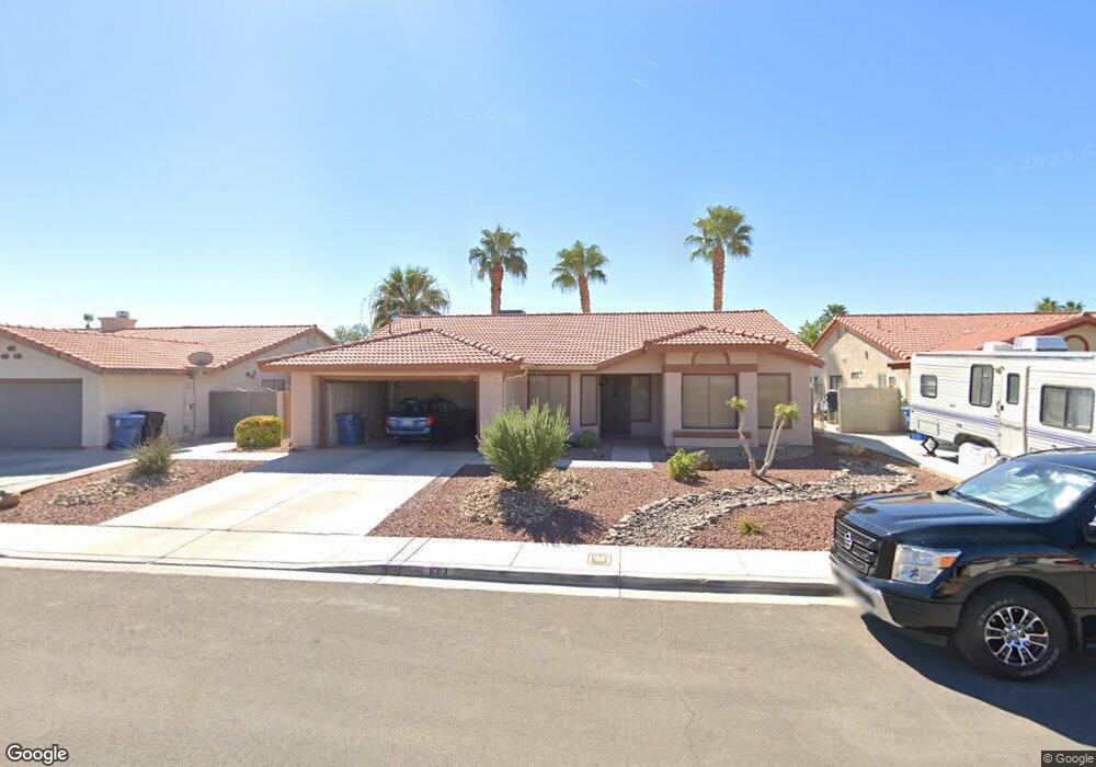
6313 Barkstone Ave Las Vegas, NV 89108
Michael Way NeighborhoodEstimated Value: $413,011 - $443,000
3
Beds
2
Baths
1,835
Sq Ft
$232/Sq Ft
Est. Value
About This Home
This home is located at 6313 Barkstone Ave, Las Vegas, NV 89108 and is currently estimated at $426,503, approximately $232 per square foot. 6313 Barkstone Ave is a home located in Clark County with nearby schools including Berkeley L. Bunker Elementary School, Irwin & Susan Molasky Junior High School, and Cimarron Memorial High School.
Ownership History
Date
Name
Owned For
Owner Type
Purchase Details
Closed on
Dec 7, 2012
Sold by
Way Richard W
Bought by
Way Richard William
Current Estimated Value
Purchase Details
Closed on
Jun 12, 1995
Sold by
Way Richard W and Way Margaret A
Bought by
Way Richard W and Way Margaret A
Create a Home Valuation Report for This Property
The Home Valuation Report is an in-depth analysis detailing your home's value as well as a comparison with similar homes in the area
Home Values in the Area
Average Home Value in this Area
Purchase History
| Date | Buyer | Sale Price | Title Company |
|---|---|---|---|
| Way Richard William | -- | None Available | |
| Way Sp Trust | -- | None Available | |
| Way Richard W | -- | -- |
Source: Public Records
Tax History Compared to Growth
Tax History
| Year | Tax Paid | Tax Assessment Tax Assessment Total Assessment is a certain percentage of the fair market value that is determined by local assessors to be the total taxable value of land and additions on the property. | Land | Improvement |
|---|---|---|---|---|
| 2025 | $1,617 | $84,866 | $31,150 | $53,716 |
| 2024 | $1,570 | $84,866 | $31,150 | $53,716 |
| 2023 | $1,570 | $83,161 | $33,250 | $49,911 |
| 2022 | $1,525 | $71,588 | $25,550 | $46,038 |
| 2021 | $1,480 | $67,976 | $23,800 | $44,176 |
| 2020 | $1,434 | $67,587 | $23,450 | $44,137 |
| 2019 | $1,392 | $65,903 | $22,050 | $43,853 |
| 2018 | $1,352 | $59,238 | $16,800 | $42,438 |
| 2017 | $1,970 | $60,084 | $16,800 | $43,284 |
| 2016 | $1,281 | $56,784 | $12,950 | $43,834 |
| 2015 | $1,278 | $46,628 | $10,500 | $36,128 |
| 2014 | $1,240 | $36,708 | $7,000 | $29,708 |
Source: Public Records
Map
Nearby Homes
- 3265 Mustang St
- 6204 Barkstone Ave
- 2912 Drury St
- 3100 Garehime St
- 3116 Gentle Breeze St
- 6100 W Brooks Ave
- 3009 Brair Knoll Ct
- 6544 Old Oxford Ave
- 6612 Gentle Winds Ct
- 6632 Coastal Breeze Ct
- 2870 Maverick St
- 6632 Light Breeze Dr
- 6428 Yarmouth Dr
- 6536 Castor Tree Way
- 6000 Santa Catalina Ave
- 6612 Old Newbury Ave
- 2879 N Jones Blvd
- 2789 Trotwood Ln
- 6000 Oceanside Way
- 0 Jone Unit 2603085
- 6317 Barkstone Ave
- 6309 Barkstone Ave
- 6312 Crosswood Ave
- 6308 Crosswood Ave
- 6316 Crosswood Ave
- 6305 Barkstone Ave
- 6321 Barkstone Ave
- 6316 Barkstone Ave
- 6312 Barkstone Ave
- 6304 Crosswood Ave
- 6308 Barkstone Ave
- 6320 Barkstone Ave
- 6320 Crosswood Ave
- 6301 Barkstone Ave
- 6300 Crosswood Ave
- 6304 Barkstone Ave
- 6324 Barkstone Ave
- 6309 Crosswood Ave
- 6317 Crosswood Ave
- 6305 Crosswood Ave